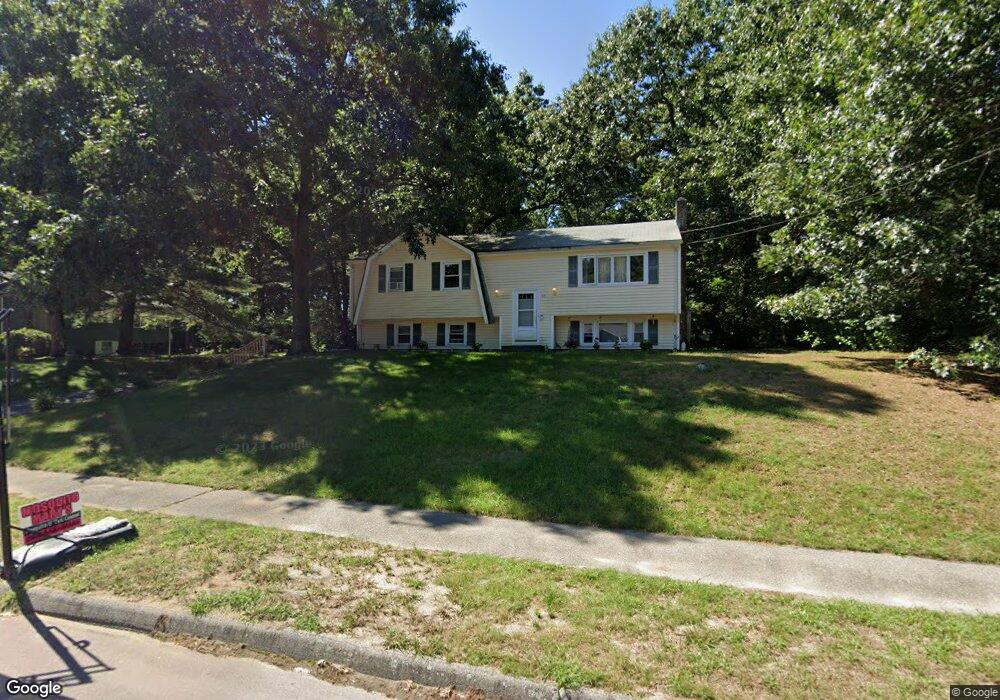
65 King James Way Wrentham, MA 02093
Estimated Value: $616,497 - $660,000
3
Beds
2
Baths
1,532
Sq Ft
$412/Sq Ft
Est. Value
About This Home
This home is located at 65 King James Way, Wrentham, MA 02093 and is currently estimated at $631,624, approximately $412 per square foot. 65 King James Way is a home located in Norfolk County with nearby schools including Delaney Elementary School, Charles E Roderick, and Foxborough Regional Charter School.
Ownership History
Date
Name
Owned For
Owner Type
Purchase Details
Closed on
May 29, 1990
Sold by
Shevchuck George A
Bought by
Rose Michael F
Current Estimated Value
Home Financials for this Owner
Home Financials are based on the most recent Mortgage that was taken out on this home.
Original Mortgage
$128,800
Interest Rate
10.13%
Mortgage Type
Purchase Money Mortgage
Create a Home Valuation Report for This Property
The Home Valuation Report is an in-depth analysis detailing your home's value as well as a comparison with similar homes in the area
Home Values in the Area
Average Home Value in this Area
Purchase History
| Date | Buyer | Sale Price | Title Company |
|---|---|---|---|
| Rose Michael F | $161,000 | -- |
Source: Public Records
Mortgage History
| Date | Status | Borrower | Loan Amount |
|---|---|---|---|
| Closed | Rose Michael F | $129,000 | |
| Closed | Rose Michael F | $128,800 |
Source: Public Records
Tax History Compared to Growth
Tax History
| Year | Tax Paid | Tax Assessment Tax Assessment Total Assessment is a certain percentage of the fair market value that is determined by local assessors to be the total taxable value of land and additions on the property. | Land | Improvement |
|---|---|---|---|---|
| 2025 | $6,072 | $523,900 | $289,100 | $234,800 |
| 2024 | $5,720 | $476,700 | $289,100 | $187,600 |
| 2023 | $5,390 | $427,100 | $262,900 | $164,200 |
| 2022 | $5,274 | $385,800 | $245,300 | $140,500 |
| 2021 | $4,490 | $319,100 | $214,100 | $105,000 |
| 2020 | $4,865 | $341,400 | $190,400 | $151,000 |
| 2019 | $4,686 | $331,900 | $190,400 | $141,500 |
| 2018 | $4,716 | $331,200 | $190,600 | $140,600 |
| 2017 | $4,457 | $312,800 | $186,900 | $125,900 |
| 2016 | $4,355 | $305,000 | $181,500 | $123,500 |
| 2015 | $4,259 | $284,300 | $174,500 | $109,800 |
| 2014 | $3,974 | $259,600 | $153,800 | $105,800 |
Source: Public Records
Map
Nearby Homes
- 362 East St
- 1 Lorraine Metcalf Dr
- 270 Dedham St
- 10 Nature View Dr
- 15 Nature View Dr
- 65 Pond St
- 319 Taunton St
- 25 Foxboro Rd
- 120 Hawes St
- 483 Thurston St
- 131 Creek St Unit 7
- 11 Earle Stewart Ln
- Lot 3 - 14 Earle Stewart Ln
- 246 Forest Grove Ave
- 10 W Birch Rd
- Lot 1 - Blueberry 2 Car Plan at King Philip Estates
- Lot 8 - Blueberry 2 Car Plan at King Philip Estates
- Lot 6 - Blueberry 3 Car Plan at King Philip Estates
- Lot 2 - Camden 2 Car Plan at King Philip Estates
- Lot 7 - Cedar Plan at King Philip Estates
- 55 King James Way
- 45 King James Way
- 50 King James Way
- 60 King James Way
- 75 King James Way
- 40 King James Way
- 35 King James Way
- 30 King James Way
- 70 King James Way
- 40 Trafalgar Square
- 201 Janice Cir
- 85 King James Way
- 199 Janice Cir
- 20 King James Way
- 80 King James Way
- 207 Janice Cir
- 44 Woodland Rd
- 25 Alderbrook Ct
- 20 Trafalgar Square
- 191 Janice Cir