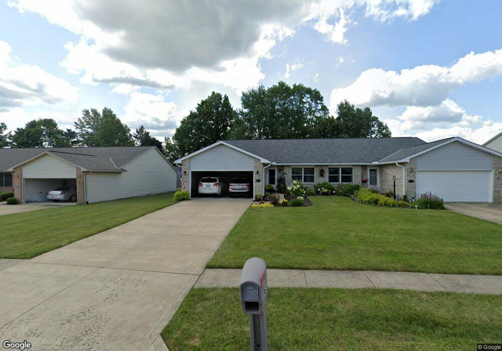
65 Mccullough Blvd Mansfield, OH 44907
Estimated Value: $216,000 - $247,000
2
Beds
2
Baths
1,460
Sq Ft
$158/Sq Ft
Est. Value
About This Home
This home is located at 65 Mccullough Blvd, Mansfield, OH 44907 and is currently estimated at $230,891, approximately $158 per square foot. 65 Mccullough Blvd is a home located in Richland County with nearby schools including Mansfield Christian School, St. Peter's Elementary/Montessori School, and St. Peter's Junior High / High School.
Ownership History
Date
Name
Owned For
Owner Type
Purchase Details
Closed on
Dec 3, 2012
Sold by
Stake Ronald D and Stake Carol A
Bought by
Stake Ronald D and Stake Carol A
Current Estimated Value
Purchase Details
Closed on
Feb 23, 2007
Sold by
Haynie Margaret
Bought by
Stake Ronald D and Stake Carol A
Purchase Details
Closed on
Aug 9, 2004
Sold by
Shaffner Enterprises Inc
Bought by
Haynie Richard D and Haynie Margaret
Home Financials for this Owner
Home Financials are based on the most recent Mortgage that was taken out on this home.
Original Mortgage
$80,000
Interest Rate
6.08%
Mortgage Type
Purchase Money Mortgage
Purchase Details
Closed on
Mar 19, 2003
Sold by
Shaffner Ernest L and Shaffner Loretta A
Bought by
Shaffner Enterprise Inc
Create a Home Valuation Report for This Property
The Home Valuation Report is an in-depth analysis detailing your home's value as well as a comparison with similar homes in the area
Home Values in the Area
Average Home Value in this Area
Purchase History
| Date | Buyer | Sale Price | Title Company |
|---|---|---|---|
| Stake Ronald D | -- | Attorney | |
| Stake Ronald D | $135,900 | Attorney | |
| Haynie Richard D | $130,000 | -- | |
| Shaffner Enterprise Inc | -- | -- |
Source: Public Records
Mortgage History
| Date | Status | Borrower | Loan Amount |
|---|---|---|---|
| Previous Owner | Haynie Richard D | $80,000 |
Source: Public Records
Tax History
| Year | Tax Paid | Tax Assessment Tax Assessment Total Assessment is a certain percentage of the fair market value that is determined by local assessors to be the total taxable value of land and additions on the property. | Land | Improvement |
|---|---|---|---|---|
| 2024 | $2,411 | $63,050 | $4,260 | $58,790 |
| 2023 | $2,493 | $63,050 | $4,260 | $58,790 |
| 2022 | $2,156 | $47,340 | $3,590 | $43,750 |
| 2021 | $2,171 | $47,340 | $3,590 | $43,750 |
| 2020 | $2,220 | $47,340 | $3,590 | $43,750 |
| 2019 | $2,001 | $40,130 | $3,050 | $37,080 |
| 2018 | $1,973 | $40,130 | $3,050 | $37,080 |
| 2017 | $1,920 | $40,130 | $3,050 | $37,080 |
| 2016 | $1,710 | $35,850 | $2,710 | $33,140 |
| 2015 | $1,710 | $35,850 | $2,710 | $33,140 |
| 2014 | $1,612 | $35,850 | $2,710 | $33,140 |
| 2012 | $614 | $35,850 | $2,710 | $33,140 |
Source: Public Records
Map
Nearby Homes
- 104 Elmridge Rd
- 33 Rambleside Dr
- 1179 Burkwood Rd
- 65 Logan Rd
- 0 Lexington Ave Unit 224009661
- 50 Lilac Ct E
- 101 Chilton Ave
- 400 James Ave
- 1599 S Main St
- 0 George Ave
- 489 Clifton Blvd
- 810 Lexington Ave
- 575 Crescent Rd
- 794 Mansfield Washington Rd
- 470 Lexington Ave
- 466 Lexington Ave
- 456 Lexington Ave
- 716 Mansfield Washington Rd
- 537 Woodville Rd
- 0 Woodville Rd Unit Lot 14952, 14953
- 61 Mccullough Blvd Unit 45
- 67 Mccullough Blvd Unit 47
- 59 Mccullough Blvd Unit 44
- 71 Mccullough Blvd Unit 48
- 55 Mccullough Blvd Unit 43
- 72 Elmridge Rd
- 70 Elmridge Rd
- 62 Mccullough Blvd Unit 38
- 64 Mccullough Blvd Unit 37
- 73 Mccullough Blvd Unit 49
- 74 Elmridge Rd
- 58 Mccullough Blvd Unit 40
- 53 Mccullough Blvd Unit 42
- 56 Mccullough Blvd Unit 41
- 77 Mccullough Blvd
- 60 Mccullough Blvd Unit 39
- 74 Mccullough Blvd Unit 33
- 66 Elmridge Rd
- 72 Mccullough Blvd Unit 34
- 79 Mccullough Blvd Unit 51
Your Personal Tour Guide
Ask me questions while you tour the home.