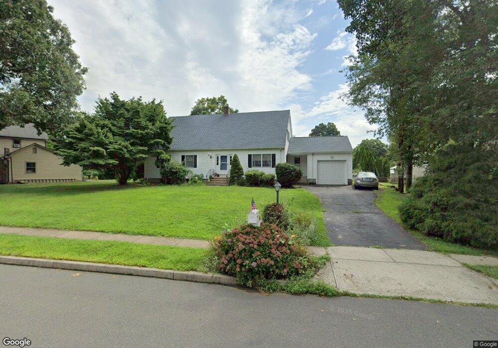
65 Miner Brook Dr Middletown, CT 06457
Westfield NeighborhoodEstimated Value: $470,000 - $590,000
4
Beds
2
Baths
1,972
Sq Ft
$262/Sq Ft
Est. Value
About This Home
This home is located at 65 Miner Brook Dr, Middletown, CT 06457 and is currently estimated at $516,578, approximately $261 per square foot. 65 Miner Brook Dr is a home located in Middlesex County with nearby schools including Moody School and Middletown High School.
Ownership History
Date
Name
Owned For
Owner Type
Purchase Details
Closed on
Jun 30, 2011
Sold by
Richardson Tricia C and Richardson Scott D
Bought by
Chaterdon-Perry E J
Current Estimated Value
Home Financials for this Owner
Home Financials are based on the most recent Mortgage that was taken out on this home.
Original Mortgage
$260,000
Outstanding Balance
$179,154
Interest Rate
4.62%
Estimated Equity
$337,424
Purchase Details
Closed on
Jul 16, 2001
Sold by
Carter David and Carter Susan
Bought by
Taylor Tricia C and Richardson Scott D
Home Financials for this Owner
Home Financials are based on the most recent Mortgage that was taken out on this home.
Original Mortgage
$199,600
Interest Rate
7.2%
Purchase Details
Closed on
Mar 24, 1999
Sold by
Sun America Inv Inc
Bought by
Carter David and Carter Susan
Home Financials for this Owner
Home Financials are based on the most recent Mortgage that was taken out on this home.
Original Mortgage
$144,000
Interest Rate
6.78%
Create a Home Valuation Report for This Property
The Home Valuation Report is an in-depth analysis detailing your home's value as well as a comparison with similar homes in the area
Home Values in the Area
Average Home Value in this Area
Purchase History
| Date | Buyer | Sale Price | Title Company |
|---|---|---|---|
| Chaterdon-Perry E J | $325,000 | -- | |
| Taylor Tricia C | $249,500 | -- | |
| Carter David | $160,000 | -- |
Source: Public Records
Mortgage History
| Date | Status | Borrower | Loan Amount |
|---|---|---|---|
| Open | Chaterdon-Perry E J | $260,000 | |
| Previous Owner | Carter David | $240,000 | |
| Previous Owner | Carter David | $25,000 | |
| Previous Owner | Carter David | $199,600 | |
| Previous Owner | Carter David | $144,000 |
Source: Public Records
Tax History
| Year | Tax Paid | Tax Assessment Tax Assessment Total Assessment is a certain percentage of the fair market value that is determined by local assessors to be the total taxable value of land and additions on the property. | Land | Improvement |
|---|---|---|---|---|
| 2025 | $8,775 | $260,490 | $72,840 | $187,650 |
| 2024 | $8,320 | $260,490 | $72,840 | $187,650 |
| 2023 | $7,826 | $260,490 | $72,840 | $187,650 |
| 2022 | $7,234 | $192,810 | $48,560 | $144,250 |
| 2021 | $7,216 | $192,810 | $48,560 | $144,250 |
| 2020 | $7,227 | $192,810 | $48,560 | $144,250 |
| 2019 | $7,266 | $192,810 | $48,560 | $144,250 |
| 2018 | $7,008 | $192,810 | $48,560 | $144,250 |
| 2017 | $6,836 | $192,830 | $51,840 | $140,990 |
| 2016 | $6,703 | $192,830 | $51,840 | $140,990 |
| 2015 | $6,535 | $192,130 | $51,840 | $140,290 |
| 2014 | $6,537 | $192,130 | $51,840 | $140,290 |
Source: Public Records
Map
Nearby Homes
- 7 W Meadow Ln Unit 5
- 72 Glendale Ave
- 301 Carriage Crossing Ln Unit 301
- 118 Carriage Crossing Ln
- 285 Carriage Crossing Ln Unit 285
- 318 Carriage Crossing Ln Unit 318
- 180 Carriage Crossing Ln Unit 180
- 167 Carriage Crossing Ln
- 281 Briarwood Ln
- 886 East St
- 123 Webster Ln
- 128 Webster Ln
- 145 Webster Ln Unit 2-41
- 137 Webster Ln Unit 2-42
- 14 Rising Trail Dr
- 36 Rising Trail Dr Unit 36
- 182 Rising Trail Dr Unit 182
- 123 Burgundy Hill Ln
- 227 Burgundy Hill Ln Unit 227
- 56 Burgundy Hill Ln Unit 56
- 55 Miner Brook Dr
- 75 Miner Brook Dr
- 45 Miner Brook Dr
- 70 Miner Brook Dr
- 80 Miner Brook Dr
- 60 Miner Brook Dr
- 124 Miner St
- 50 Miner Brook Dr
- 38 Smith St
- 48 Smith St
- 130 Miner St
- 58 Smith St
- 129 Glenwood Terrace
- 119 Glenwood Terrace
- 28 Smith St
- 139 Glenwood Terrace
- 109 Glenwood Terrace
- 115 Miner St
- 60 Miner St
- 149 Glenwood Terrace
Your Personal Tour Guide
Ask me questions while you tour the home.