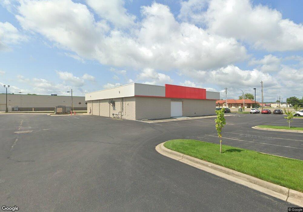
65 N University Blvd Middletown, OH 45042
Church NeighborhoodEstimated Value: $270,814
--
Bed
--
Bath
6,889
Sq Ft
$39/Sq Ft
Est. Value
About This Home
This home is located at 65 N University Blvd, Middletown, OH 45042 and is currently estimated at $270,814, approximately $39 per square foot. 65 N University Blvd is a home located in Butler County with nearby schools including Rosa Parks Elementary School, Highview 6th Grade Center, and Middletown Middle School.
Ownership History
Date
Name
Owned For
Owner Type
Purchase Details
Closed on
Apr 13, 2022
Sold by
Adam Dwyer Funeral Trade Inc
Bought by
65 North University Llc
Current Estimated Value
Purchase Details
Closed on
Jul 29, 2021
Sold by
Aei Income & Growth Fund 24 Llc
Bought by
Adam Dwyer Funeral Rrrade Inc
Purchase Details
Closed on
Jun 29, 2021
Sold by
Aei Income & Growth Fund 24 Llc
Bought by
Adam Dwyer Funeral Trade Inc
Purchase Details
Closed on
May 3, 2006
Sold by
Blue Bell Partners Llc
Bought by
Aei Income & Growth Fund 24 Llc and Aei Income & Growth Fund 26 Llc
Create a Home Valuation Report for This Property
The Home Valuation Report is an in-depth analysis detailing your home's value as well as a comparison with similar homes in the area
Home Values in the Area
Average Home Value in this Area
Purchase History
| Date | Buyer | Sale Price | Title Company |
|---|---|---|---|
| 65 North University Llc | -- | Brown Law Office Llc | |
| Adam Dwyer Funeral Rrrade Inc | $199,000 | First Amer Ttl Ins Co Ncs | |
| Adam Dwyer Funeral Trade Inc | $199,000 | First American Title | |
| Aei Income & Growth Fund 24 Llc | $1,820,400 | None Available |
Source: Public Records
Tax History Compared to Growth
Tax History
| Year | Tax Paid | Tax Assessment Tax Assessment Total Assessment is a certain percentage of the fair market value that is determined by local assessors to be the total taxable value of land and additions on the property. | Land | Improvement |
|---|---|---|---|---|
| 2024 | $6,948 | $91,540 | $39,250 | $52,290 |
| 2023 | $3,971 | $66,170 | $39,250 | $26,920 |
| 2022 | $4,431 | $66,170 | $39,250 | $26,920 |
| 2021 | $4,260 | $66,170 | $39,250 | $26,920 |
| 2020 | $6,115 | $91,540 | $39,250 | $52,290 |
| 2019 | $10,630 | $146,660 | $20,930 | $125,730 |
| 2018 | $10,680 | $146,660 | $20,930 | $125,730 |
| 2017 | $10,727 | $146,660 | $20,930 | $125,730 |
| 2016 | $11,034 | $146,660 | $20,930 | $125,730 |
| 2015 | $10,875 | $146,660 | $20,930 | $125,730 |
| 2014 | $10,549 | $146,660 | $20,930 | $125,730 |
| 2013 | $10,549 | $153,520 | $20,930 | $132,590 |
Source: Public Records
Map
Nearby Homes
- 113 N Sutphin St
- 2007 Central Ave
- 206 N Sutphin St
- 2016 Linden Ave
- 2113 Central Ave
- 2115 Central Ave
- 2112 Central Ave
- 6800 Fielders Way
- 211 Harrison St
- 2119 Central Ave
- 319 Moore St
- 1609 1st Ave
- 15 Garfield St
- 1814.5 Logan Ave
- 408 Moore St
- 19 Mckinley St
- 1812 Carroll Ave
- 410 Moore St
- 1814 Logan Ave
- 2208 Superior Ave
- 109 N University Blvd
- 1901 Manchester Ave
- 1913 Manchester Ave
- 1915 Manchester Ave
- 1919 Manchester Ave
- 1901 Casper St
- 1903 Casper St
- 1911 Casper St
- 1917 Casper St
- 1913 Casper St
- 1913 Casper Ave
- 1914 Central Ave
- 1955 Central Ave
- 1949 Central Ave
- 1951 Central Ave
- 20 N Sutphin St
- 104 N Sutphin St
- 104 N Sutphin St Unit 2
- 104 N Sutphin St Unit 3
- 100 N Sutphin St