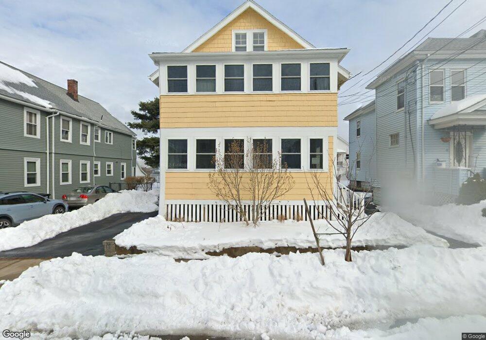
65 Putnam Rd Somerville, MA 02145
Ten Hills NeighborhoodEstimated Value: $932,171 - $1,102,000
4
Beds
2
Baths
2,250
Sq Ft
$450/Sq Ft
Est. Value
About This Home
This home is located at 65 Putnam Rd, Somerville, MA 02145 and is currently estimated at $1,011,793, approximately $449 per square foot. 65 Putnam Rd is a home located in Middlesex County with nearby schools including Somerville High School, Prospect Hill Academy Upper Elementary Campus, and Bright Future Educare Center.
Ownership History
Date
Name
Owned For
Owner Type
Purchase Details
Closed on
Jul 23, 1998
Sold by
Eifler Richard W and Comeau Merill L
Bought by
Altman Micah and Mills Kylie K
Current Estimated Value
Home Financials for this Owner
Home Financials are based on the most recent Mortgage that was taken out on this home.
Original Mortgage
$218,250
Interest Rate
6.99%
Mortgage Type
Purchase Money Mortgage
Create a Home Valuation Report for This Property
The Home Valuation Report is an in-depth analysis detailing your home's value as well as a comparison with similar homes in the area
Home Values in the Area
Average Home Value in this Area
Purchase History
| Date | Buyer | Sale Price | Title Company |
|---|---|---|---|
| Altman Micah | $242,500 | -- |
Source: Public Records
Mortgage History
| Date | Status | Borrower | Loan Amount |
|---|---|---|---|
| Open | Altman Micah | $221,986 | |
| Closed | Altman Micah | $28,058 | |
| Closed | Altman Micah | $218,250 |
Source: Public Records
Tax History
| Year | Tax Paid | Tax Assessment Tax Assessment Total Assessment is a certain percentage of the fair market value that is determined by local assessors to be the total taxable value of land and additions on the property. | Land | Improvement |
|---|---|---|---|---|
| 2025 | $8,311 | $761,800 | $395,000 | $366,800 |
| 2024 | $7,812 | $742,600 | $395,000 | $347,600 |
| 2023 | $7,620 | $736,900 | $395,000 | $341,900 |
| 2022 | $7,016 | $689,200 | $376,100 | $313,100 |
| 2021 | $6,346 | $622,800 | $326,900 | $295,900 |
| 2020 | $5,709 | $565,800 | $275,600 | $290,200 |
| 2019 | $5,185 | $481,900 | $239,600 | $242,300 |
| 2018 | $5,946 | $525,700 | $279,100 | $246,600 |
| 2017 | $5,708 | $489,100 | $263,300 | $225,800 |
| 2016 | $5,874 | $468,800 | $230,600 | $238,200 |
| 2015 | $5,498 | $436,000 | $202,000 | $234,000 |
Source: Public Records
Map
Nearby Homes
- 72 Governor Winthrop Rd Unit 2
- 34 Governor Winthrop Rd Unit 1
- 41 Bailey Rd
- 66 Grant St Unit 1
- 100 Station Landing Unit 1008
- 654 Mystic Ave Unit B
- 656 Mystic Ave Unit B
- 658 Mystic Ave Unit B
- 658 Mystic Ave Unit A
- 79 Moreland St
- 19 Fenwick St Unit 4
- 375 Canal St Unit 1103
- 100 Fremont St
- 77 Fremont St Unit 1
- 17 Kensington Ave
- 3920 Mystic Valley Pkwy Unit 620
- 3920 Mystic Valley Pkwy Unit 613
- 3920 Mystic Valley Pkwy Unit 303
- 3920 Mystic Valley Pkwy Unit 709
- 115 Thurston St Unit I
- 69 Putnam Rd
- 61 Putnam Rd
- 61 Putnam Rd
- 61 Putnam Rd
- 61 Putnam Rd Unit 2
- 61 Putnam Road (Not Street) Unit 2
- 59 Putnam Rd
- 118 Ten Hills Rd Unit 120
- 73 Putnam Rd
- 116 Ten Hills Rd
- 116 Ten Hills Rd Unit 2
- 122 Ten Hills Rd
- 114 Ten Hills Rd
- 114 Ten Hills Rd Unit 114
- 114 Ten Hills Rd Unit 1
- 66 Putnam Rd Unit 66
- 66 Putnam Rd Unit 2
- 66 Putnam Rd Unit 1
- 66 Putnam Rd Unit 68
- 68 Putnam Rd Unit 68
Your Personal Tour Guide
Ask me questions while you tour the home.