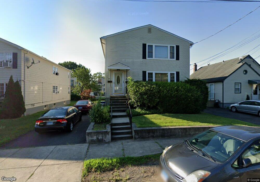
65 Robin St Bridgeport, CT 06606
Brooklawn-Saint Vincent NeighborhoodEstimated Value: $486,704 - $703,000
6
Beds
2
Baths
2,688
Sq Ft
$231/Sq Ft
Est. Value
About This Home
This home is located at 65 Robin St, Bridgeport, CT 06606 and is currently estimated at $620,926, approximately $230 per square foot. 65 Robin St is a home located in Fairfield County with nearby schools including Blackham School, Central High School, and Assumption Catholic School.
Create a Home Valuation Report for This Property
The Home Valuation Report is an in-depth analysis detailing your home's value as well as a comparison with similar homes in the area
Home Values in the Area
Average Home Value in this Area
Tax History
| Year | Tax Paid | Tax Assessment Tax Assessment Total Assessment is a certain percentage of the fair market value that is determined by local assessors to be the total taxable value of land and additions on the property. | Land | Improvement |
|---|---|---|---|---|
| 2025 | $9,139 | $210,330 | $75,310 | $135,020 |
| 2024 | $9,139 | $210,330 | $75,310 | $135,020 |
| 2023 | $9,139 | $210,330 | $75,310 | $135,020 |
| 2022 | $9,139 | $210,330 | $75,310 | $135,020 |
| 2021 | $9,139 | $210,330 | $75,310 | $135,020 |
| 2020 | $8,265 | $153,090 | $42,490 | $110,600 |
| 2019 | $8,265 | $153,090 | $42,490 | $110,600 |
| 2018 | $8,324 | $153,090 | $42,490 | $110,600 |
| 2017 | $8,324 | $153,090 | $42,490 | $110,600 |
| 2016 | $8,324 | $153,090 | $42,490 | $110,600 |
| 2015 | $8,627 | $204,440 | $51,410 | $153,030 |
| 2014 | $8,627 | $204,440 | $51,410 | $153,030 |
Source: Public Records
Map
Nearby Homes
- 95 Alexander Ave
- 125 Garden Dr
- 156 Garden Dr Unit 158
- 105 Tremont Ave Unit E
- 105 Tremont Ave Unit 2
- 671 Fairview Ave
- 125 Alexander Dr
- 631 Fairview Ave
- 254 Wayne St
- 85 Alexander Dr
- 525 Westfield Ave
- 405 Westfield Ave
- 123 Harlem Ave
- 74 Harlem Ave
- 11 Stratfield Place
- 26 Marsdale Ave
- 2625 Park Ave Unit 9R
- 234 Savoy St
- 2675 Park Ave Unit 26
- 3200 Park Ave Unit 5F1
Your Personal Tour Guide
Ask me questions while you tour the home.