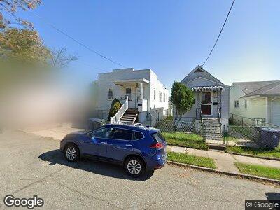
650 Atlantic Ave Perth Amboy, NJ 08861
Amboy Avenue NeighborhoodEstimated Value: $296,032 - $376,000
--
Bed
--
Bath
1,029
Sq Ft
$327/Sq Ft
Est. Value
About This Home
This home is located at 650 Atlantic Ave, Perth Amboy, NJ 08861 and is currently estimated at $336,258, approximately $326 per square foot. 650 Atlantic Ave is a home located in Middlesex County with nearby schools including Perth Amboy High School, Middlesex County STEM Charter School, and Academy for Urban Leadership Charter School.
Ownership History
Date
Name
Owned For
Owner Type
Purchase Details
Closed on
Sep 7, 2017
Sold by
Perez Martin R and Perez Mayra
Bought by
Perez Mayra
Current Estimated Value
Purchase Details
Closed on
Jun 30, 1999
Sold by
Melnyk Anna
Bought by
Perez Martin and Perez Mayra
Home Financials for this Owner
Home Financials are based on the most recent Mortgage that was taken out on this home.
Original Mortgage
$70,800
Interest Rate
7.49%
Create a Home Valuation Report for This Property
The Home Valuation Report is an in-depth analysis detailing your home's value as well as a comparison with similar homes in the area
Home Values in the Area
Average Home Value in this Area
Purchase History
| Date | Buyer | Sale Price | Title Company |
|---|---|---|---|
| Perez Mayra | -- | None Available | |
| Perez Martin | $73,000 | -- |
Source: Public Records
Mortgage History
| Date | Status | Borrower | Loan Amount |
|---|---|---|---|
| Open | Perez Martin R | $34,000 | |
| Closed | Perez Martin R | $100,000 | |
| Closed | Perez Martin | $70,800 |
Source: Public Records
Tax History Compared to Growth
Tax History
| Year | Tax Paid | Tax Assessment Tax Assessment Total Assessment is a certain percentage of the fair market value that is determined by local assessors to be the total taxable value of land and additions on the property. | Land | Improvement |
|---|---|---|---|---|
| 2024 | $5,296 | $175,900 | $111,400 | $64,500 |
| 2023 | $5,296 | $175,900 | $111,400 | $64,500 |
| 2022 | $5,233 | $175,900 | $111,400 | $64,500 |
| 2021 | $5,240 | $175,900 | $111,400 | $64,500 |
| 2020 | $5,238 | $175,900 | $111,400 | $64,500 |
| 2019 | $5,258 | $175,900 | $111,400 | $64,500 |
| 2018 | $5,212 | $175,900 | $111,400 | $64,500 |
| 2017 | $5,201 | $175,900 | $111,400 | $64,500 |
| 2016 | $5,066 | $175,900 | $111,400 | $64,500 |
| 2015 | $5,101 | $175,900 | $111,400 | $64,500 |
| 2014 | $5,133 | $175,900 | $111,400 | $64,500 |
Source: Public Records
Map
Nearby Homes
- 491 Compton Ave
- 549 Compton Ave
- 757 Chester St
- 687 Hommann Ave
- 676 Johnstone St
- 537 Harding Ave
- 596 Johnstone St
- 381 Keene St
- 423 Augustine Place
- 424 Steadman Place
- 651 Penn St
- 298 Sutton St
- 685 Raritan Ave
- 434 Lawrence St Unit 12
- 434 Lawrence St Unit 6
- 308 Keene St
- 533 W Side Ave
- 336 Lawrence St
- 422 Johnstone St
- 747 Catherine St
- 650 Atlantic Ave
- 648 Atlantic Ave
- 652 Atlantic Ave
- 644 Atlantic Ave
- 649 Cornell St
- 647 Cornell St
- 645 Cornell St
- 643 Cornell St
- 651 Cornell St
- 651 Atlantic Ave
- 639 Cornell St
- 643 Atlantic Ave
- 641 Atlantic Ave
- 639 Atlantic Ave
- 639 Atlantic Ave Unit 9
- 454 Hall Ave
- 458 Hall Ave
- 452 Hall Ave
- 450 Hall Ave
- 464 Hall Ave