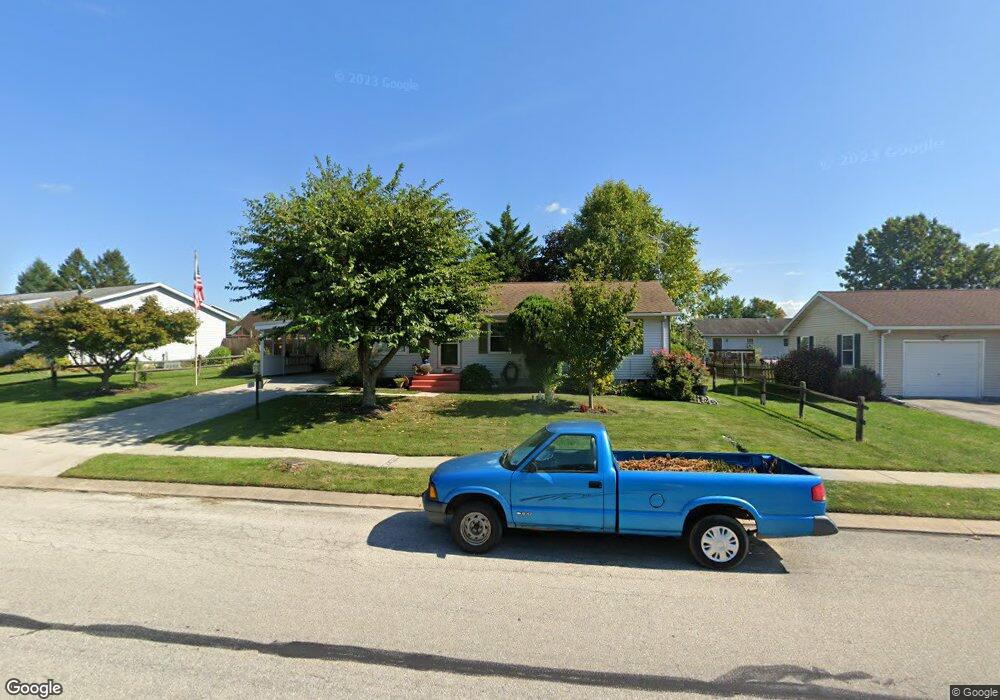
650 Poplar St Unit 92 Hanover, PA 17331
Estimated Value: $230,771 - $251,000
3
Beds
1
Bath
1,100
Sq Ft
$218/Sq Ft
Est. Value
About This Home
This home is located at 650 Poplar St Unit 92, Hanover, PA 17331 and is currently estimated at $239,693, approximately $217 per square foot. 650 Poplar St Unit 92 is a home located in Adams County with nearby schools including New Oxford Senior High School, St. Teresa of Calcutta Catholic School - McSherrystown Campus, and St. Teresa of Calcutta Catholic School - Conewago Campus.
Ownership History
Date
Name
Owned For
Owner Type
Purchase Details
Closed on
Jan 5, 1989
Bought by
Lippy Philip A and Virginia Sue
Current Estimated Value
Create a Home Valuation Report for This Property
The Home Valuation Report is an in-depth analysis detailing your home's value as well as a comparison with similar homes in the area
Home Values in the Area
Average Home Value in this Area
Purchase History
| Date | Buyer | Sale Price | Title Company |
|---|---|---|---|
| Lippy Philip A | $66,700 | -- |
Source: Public Records
Tax History Compared to Growth
Tax History
| Year | Tax Paid | Tax Assessment Tax Assessment Total Assessment is a certain percentage of the fair market value that is determined by local assessors to be the total taxable value of land and additions on the property. | Land | Improvement |
|---|---|---|---|---|
| 2025 | $4,081 | $170,400 | $43,000 | $127,400 |
| 2024 | $3,769 | $170,400 | $43,000 | $127,400 |
| 2023 | $3,630 | $170,400 | $43,000 | $127,400 |
| 2022 | $3,519 | $170,400 | $43,000 | $127,400 |
| 2021 | $3,429 | $170,400 | $43,000 | $127,400 |
| 2020 | $3,434 | $170,400 | $43,000 | $127,400 |
| 2019 | $3,280 | $170,400 | $43,000 | $127,400 |
| 2018 | $3,211 | $170,400 | $43,000 | $127,400 |
| 2017 | $3,078 | $170,400 | $43,000 | $127,400 |
| 2016 | -- | $170,400 | $43,000 | $127,400 |
| 2015 | -- | $170,400 | $43,000 | $127,400 |
| 2014 | -- | $170,400 | $43,000 | $127,400 |
Source: Public Records
Map
Nearby Homes
- 644 Poplar St Unit 93
- 20 Caribou St Unit 103
- 14 Caribou St Unit 104
- 638 Poplar St Unit 94
- 26 Caribou St Unit 102
- 662 Poplar St Unit 90
- 649 Poplar St Unit 82
- 645 Poplar St Unit 81
- 8 Caribou St Unit 105
- 655 Poplar St Unit 83
- 641 Poplar St Unit 80
- 678 Poplar St Unit 89
- 632 Poplar St Unit 95
- 661 Poplar St Unit 84
- 32 Caribou St Unit 101
- 635 Poplar St Unit 79
- 8 Elk Dr Unit 106
- 17 Caribou St Unit 110
- 677 Poplar St Unit 85
- 11 Caribou St Unit 109