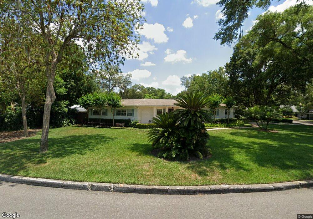
650 Randy Ln Winter Park, FL 32789
Estimated Value: $887,000 - $1,043,000
3
Beds
3
Baths
2,221
Sq Ft
$423/Sq Ft
Est. Value
About This Home
This home is located at 650 Randy Ln, Winter Park, FL 32789 and is currently estimated at $939,549, approximately $423 per square foot. 650 Randy Ln is a home located in Orange County with nearby schools including Audubon Park School, Winter Park High, and Central Florida Leadership Academy Charter.
Ownership History
Date
Name
Owned For
Owner Type
Purchase Details
Closed on
Apr 15, 2016
Sold by
Radford Michael L and Radford Renea R
Bought by
Gainsford Bret C and Gainsford Rachel W
Current Estimated Value
Home Financials for this Owner
Home Financials are based on the most recent Mortgage that was taken out on this home.
Original Mortgage
$318,000
Outstanding Balance
$252,299
Interest Rate
3.64%
Mortgage Type
Credit Line Revolving
Estimated Equity
$687,250
Purchase Details
Closed on
May 31, 1994
Sold by
Heart Of City Foundation Inc
Bought by
Radford Michael L and Radford Renea R
Home Financials for this Owner
Home Financials are based on the most recent Mortgage that was taken out on this home.
Original Mortgage
$149,400
Interest Rate
8.46%
Purchase Details
Closed on
Jun 4, 1993
Sold by
Mcmurrin Roger G and Mcmurrin Beverly Diane
Bought by
Heart City Foundation Inc
Create a Home Valuation Report for This Property
The Home Valuation Report is an in-depth analysis detailing your home's value as well as a comparison with similar homes in the area
Home Values in the Area
Average Home Value in this Area
Purchase History
| Date | Buyer | Sale Price | Title Company |
|---|---|---|---|
| Gainsford Bret C | $397,500 | First Advantage Titlepartner | |
| Radford Michael L | $166,000 | -- | |
| Heart City Foundation Inc | $170,100 | -- |
Source: Public Records
Mortgage History
| Date | Status | Borrower | Loan Amount |
|---|---|---|---|
| Open | Gainsford Bret C | $318,000 | |
| Previous Owner | Radford Michael L | $149,400 |
Source: Public Records
Tax History
| Year | Tax Paid | Tax Assessment Tax Assessment Total Assessment is a certain percentage of the fair market value that is determined by local assessors to be the total taxable value of land and additions on the property. | Land | Improvement |
|---|---|---|---|---|
| 2025 | $6,612 | $456,421 | -- | -- |
| 2024 | $6,131 | $443,558 | -- | -- |
| 2023 | $6,131 | $418,502 | $0 | $0 |
| 2022 | $5,667 | $406,313 | $0 | $0 |
| 2021 | $5,602 | $394,479 | $0 | $0 |
| 2020 | $4,953 | $360,926 | $0 | $0 |
| 2019 | $5,118 | $352,811 | $0 | $0 |
| 2018 | $5,087 | $346,233 | $0 | $0 |
| 2017 | $4,375 | $332,233 | $185,000 | $147,233 |
| 2016 | $2,625 | $329,668 | $185,000 | $144,668 |
| 2015 | $2,687 | $317,846 | $169,000 | $148,846 |
| 2014 | $2,709 | $305,283 | $188,000 | $117,283 |
Source: Public Records
Map
Nearby Homes
- 2119 Howard Dr
- 2823 Wright Ave
- 640 Arjay Way
- 2722 Eastern Pkwy
- 151 Oakwood Way
- 2040 Randall Cir
- 1841 Harland Park Dr
- 2501 Winter Park Rd
- 3018 Northwood Blvd
- 2614 Parkland Dr
- 2812 Mulford Ave
- 2035 Lake Sue Dr
- 3505 Corrine Dr
- 1809 Hammerlin Ave
- 1807 Hammerlin Ave Unit G
- 3838 Haws Ln
- 2059 Woodlawn Dr
- 207 E Kings Way
- 1901 Lake Sue Dr
- 1702 Glenridge Way
Your Personal Tour Guide
Ask me questions while you tour the home.