Estimated Value: $188,000 - $251,000
Studio
2
Baths
1,413
Sq Ft
$157/Sq Ft
Est. Value
About This Home
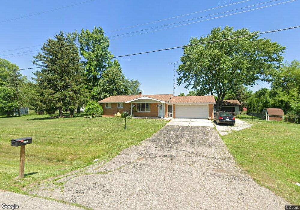
This home is located at 6501 Nightingale Dr Unit Bldg-Unit, Flint, MI 48506 and is currently estimated at $222,475, approximately $157 per square foot. 6501 Nightingale Dr Unit Bldg-Unit is a home located in Genesee County with nearby schools including Weston Elementary School, Leota Fiedler Elementary School, and Kate Dowdall Elementary School.
Ownership History
Date
Name
Owned For
Owner Type
Purchase Details
Closed on
Feb 23, 2018
Sold by
Ferguson Rex S and Ferguson Penny R
Bought by
Williams Dale and Williams Ciristina
Current Estimated Value
Purchase Details
Closed on
Jan 23, 2013
Sold by
Ferguson Rex S and Ferguson Penny R
Bought by
Ferguson Rex S and Ferguson Penny R
Purchase Details
Closed on
Sep 9, 2005
Sold by
Shinabarger James C and Shinabarger Barbara H
Bought by
Ferguson Rex S and Ferguson Penny R
Purchase Details
Closed on
Nov 30, 2004
Sold by
Shinabarger James C and Robbins Norma E
Bought by
Shinabarger James C and Shinabarger Barbara H
Purchase Details
Closed on
Oct 3, 2002
Sold by
Shinabarger James C and Shinabarger Barbara H
Bought by
Robbins Norma E and Shinabarger James C
Purchase Details
Closed on
Aug 7, 2000
Sold by
Robbins Norma E
Bought by
Robbins Norma E and Shinabarger James C
Create a Home Valuation Report for This Property
The Home Valuation Report is an in-depth analysis detailing your home's value as well as a comparison with similar homes in the area
Home Values in the Area
Average Home Value in this Area
Purchase History
We collect this data history from publicly available records. To have your information removed, we recommend requesting removal directly through your county’s website.
| Date | Buyer | Sale Price | Title Company |
|---|---|---|---|
| Williams Dale | $149,900 | Bell Title Agency | |
| Ferguson Rex S | -- | None Available | |
| Ferguson Rex S | $118,000 | Sargents Title Company | |
| Shinabarger James C | -- | -- | |
| Robbins Norma E | -- | -- | |
| Robbins Norma E | -- | -- |
Source: Public Records
Tax History
| Year | Tax Paid | Tax Assessment Tax Assessment Total Assessment is a certain percentage of the fair market value that is determined by local assessors to be the total taxable value of land and additions on the property. | Land | Improvement |
|---|---|---|---|---|
| 2025 | $3,423 | $99,500 | $0 | $0 |
| 2024 | $787 | $92,300 | $0 | $0 |
| 2023 | $750 | $82,700 | $0 | $0 |
| 2022 | $2,860 | $77,200 | $0 | $0 |
| 2021 | $2,840 | $70,600 | $0 | $0 |
| 2020 | $686 | $64,400 | $0 | $0 |
| 2019 | $675 | $58,200 | $0 | $0 |
| 2018 | $1,799 | $52,600 | $0 | $0 |
| 2017 | $1,770 | $51,100 | $0 | $0 |
| 2016 | $1,730 | $49,400 | $0 | $0 |
| 2015 | $1,464 | $48,000 | $0 | $0 |
| 2014 | $489 | $43,500 | $0 | $0 |
| 2012 | -- | $41,500 | $41,500 | $0 |
Source: Public Records
Map
Nearby Homes
- 4156 Bobwhite Dr
- 6437 Oriole Dr
- 6350 Tamara Dr
- 4450 N Vassar Rd
- 6443 Richfield Rd
- 6062 Hopkins Rd
- 6054 E Pierson Rd
- 5165 N Irish Rd
- 5189 N Irish Rd
- 5177 N Irish Rd
- 1240 N Irish Rd
- 5481 Tipperary Ln
- 5482 Shamrock Ln
- 0 Whisper Ridge Ct
- 7200 E Potter Rd
- 2465 Mcclellan Blvd
- 2423 Whisper Ridge Dr
- 2411 Briar Creek Ln
- 2390 N Vassar Rd
- 5501 Potter Rd
- 6501 Nightingale Dr
- 6479 Nightingale Dr
- 4265 N Vassar Rd
- 4255 N Vassar Rd
- 4277 N Vassar Rd
- 6492 Nightingale Dr
- 6504 Nightingale Dr Unit Bldg-Unit
- 6504 Nightingale Dr
- 6484 Nightingale Dr
- 4231 N Vassar Rd
- 6474 Nightingale Dr
- 4295 N Vassar Rd
- 4266 Pheasant Dr
- 4286 Pheasant Dr
- 4294 Pheasant Dr
- 4191 Red Bird Ln
- 6464 Nightingale Dr
- 4304 Pheasant Dr
- 4307 N Vassar Rd
- 6456 Nightingale Dr
Your Personal Tour Guide
Ask me questions while you tour the home.