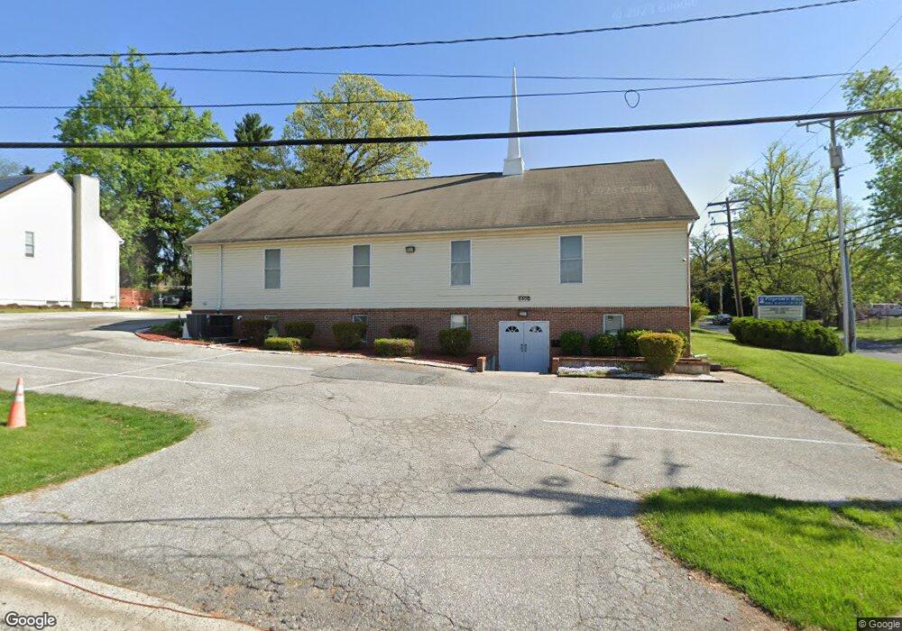
6501 Parsons Ave Baltimore, MD 21215
Reisterstown Station NeighborhoodEstimated Value: $94,463
--
Bed
--
Bath
2,304
Sq Ft
$41/Sq Ft
Est. Value
About This Home
This home is located at 6501 Parsons Ave, Baltimore, MD 21215 and is currently priced at $94,463, approximately $40 per square foot. 6501 Parsons Ave is a home located in Baltimore City with nearby schools including Calvin M. Rodwell Elementary School, Booker T. Washington Middle School, and Forest Park High School.
Ownership History
Date
Name
Owned For
Owner Type
Purchase Details
Closed on
May 5, 2000
Sold by
Progressive Brothers
Bought by
Progressive Brothers and Investment Club
Current Estimated Value
Purchase Details
Closed on
Jun 16, 1999
Sold by
Gospel In Action Inc The
Bought by
Progressive Brothers and Investment Club
Purchase Details
Closed on
Mar 19, 1999
Sold by
Mcenroe James E
Bought by
Gospel In Action Inc The
Create a Home Valuation Report for This Property
The Home Valuation Report is an in-depth analysis detailing your home's value as well as a comparison with similar homes in the area
Home Values in the Area
Average Home Value in this Area
Purchase History
| Date | Buyer | Sale Price | Title Company |
|---|---|---|---|
| Progressive Brothers | $485,000 | -- | |
| Progressive Brothers | $75,000 | -- | |
| Gospel In Action Inc The | $27,000 | -- |
Source: Public Records
Tax History Compared to Growth
Tax History
| Year | Tax Paid | Tax Assessment Tax Assessment Total Assessment is a certain percentage of the fair market value that is determined by local assessors to be the total taxable value of land and additions on the property. | Land | Improvement |
|---|---|---|---|---|
| 2025 | $8,390 | $359,300 | -- | -- |
| 2024 | $8,390 | $355,500 | $82,500 | $273,000 |
| 2023 | $0 | $355,500 | $82,500 | $273,000 |
| 2022 | $8,390 | $355,500 | $82,500 | $273,000 |
| 2021 | $9,079 | $384,700 | $82,500 | $302,200 |
| 2020 | $0 | $384,700 | $82,500 | $302,200 |
| 2019 | $0 | $384,700 | $82,500 | $302,200 |
| 2018 | $0 | $392,700 | $82,500 | $310,200 |
| 2017 | $9,268 | $392,700 | $0 | $0 |
| 2016 | -- | $392,700 | $0 | $0 |
| 2015 | -- | $399,000 | $0 | $0 |
| 2014 | -- | $399,000 | $0 | $0 |
Source: Public Records
Map
Nearby Homes
- 6509 Parr Ave
- 6603 Fairmount Ave
- 6705 Fairmount Ave
- 6615 Laurel Dr
- 6811 Parsons Ave
- 4108 Fords Ln
- 3833 Arbutus Ave
- 3655 Forest Garden Ave
- 3809 Southern Cross Dr
- 3724 Oak Ave
- 3805 Arbutus Ave
- 3716 Sylvan Dr
- 4348 Danlou Dr
- 7023 Concord Rd
- 7004 Alden Rd
- 5561 Kennison Ave
- 3737 Clarks Ln
- 3737 Clarks Ln
- 3811 Parkview Ave
- 6804 Carol Rd
- 6505 Parsons Ave
- 4610 Patterson Ave
- Parsons Ave
- 6507 Parsons Ave
- 6500 Parsons Ave
- 4700 Patterson Ave
- 6504 Brighton Ave
- 6502 Parsons Ave
- 6504 Parsons Ave
- 6511 Parsons Ave
- 6506 Parsons Ave
- 6508 Parsons Ave
- 4602 Patterson Ave
- 6501 Fairmount Ave
- 6501 Fairmount Ave
- 6503 Brighton Ave
- 6510 Brighton Ave
- 6503 Fairmount Ave
- 6505 Fairmount Ave
- 6511 Brighton Ave Unit D