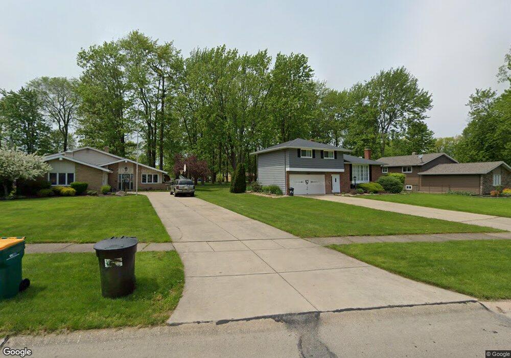
6502 Melshore Dr Mentor, OH 44060
Estimated Value: $272,624 - $306,000
3
Beds
2
Baths
1,248
Sq Ft
$230/Sq Ft
Est. Value
About This Home
This home is located at 6502 Melshore Dr, Mentor, OH 44060 and is currently estimated at $286,906, approximately $229 per square foot. 6502 Melshore Dr is a home located in Lake County with nearby schools including Fairfax Elementary School, Memorial Middle School, and Mentor High School.
Ownership History
Date
Name
Owned For
Owner Type
Purchase Details
Closed on
Feb 24, 2004
Sold by
Martin Donald E and Martin Virginia I
Bought by
Mazzocco Brian A and Mazzocco Deborah J
Current Estimated Value
Home Financials for this Owner
Home Financials are based on the most recent Mortgage that was taken out on this home.
Original Mortgage
$141,600
Outstanding Balance
$64,458
Interest Rate
5.74%
Mortgage Type
Purchase Money Mortgage
Estimated Equity
$222,448
Purchase Details
Closed on
Jan 1, 1990
Bought by
Martin Donald E
Create a Home Valuation Report for This Property
The Home Valuation Report is an in-depth analysis detailing your home's value as well as a comparison with similar homes in the area
Home Values in the Area
Average Home Value in this Area
Purchase History
| Date | Buyer | Sale Price | Title Company |
|---|---|---|---|
| Mazzocco Brian A | $177,000 | Insured Title | |
| Martin Donald E | -- | -- |
Source: Public Records
Mortgage History
| Date | Status | Borrower | Loan Amount |
|---|---|---|---|
| Open | Mazzocco Brian A | $141,600 | |
| Closed | Mazzocco Brian A | $26,500 |
Source: Public Records
Tax History
| Year | Tax Paid | Tax Assessment Tax Assessment Total Assessment is a certain percentage of the fair market value that is determined by local assessors to be the total taxable value of land and additions on the property. | Land | Improvement |
|---|---|---|---|---|
| 2025 | -- | $84,990 | $27,020 | $57,970 |
| 2024 | -- | $84,990 | $27,020 | $57,970 |
| 2023 | $6,717 | $64,640 | $19,120 | $45,520 |
| 2022 | $3,051 | $64,640 | $19,120 | $45,520 |
| 2021 | $3,060 | $64,640 | $19,120 | $45,520 |
| 2020 | $2,957 | $54,780 | $16,210 | $38,570 |
| 2019 | $2,961 | $54,780 | $16,210 | $38,570 |
| 2018 | $2,952 | $48,960 | $19,540 | $29,420 |
| 2017 | $2,775 | $48,960 | $19,540 | $29,420 |
| 2016 | $2,759 | $48,960 | $19,540 | $29,420 |
| 2015 | $2,522 | $48,960 | $19,540 | $29,420 |
| 2014 | $2,421 | $46,300 | $19,540 | $26,760 |
| 2013 | $2,423 | $46,300 | $19,540 | $26,760 |
Source: Public Records
Map
Nearby Homes
- 6484 Elmwood Rd
- 6595 Devonshire Ct
- 6270 Cumberland Dr
- 6676 Oakdale Rd
- 8140 Independence Dr Unit B
- 7723 Rutland Dr
- 8078 Puritan Dr Unit 58-D
- 8104 Puritan Dr Unit 52-C
- 7992 Puritan Dr Unit 76-C
- 6853 Colonial Dr Unit A
- 6239 Dunbar Dr
- 8285 Munson Rd
- 7972 Colonial Dr Unit 89C
- 6452 Brooks Blvd
- 8031 Munson Rd
- 8290 Quail Point Ln
- 6067 Collins Rd
- 6218 Center St Unit 6218
- 6443 Chase Dr
- 8352 Quail Point Ln Unit 8352
- 6498 Melshore Dr
- 6512 Melshore Dr
- 6490 Melshore Dr
- 6518 Melshore Dr
- 6497 Bryson Dr
- 6511 Melshore Dr
- 6491 Bryson Dr
- 6505 Bryson Dr
- 6526 Melshore Dr
- 6513 Bryson Dr
- 6483 Bryson Dr
- 6525 Melshore Dr
- 8072 Meadowdale Dr
- 8080 Meadowdale Dr
- 8066 Meadowdale Dr
- 6503 Melshore Dr
- 6517 Melshore Dr
- 6495 Melshore Dr
- 8088 Meadowdale Dr
- 6473 Bryson Dr
Your Personal Tour Guide
Ask me questions while you tour the home.