Estimated Value: $190,000 - $224,000
--
Bed
2
Baths
1,188
Sq Ft
$173/Sq Ft
Est. Value
About This Home
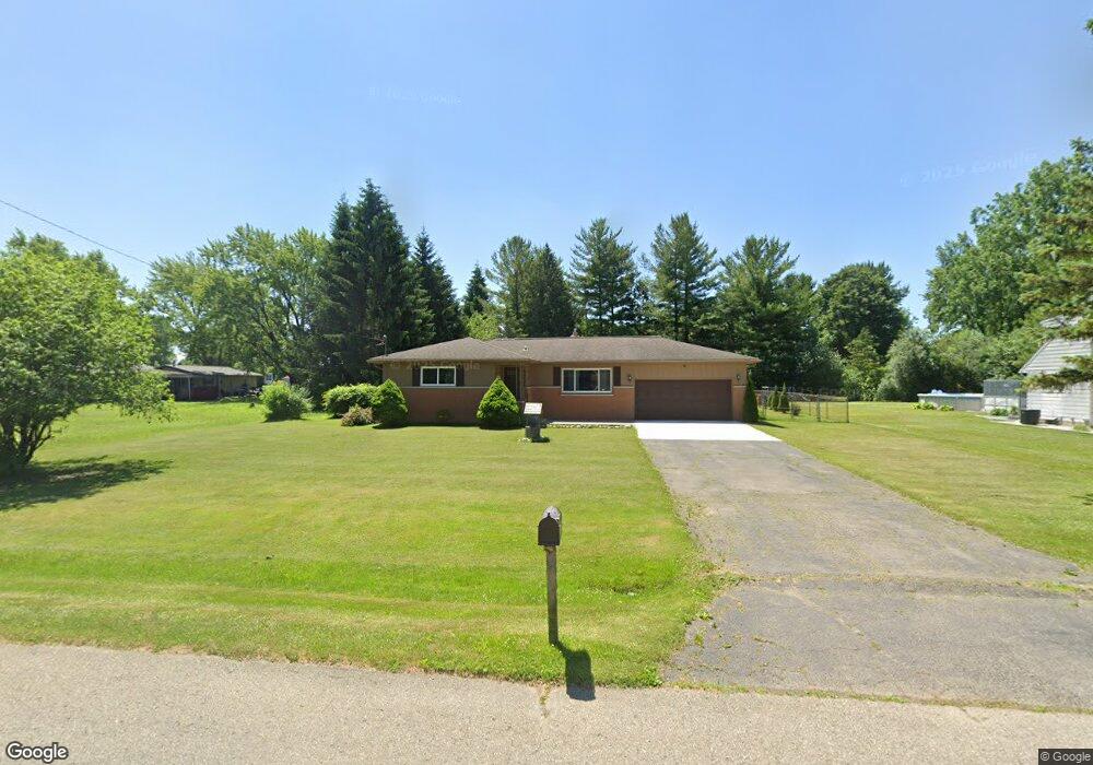
This home is located at 6504 Nightingale Dr Unit Bldg-Unit, Flint, MI 48506 and is currently estimated at $205,666, approximately $173 per square foot. 6504 Nightingale Dr Unit Bldg-Unit is a home located in Genesee County with nearby schools including Weston Elementary School, Leota Fiedler Elementary School, and Kate Dowdall Elementary School.
Ownership History
Date
Name
Owned For
Owner Type
Purchase Details
Closed on
Nov 14, 2024
Sold by
Edington Amber D and Edington William E
Bought by
Bandy Abel Elijah
Current Estimated Value
Purchase Details
Closed on
Jun 22, 2018
Sold by
Mey Investments
Bought by
Edington Amber D and Edington Amber
Purchase Details
Closed on
Mar 22, 2018
Sold by
Harris Sharon
Bought by
Mey Investmenmts Inc
Purchase Details
Closed on
Aug 21, 2015
Sold by
Erickson Birger
Bought by
Erickson Birger and Harris Sharon
Create a Home Valuation Report for This Property
The Home Valuation Report is an in-depth analysis detailing your home's value as well as a comparison with similar homes in the area
Home Values in the Area
Average Home Value in this Area
Purchase History
| Date | Buyer | Sale Price | Title Company |
|---|---|---|---|
| Bandy Abel Elijah | $205,000 | Liberty Title | |
| Edington Amber D | $138,500 | Liberty Title | |
| Mey Investmenmts Inc | -- | Liberty Title | |
| Erickson Birger | -- | Attorney |
Source: Public Records
Tax History Compared to Growth
Tax History
| Year | Tax Paid | Tax Assessment Tax Assessment Total Assessment is a certain percentage of the fair market value that is determined by local assessors to be the total taxable value of land and additions on the property. | Land | Improvement |
|---|---|---|---|---|
| 2025 | $2,422 | $86,300 | $0 | $0 |
| 2024 | $668 | $79,400 | $0 | $0 |
| 2023 | $637 | $70,800 | $0 | $0 |
| 2022 | $1,855 | $66,500 | $0 | $0 |
| 2021 | $1,767 | $52,400 | $0 | $0 |
| 2020 | $513 | $48,200 | $0 | $0 |
| 2019 | $505 | $43,500 | $0 | $0 |
| 2018 | $932 | $39,100 | $0 | $0 |
| 2017 | $921 | $37,700 | $0 | $0 |
| 2016 | $899 | $36,400 | $0 | $0 |
| 2015 | $707 | $33,400 | $0 | $0 |
| 2014 | $236 | $31,100 | $0 | $0 |
| 2012 | -- | $19,700 | $19,700 | $0 |
Source: Public Records
Map
Nearby Homes
- 4156 Bobwhite Dr
- 6298 Nightingale Dr
- 6363 Bluejay Dr
- 6323 Bluejay Dr
- 3485 N Vassar Rd
- 7020 E Carpenter Rd
- 6443 Richfield Rd
- 6077 Crown Point
- 5141 N Vassar Rd
- 3454 Eastdale Dr
- 4062 N Belsay Rd
- 3389 Eastdale Dr
- 5091 N Irish Rd
- 3365 Eastdale Dr
- 5105 N Irish Rd
- 5165 N Irish Rd
- 1240 N Irish Rd
- 5429 Hopkins Rd
- 5467 Richfield Rd
- 0 Whisper Ridge Ct
- 6504 Nightingale Dr
- 6492 Nightingale Dr
- 4231 N Vassar Rd
- 6484 Nightingale Dr
- 4191 Red Bird Ln
- 4255 N Vassar Rd
- 6501 Nightingale Dr Unit Bldg-Unit
- 6501 Nightingale Dr
- 4215 N Vassar Rd
- 6474 Nightingale Dr
- 4187 Red Bird Ln
- 4265 N Vassar Rd
- 6479 Nightingale Dr
- 6464 Nightingale Dr
- 4203 N Vassar Rd
- 4190 Red Bird Ln
- 4277 N Vassar Rd
- 4238 Pheasant Dr
- 4189 N Vassar Rd
- 6456 Nightingale Dr