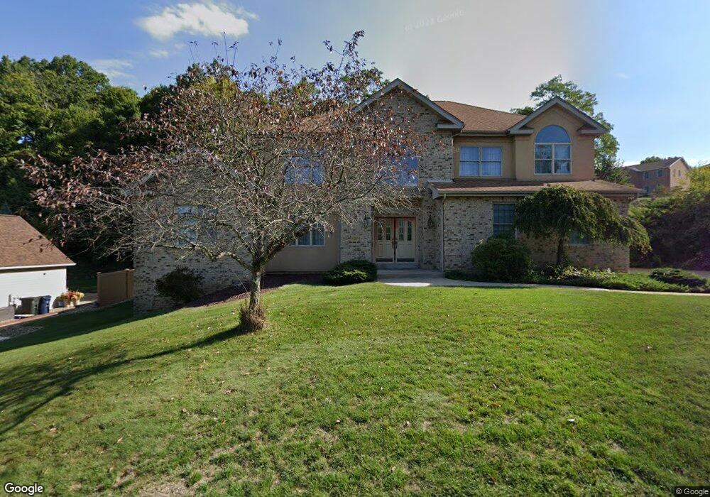
6504 Ten Point Cir Trafford, PA 15085
Penn Township NeighborhoodEstimated Value: $108,653 - $566,000
--
Bed
--
Bath
2,109
Sq Ft
$199/Sq Ft
Est. Value
About This Home
This home is located at 6504 Ten Point Cir, Trafford, PA 15085 and is currently estimated at $419,913, approximately $199 per square foot. 6504 Ten Point Cir is a home located in Westmoreland County with nearby schools including Penn Trafford High School.
Ownership History
Date
Name
Owned For
Owner Type
Purchase Details
Closed on
Oct 9, 2012
Sold by
Ondrey David K
Bought by
Ondrey Robert S
Current Estimated Value
Create a Home Valuation Report for This Property
The Home Valuation Report is an in-depth analysis detailing your home's value as well as a comparison with similar homes in the area
Home Values in the Area
Average Home Value in this Area
Purchase History
| Date | Buyer | Sale Price | Title Company |
|---|---|---|---|
| Ondrey Robert S | -- | None Available |
Source: Public Records
Tax History Compared to Growth
Tax History
| Year | Tax Paid | Tax Assessment Tax Assessment Total Assessment is a certain percentage of the fair market value that is determined by local assessors to be the total taxable value of land and additions on the property. | Land | Improvement |
|---|---|---|---|---|
| 2025 | $6,770 | $49,440 | $2,840 | $46,600 |
| 2024 | $6,720 | $49,440 | $2,840 | $46,600 |
| 2023 | $6,375 | $49,440 | $2,840 | $46,600 |
| 2022 | $6,301 | $49,440 | $2,840 | $46,600 |
| 2021 | $6,251 | $49,440 | $2,840 | $46,600 |
| 2020 | $6,202 | $49,440 | $2,840 | $46,600 |
| 2019 | $6,053 | $49,440 | $2,840 | $46,600 |
| 2018 | $5,880 | $49,440 | $2,840 | $46,600 |
| 2017 | $5,732 | $49,440 | $2,840 | $46,600 |
| 2016 | $5,564 | $49,440 | $2,840 | $46,600 |
| 2015 | $5,564 | $49,440 | $2,840 | $46,600 |
| 2014 | $5,465 | $49,440 | $2,840 | $46,600 |
Source: Public Records
Map
Nearby Homes
- 6411 Ten Point Cir
- 6178 Baker School Rd
- 1004 Blueridge Ct
- 611 & 611 1/2 Sixth St
- 0 Evergreen (Lot 21-22) Unit 1711486
- 1015 Noble Pine Ct
- 1004 Christina Ct
- 729 State Route 130
- 708 State Route 130
- 301 Pine Hollow Rd
- 632 Penn Dr
- 674 Meadowbrook Rd
- 4073 Route 130
- 0 Pine Hollow Road Extension
- 1010 1st St
- 160 Sunrise Dr
- 129 Fern Dr
- 117 Plum Dr
- 1004 Government Rd
- 113 Penn Woods Ct
- 6502 Ten Point Cir
- 6506 Ten Point Cir
- L#250 Ten Point Cir
- 6222 Antler Hill Dr
- 6505 Ten Point Cir
- 6507 Ten Point Cir
- 6508 Ten Point Cir
- 6225 Antler Hill Dr
- 6227 Antler Hill Dr
- 6509 Ten Point Cir
- 6301 Doe Cir
- 6223 Antler Hill Dr
- 6303 Doe Cir
- 6501 Ten Point Cir
- 6510 Ten Point Cir
- 6305 Doe Cir
- 6511 Ten Point Cir
- 6221 Antler Hill Dr
- 6400 Ten Point Cir
- 6512 Ten Point Cir