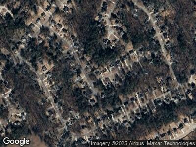
6505 Shady Valley Dr Flowery Branch, GA 30542
Estimated Value: $348,000 - $364,331
3
Beds
2
Baths
1,426
Sq Ft
$252/Sq Ft
Est. Value
About This Home
This home is located at 6505 Shady Valley Dr, Flowery Branch, GA 30542 and is currently estimated at $358,833, approximately $251 per square foot. 6505 Shady Valley Dr is a home located in Hall County with nearby schools including Spout Springs Elementary School, Cherokee Bluff Middle School, and Cherokee Bluff High School.
Ownership History
Date
Name
Owned For
Owner Type
Purchase Details
Closed on
Apr 27, 2004
Sold by
Contreras Manuel
Bought by
Anderson Terry H
Current Estimated Value
Home Financials for this Owner
Home Financials are based on the most recent Mortgage that was taken out on this home.
Original Mortgage
$120,000
Interest Rate
5.77%
Mortgage Type
New Conventional
Purchase Details
Closed on
Dec 16, 1999
Sold by
Anderson Steven R and Anderson Jennifer N
Bought by
Contreras Manuel D
Home Financials for this Owner
Home Financials are based on the most recent Mortgage that was taken out on this home.
Original Mortgage
$90,000
Interest Rate
7.85%
Mortgage Type
New Conventional
Purchase Details
Closed on
Mar 31, 1995
Sold by
Lance Linda
Bought by
Anderson Steven
Purchase Details
Closed on
Dec 1, 1994
Create a Home Valuation Report for This Property
The Home Valuation Report is an in-depth analysis detailing your home's value as well as a comparison with similar homes in the area
Home Values in the Area
Average Home Value in this Area
Purchase History
| Date | Buyer | Sale Price | Title Company |
|---|---|---|---|
| Anderson Terry H | $150,000 | -- | |
| Contreras Manuel D | $121,500 | -- | |
| Anderson Steven | $99,500 | -- | |
| -- | $18,500 | -- |
Source: Public Records
Mortgage History
| Date | Status | Borrower | Loan Amount |
|---|---|---|---|
| Open | Anderson Terry H | $103,036 | |
| Closed | Anderson Terry H | $120,000 | |
| Previous Owner | Contreras Manuel D | $19,500 | |
| Previous Owner | Contreras Manuel D | $90,000 | |
| Previous Owner | Anderson Steven R | $92,380 |
Source: Public Records
Tax History Compared to Growth
Tax History
| Year | Tax Paid | Tax Assessment Tax Assessment Total Assessment is a certain percentage of the fair market value that is determined by local assessors to be the total taxable value of land and additions on the property. | Land | Improvement |
|---|---|---|---|---|
| 2024 | $3,390 | $132,160 | $24,200 | $107,960 |
| 2023 | $2,794 | $107,864 | $21,400 | $86,464 |
| 2022 | $2,695 | $99,748 | $25,680 | $74,068 |
| 2021 | $2,583 | $93,560 | $26,320 | $67,240 |
| 2020 | $2,296 | $80,240 | $16,400 | $63,840 |
| 2019 | $2,192 | $75,720 | $19,720 | $56,000 |
| 2018 | $2,125 | $70,880 | $17,600 | $53,280 |
| 2017 | $1,657 | $54,920 | $11,520 | $43,400 |
| 2016 | $1,454 | $48,840 | $11,520 | $37,320 |
| 2015 | $1,200 | $48,840 | $11,520 | $37,320 |
| 2014 | $1,200 | $39,270 | $7,960 | $31,310 |
Source: Public Records
Map
Nearby Homes
- 6522 Parkland Place
- 6335 Flat Rock Dr
- 5541 Mulberry Preserve Dr
- 4654 Fox Forrest Dr
- 5515 Preserve Point
- 5176 Glen Forrest Dr
- 6314 Spout Springs Rd
- 6151 Spout Springs Rd
- 6434 Mossy Boulder Dr
- 6340 Spout Springs Rd
- 5129 Glen Forrest Dr
- 6233 Caprice Dr
- 6239 Malibu Ridge
- 5155 Scenic View Rd
- 5036 Glen Forrest Dr
- 6238 Grand Fox Cir
- 4875 Cash Rd
- 6505 Shady Valley Dr
- 6509 Shady Valley Dr
- 6429 Farm Ridge Ct
- 6441 Farm Ridge Ct
- 6508 Shady Valley Dr
- 6513 Shady Valley Dr
- 6436 Farm Ridge Ct
- 6425 Farm Ridge Ct
- 0 Shady Valley Dr Unit 8702208
- 0 Shady Valley Dr Unit 8571887
- 0 Shady Valley Dr Unit 8103629
- 0 Shady Valley Dr Unit 9063405
- 0 Shady Valley Dr Unit 8854936
- 0 Shady Valley Dr Unit 8901681
- 0 Shady Valley Dr Unit 107 7401102
- 0 Shady Valley Dr
- 6432 Farm Ridge Ct
- 6440 Farm Ridge Ct
- 6512 Shady Valley Dr
- 6428 Farm Ridge Ct
