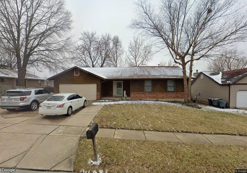
6506 Star Buck Dr O Fallon, MO 63368
Estimated Value: $317,000 - $355,858
3
Beds
3
Baths
1,451
Sq Ft
$234/Sq Ft
Est. Value
About This Home
This home is located at 6506 Star Buck Dr, O Fallon, MO 63368 and is currently estimated at $340,215, approximately $234 per square foot. 6506 Star Buck Dr is a home located in St. Charles County with nearby schools including Pheasant Point Elementary School, Fort Zumwalt South Middle School, and Fort Zumwalt South High School.
Ownership History
Date
Name
Owned For
Owner Type
Purchase Details
Closed on
Jun 28, 2021
Sold by
Woodson Terry and Woodson Debra
Bought by
Walker Scott and Schrand Jaclyn
Current Estimated Value
Home Financials for this Owner
Home Financials are based on the most recent Mortgage that was taken out on this home.
Original Mortgage
$245,471
Outstanding Balance
$222,727
Interest Rate
2.9%
Mortgage Type
FHA
Estimated Equity
$117,488
Create a Home Valuation Report for This Property
The Home Valuation Report is an in-depth analysis detailing your home's value as well as a comparison with similar homes in the area
Home Values in the Area
Average Home Value in this Area
Purchase History
| Date | Buyer | Sale Price | Title Company |
|---|---|---|---|
| Walker Scott | -- | None Available |
Source: Public Records
Mortgage History
| Date | Status | Borrower | Loan Amount |
|---|---|---|---|
| Open | Walker Scott | $245,471 |
Source: Public Records
Tax History
| Year | Tax Paid | Tax Assessment Tax Assessment Total Assessment is a certain percentage of the fair market value that is determined by local assessors to be the total taxable value of land and additions on the property. | Land | Improvement |
|---|---|---|---|---|
| 2025 | $3,513 | $60,792 | -- | -- |
| 2023 | $3,516 | $53,296 | $0 | $0 |
| 2022 | $2,927 | $41,291 | $0 | $0 |
| 2021 | $2,934 | $41,291 | $0 | $0 |
| 2020 | $2,844 | $38,516 | $0 | $0 |
| 2019 | $2,850 | $38,516 | $0 | $0 |
| 2018 | $2,741 | $35,434 | $0 | $0 |
| 2017 | $2,697 | $35,434 | $0 | $0 |
| 2016 | $2,503 | $31,583 | $0 | $0 |
| 2015 | $2,333 | $31,583 | $0 | $0 |
| 2014 | $2,082 | $27,800 | $0 | $0 |
Source: Public Records
Map
Nearby Homes
- 1130 Spring Orchard Dr
- 703 Tinsley Ct
- 178 Christina Marie Dr
- 1343 Avondale Spring Dr
- 71 Harrisburg Ct
- 249 Dardenne Farms Dr
- 661 Clifton Hill Dr
- 101 Winterbrooke Ct
- 112 Auburn Trace Pointe Ct
- 527 Auburn Trace Ln
- 103 Auburn Trace Point
- 12 McCluer Ct
- 2662 Breckenridge Cir
- 3 Royallbend Ct
- 93 Arapahoe Basin Ct
- 367 Shamrock St
- 361 Shamrock St
- 1319 Commons Cir
- 10 Muir Trail Ct
- 2628 Breckenridge Cir
- 6510 Star Buck Dr
- 3017 Long Wheat Dr
- 6505 Long Timber Dr
- 6509 Long Timber Dr
- 6501 Long Timber Dr
- 6514 Star Buck Dr
- 6507 Star Buck Dr
- 6513 Long Timber Dr
- 6511 Star Buck Dr
- 6503 Star Buck Dr
- 6442 Star Buck Dr
- 6515 Star Buck Dr
- 6518 Star Buck Dr
- 3022 Long Wheat Dr
- 6517 Long Timber Dr
- 6504 Sprucefield Dr
- 3014 Long Wheat Dr
- 6504 Long Timber Dr
- 6500 Sprucefield Dr
- 6508 Long Timber Dr
Your Personal Tour Guide
Ask me questions while you tour the home.