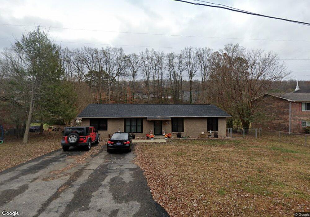
6509 W Garwood Cir Knoxville, TN 37918
Halls Crossroads NeighborhoodEstimated Value: $291,000 - $312,000
3
Beds
2
Baths
1,508
Sq Ft
$201/Sq Ft
Est. Value
About This Home
This home is located at 6509 W Garwood Cir, Knoxville, TN 37918 and is currently estimated at $302,535, approximately $200 per square foot. 6509 W Garwood Cir is a home located in Knox County with nearby schools including Adrian Burnett Elementary School, Halls High School, and Halls Middle School.
Ownership History
Date
Name
Owned For
Owner Type
Purchase Details
Closed on
Jan 6, 2023
Sold by
Varnell Edmund F
Bought by
Varnell Edmund F and Varnell Jennifer Ann
Current Estimated Value
Purchase Details
Closed on
Dec 10, 2018
Sold by
Varnell Sandy M
Bought by
Varnell Edmund F
Home Financials for this Owner
Home Financials are based on the most recent Mortgage that was taken out on this home.
Original Mortgage
$96,997
Interest Rate
4.8%
Mortgage Type
VA
Purchase Details
Closed on
Aug 11, 1999
Sold by
Donovan Costanza Richard and Costanza Rebecca
Bought by
Varnell Edmund F and Varnell Sandy M
Home Financials for this Owner
Home Financials are based on the most recent Mortgage that was taken out on this home.
Original Mortgage
$78,540
Interest Rate
7.7%
Mortgage Type
VA
Create a Home Valuation Report for This Property
The Home Valuation Report is an in-depth analysis detailing your home's value as well as a comparison with similar homes in the area
Home Values in the Area
Average Home Value in this Area
Purchase History
| Date | Buyer | Sale Price | Title Company |
|---|---|---|---|
| Varnell Edmund F | -- | None Listed On Document | |
| Varnell Edmund F | -- | Tallent Title Group Inc | |
| Varnell Edmund F | $77,000 | -- |
Source: Public Records
Mortgage History
| Date | Status | Borrower | Loan Amount |
|---|---|---|---|
| Previous Owner | Varnell Edmund F | $96,997 | |
| Previous Owner | Varnell Edmund F | $78,540 |
Source: Public Records
Tax History Compared to Growth
Tax History
| Year | Tax Paid | Tax Assessment Tax Assessment Total Assessment is a certain percentage of the fair market value that is determined by local assessors to be the total taxable value of land and additions on the property. | Land | Improvement |
|---|---|---|---|---|
| 2024 | $681 | $43,825 | $0 | $0 |
| 2023 | $681 | $43,825 | $0 | $0 |
| 2022 | $681 | $43,825 | $0 | $0 |
| 2021 | $667 | $31,450 | $0 | $0 |
| 2020 | $667 | $31,450 | $0 | $0 |
| 2019 | $667 | $31,450 | $0 | $0 |
| 2018 | $667 | $31,450 | $0 | $0 |
| 2017 | $667 | $31,450 | $0 | $0 |
| 2016 | $604 | $0 | $0 | $0 |
| 2015 | $604 | $0 | $0 | $0 |
| 2014 | $604 | $0 | $0 | $0 |
Source: Public Records
Map
Nearby Homes
- 2833 Ithaca Dr
- 6553 E Garwood Cir
- 2839 Rifle Range Dr
- 6524 E Garwood Cir
- 2928 Mynatt Rd
- 2705 Rifle Range Dr
- 6609 Cochise Dr
- 2601 Rifle Range Rd
- 5913 Ridgewood Rd
- 3201 Rifle Range Dr
- 5828 Eldridge Rd
- 826 Gresham Rd
- 0 Grove Dr
- 0 Ottari Dr - Ottari Acres Lot 1
- 3521 Rothmoor Dr
- 5616 N Broadway St
- 5728 N Broadway St
- 3415 Harvey Rd
- 0 Cochise Dr
- 5608 Lon Roberts Dr
- 6505 W Garwood Cir
- 6513 W Garwood Cir
- 6501 W Garwood Cir
- 6517 W Garwood Cir
- 2821 Colt Dr Unit 1
- 2817 Colt Dr Unit 1
- 6504 W Garwood Cir
- 2825 Colt Dr Unit 1
- 2825 Colt Dr
- 6501 Greenwood Rd
- 6516 W Garwood Cir
- 6500 E Garwood Cir
- 2916 Gordon Place
- 6526 W Garwood Cir
- 6523 W Garwood Cir
- 6505 Greenwood Rd
- 2831 Colt Dr Unit 1
- 6500 Greenwood Rd
- 2829 Colt Dr
- 2820 Colt Dr Unit 1