Estimated Value: $202,000
Studio
--
Bath
2,400
Sq Ft
$84/Sq Ft
Est. Value
About This Home
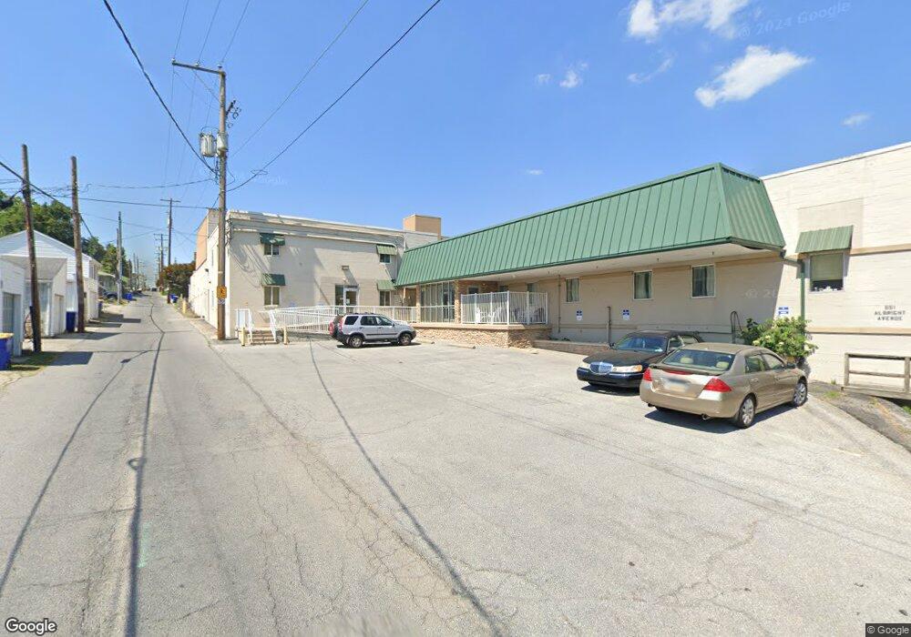
This home is located at 651 Albright Ave, York, PA 17404 and is currently priced at $202,000, approximately $84 per square foot. 651 Albright Ave is a home located in York County with nearby schools including Central York High School, York Academy Regional Charter Lower School, and Holy Trinity Catholic School.
Ownership History
Date
Name
Owned For
Owner Type
Purchase Details
Closed on
Feb 11, 2006
Sold by
Smith Philip C
Bought by
Rotz Development Llc
Current Estimated Value
Purchase Details
Closed on
Nov 19, 2004
Sold by
Smith Philip C
Bought by
Rotz Development Llc
Create a Home Valuation Report for This Property
The Home Valuation Report is an in-depth analysis detailing your home's value as well as a comparison with similar homes in the area
Home Values in the Area
Average Home Value in this Area
Purchase History
| Date | Buyer | Sale Price | Title Company |
|---|---|---|---|
| Rotz Development Llc | -- | None Available | |
| Rotz Development Llc | $10,000 | -- |
Source: Public Records
Tax History
| Year | Tax Paid | Tax Assessment Tax Assessment Total Assessment is a certain percentage of the fair market value that is determined by local assessors to be the total taxable value of land and additions on the property. | Land | Improvement |
|---|---|---|---|---|
| 2025 | $4,873 | $129,440 | $91,930 | $37,510 |
| 2024 | $4,760 | $129,440 | $91,930 | $37,510 |
| 2023 | $4,620 | $129,440 | $91,930 | $37,510 |
| 2022 | $4,560 | $129,440 | $91,930 | $37,510 |
| 2021 | $4,431 | $129,440 | $91,930 | $37,510 |
| 2020 | $4,431 | $129,440 | $91,930 | $37,510 |
| 2019 | $4,366 | $129,440 | $91,930 | $37,510 |
| 2018 | $4,291 | $129,440 | $91,930 | $37,510 |
| 2017 | $4,235 | $129,440 | $91,930 | $37,510 |
| 2016 | $0 | $129,440 | $91,930 | $37,510 |
| 2015 | -- | $129,440 | $91,930 | $37,510 |
| 2014 | -- | $129,440 | $91,930 | $37,510 |
Source: Public Records
Map
Nearby Homes
- 505 Bravery Dr
- 151 Arch St
- 934 N Queen St
- 540 N Pershing Ave
- 993 N Queen St
- 700 N Pershing Ave
- 225 Front St
- 213 Parkway Blvd
- 25 Laurel St
- 119 N George St
- 307 Walnut St
- 41 W Philadelphia St
- 150 E Philadelphia St
- 315 W North St
- 15 N Cherry Ln Unit 3
- 737 Oatman St
- 348 Garfield St
- 1323 N George St
- 750 Oatman St
- 368 E Philadelphia St
- 15 E 2nd Ave
- 16 E 3rd Ave
- 20 E 3rd Ave
- 12 E 3rd Ave
- 621 N George St
- 619 N George St
- 615 N George St
- 627 N George St
- 611 N George St
- 629 N George St
- 631 N George St
- 609 N George St
- 607 N George St
- 635 N George St
- 605 N George St
- 637 N George St
- 601 N George St
- 603 N George St
- 701 N George St
- 0 Second Ave Unit 1 1003773931
Your Personal Tour Guide
Ask me questions while you tour the home.