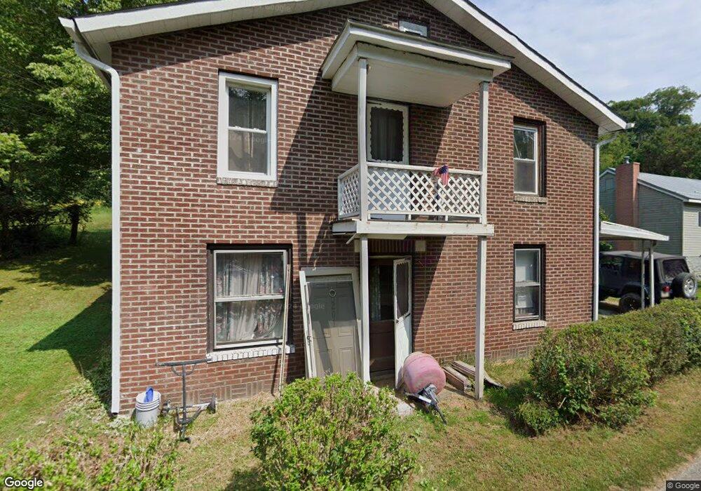
651 Canal Rd Apollo, PA 15613
Kiskiminetas Township NeighborhoodEstimated Value: $150,000 - $212,000
3
Beds
2
Baths
1,183
Sq Ft
$159/Sq Ft
Est. Value
About This Home
This home is located at 651 Canal Rd, Apollo, PA 15613 and is currently estimated at $187,577, approximately $158 per square foot. 651 Canal Rd is a home located in Armstrong County with nearby schools including Apollo-Ridge Elementary School, Apollo-Ridge Middle School, and Apollo-Ridge High School.
Ownership History
Date
Name
Owned For
Owner Type
Purchase Details
Closed on
Nov 10, 2010
Sold by
Estate Of Joyce Ann Nulph
Bought by
Nulph Jacob M and Nulph Angela C
Current Estimated Value
Home Financials for this Owner
Home Financials are based on the most recent Mortgage that was taken out on this home.
Original Mortgage
$75,000
Outstanding Balance
$49,685
Interest Rate
4.35%
Mortgage Type
Stand Alone Refi Refinance Of Original Loan
Estimated Equity
$137,892
Purchase Details
Closed on
Aug 19, 2010
Sold by
Nulph Clifford A
Bought by
The Estate Of Joyce Ann Nulph and Nulph Jacob M
Purchase Details
Closed on
Jul 20, 1990
Create a Home Valuation Report for This Property
The Home Valuation Report is an in-depth analysis detailing your home's value as well as a comparison with similar homes in the area
Home Values in the Area
Average Home Value in this Area
Purchase History
| Date | Buyer | Sale Price | Title Company |
|---|---|---|---|
| Nulph Jacob M | $80,000 | None Available | |
| The Estate Of Joyce Ann Nulph | -- | None Available | |
| -- | $56,400 | -- |
Source: Public Records
Mortgage History
| Date | Status | Borrower | Loan Amount |
|---|---|---|---|
| Open | Nulph Jacob M | $75,000 |
Source: Public Records
Tax History Compared to Growth
Tax History
| Year | Tax Paid | Tax Assessment Tax Assessment Total Assessment is a certain percentage of the fair market value that is determined by local assessors to be the total taxable value of land and additions on the property. | Land | Improvement |
|---|---|---|---|---|
| 2025 | $3,266 | $34,120 | $18,830 | $15,290 |
| 2024 | $3,033 | $34,120 | $18,830 | $15,290 |
| 2023 | $2,378 | $34,120 | $18,830 | $15,290 |
| 2022 | $2,351 | $34,120 | $18,830 | $15,290 |
| 2021 | $2,311 | $34,120 | $18,830 | $15,290 |
| 2020 | $2,311 | $34,120 | $18,830 | $15,290 |
| 2019 | $2,298 | $34,120 | $18,830 | $15,290 |
| 2018 | $2,298 | $26,905 | $5,060 | $21,845 |
| 2017 | $2,284 | $34,120 | $18,830 | $15,290 |
| 2016 | $2,284 | $34,120 | $18,830 | $15,290 |
| 2015 | $1,753 | $34,120 | $18,830 | $15,290 |
| 2014 | $1,753 | $34,120 | $18,830 | $15,290 |
Source: Public Records
Map
Nearby Homes
- 311 & 313 N 2nd St
- 211 Old Mill Rd
- 223 Old Mill Rd
- 115 Acadia Ln
- 625 Rose St Unit 276
- 4792 State Route 66
- 314 S 5th St
- 957 Cherry Lane Rd
- 404 N Pennsylvania Ave
- 262 Vista Dr
- 212 Terrace Ave
- 322 N 4th St
- 726 N 4th St
- 225 Kochka Dr
- 411a N Pennsylvania Ave
- 1316 Hancock Ave
- 715 1/2 Armstrong Ave Unit 1/2
- 402.5 N 10th St
- 404 N 10th St
- 115 Truxall Rd