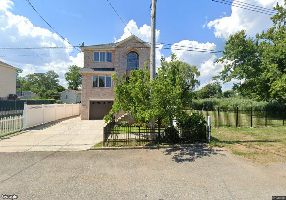
651 Quincy Ave Staten Island, NY 10305
Ocean Breeze NeighborhoodEstimated Value: $18,589 - $723,000
3
Beds
2
Baths
1,760
Sq Ft
$144/Sq Ft
Est. Value
About This Home
This home is located at 651 Quincy Ave, Staten Island, NY 10305 and is currently estimated at $253,147, approximately $143 per square foot. 651 Quincy Ave is a home located in Richmond County with nearby schools including P.S. 052 John C. Thompson, Is 2 George L Egbert, and New Dorp High School.
Ownership History
Date
Name
Owned For
Owner Type
Purchase Details
Closed on
Sep 15, 2021
Sold by
Housing Trust Fund Corporation
Bought by
Huie Lai Sheung and The Lai Sheung Huie Revocable
Current Estimated Value
Purchase Details
Closed on
Jul 29, 2014
Sold by
Derosa Ralph and Derosa Annie
Bought by
Housing Trust Fund Corporation
Purchase Details
Closed on
Feb 9, 2006
Sold by
Duffy Timothy
Bought by
Derosa Ralph and Derosa Annie
Home Financials for this Owner
Home Financials are based on the most recent Mortgage that was taken out on this home.
Original Mortgage
$315,000
Interest Rate
6.15%
Mortgage Type
Fannie Mae Freddie Mac
Create a Home Valuation Report for This Property
The Home Valuation Report is an in-depth analysis detailing your home's value as well as a comparison with similar homes in the area
Home Values in the Area
Average Home Value in this Area
Purchase History
| Date | Buyer | Sale Price | Title Company |
|---|---|---|---|
| Huie Lai Sheung | $16,000 | Primary Land Abstract Llc | |
| Housing Trust Fund Corporation | -- | Fidelity Natl Title Ins Co | |
| Derosa Ralph | $499,500 | None Available |
Source: Public Records
Mortgage History
| Date | Status | Borrower | Loan Amount |
|---|---|---|---|
| Previous Owner | Derosa Ralph | $315,000 |
Source: Public Records
Tax History Compared to Growth
Tax History
| Year | Tax Paid | Tax Assessment Tax Assessment Total Assessment is a certain percentage of the fair market value that is determined by local assessors to be the total taxable value of land and additions on the property. | Land | Improvement |
|---|---|---|---|---|
| 2025 | $169 | $798 | $890 | -- |
| 2024 | $169 | $840 | $954 | -- |
| 2023 | $183 | $1,018 | $1,018 | $0 |
| 2022 | $192 | $960 | $960 | $0 |
| 2021 | $0 | $10,140 | $10,140 | $0 |
| 2020 | $0 | $8,820 | $8,820 | $0 |
| 2019 | $0 | $7,680 | $7,680 | $0 |
| 2018 | $0 | $7,260 | $7,260 | $0 |
| 2017 | $0 | $7,200 | $7,200 | $0 |
| 2016 | -- | $7,260 | $7,200 | $60 |
| 2015 | $2,364 | $13,919 | $5,568 | $8,351 |
| 2014 | $2,364 | $13,132 | $5,253 | $7,879 |
Source: Public Records
Map
Nearby Homes
- 795 Father Capodanno Blvd
- 797 Father Capodanno Blvd
- 799 Father Capodanno Blvd
- 45 Iona St
- 762 Seaview Ave
- 0 Quincy Ave
- 431 Patterson Ave
- 558 Dongan Hills Ave Unit 14A2
- 568 Dongan Hills Ave Unit 19A1
- 9 Iroquois St
- 498 Dongan Hills Ave
- 929 Father Capodanno Blvd
- 473 Dongan Hills Ave
- 519 Buel Ave
- 517 Buel Ave
- 467 Dongan Hills Ave
- 228 Slater Blvd
- 00 Baden Place
- 0 Baden Place Unit 2503276
- 188 Graham Blvd Unit B
- 655 Quincy Ave
- 659 Quincy Ave
- 663 Quincy Ave
- 660 Quincy Ave
- 679 Naughton Ave
- 667 Quincy Ave
- 658 Quincy Ave
- 664 Quincy Ave
- 632 Quincy Ave
- 668 Quincy Ave
- 628 Quincy Ave
- 717 Naughton Ave
- 620 Quincy Ave
- 714 Buel Ave
- 729 Oceanside Ave
- 731 Oceanside Ave
- 716 Buel Ave
- 737 Oceanside Ave
- 712 Naughton Ave Unit 716
- 712-716 Naughton Ave