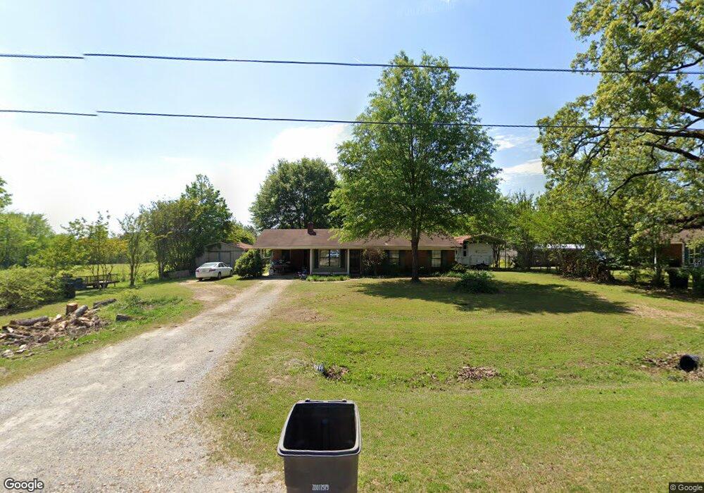
651 Road 261 Tupelo, MS 38801
Estimated Value: $131,000 - $184,000
Studio
--
Bath
1,192
Sq Ft
$129/Sq Ft
Est. Value
About This Home
This home is located at 651 Road 261, Tupelo, MS 38801 and is currently estimated at $154,281, approximately $129 per square foot. 651 Road 261 is a home located in Lee County with nearby schools including Shannon Elementary School, Shannon Primary School, and Shannon Middle School.
Ownership History
Date
Name
Owned For
Owner Type
Purchase Details
Closed on
Mar 13, 2015
Sold by
Maxfield Kristen
Bought by
Grisham John
Current Estimated Value
Purchase Details
Closed on
Nov 2, 2007
Sold by
Kerr Paul L and Turner Barbara K
Bought by
Maxfield Kristen L
Home Financials for this Owner
Home Financials are based on the most recent Mortgage that was taken out on this home.
Original Mortgage
$15,000
Interest Rate
6.32%
Mortgage Type
Unknown
Create a Home Valuation Report for This Property
The Home Valuation Report is an in-depth analysis detailing your home's value as well as a comparison with similar homes in the area
Purchase History
| Date | Buyer | Sale Price | Title Company |
|---|---|---|---|
| Grisham John | -- | -- | |
| Maxfield Kristen L | -- | -- |
Source: Public Records
Mortgage History
| Date | Status | Borrower | Loan Amount |
|---|---|---|---|
| Previous Owner | Maxfield Kristen L | $15,000 | |
| Previous Owner | Maxfield Kristen L | $57,900 |
Source: Public Records
Tax History
| Year | Tax Paid | Tax Assessment Tax Assessment Total Assessment is a certain percentage of the fair market value that is determined by local assessors to be the total taxable value of land and additions on the property. | Land | Improvement |
|---|---|---|---|---|
| 2025 | $860 | $7,974 | $0 | $0 |
| 2024 | $860 | $7,974 | $0 | $0 |
| 2023 | $466 | $6,737 | $0 | $0 |
| 2022 | $453 | $6,737 | $0 | $0 |
| 2021 | $453 | $6,737 | $0 | $0 |
| 2020 | $724 | $6,737 | $0 | $0 |
| 2019 | $449 | $6,670 | $0 | $0 |
| 2018 | $455 | $6,670 | $0 | $0 |
| 2017 | $440 | $6,670 | $0 | $0 |
| 2016 | $417 | $6,670 | $0 | $0 |
| 2015 | -- | $6,190 | $0 | $0 |
| 2014 | -- | $6,190 | $0 | $0 |
Source: Public Records
Map
Nearby Homes
- 0 Graham Dr Unit 25-471
- 0 (7 Acres) Graham Dr
- 163 Road 1046
- 0 Bissell Rd Unit 25-3147
- 0 Unit 25-2748
- 2699 Edwards St
- 0 Road 684
- 0 Lumpkin & Natchez Trace Pkwy
- 0 Cliff Gookin
- 0 Cr 41 Rd
- 0 Mitchell Rd
- 0 Lot 17 Timberlane Dr Unit 26-389
- 0 Lot 15 Timberlane Dr Unit 26-388
- 55 N Lane Dr
- 0 Lot 26 Emberwood Ct Unit 26-391
- 0 Lot 21 Emberwood Ct Unit 26-386
- 0 Lot 27 Emberwood Ct Unit 26-390
- 109 Woodland Ave
- Lot 3 Cliff Gookin Blvd
- 0 Cliff Gookin Blvd
- 651 Road 261
- 652 Road 261
- 122 Appaloosa Run
- 0 Cr 261
- 129 Appaloosa Run
- 647 Road 261
- 129 Appaloosa Run
- 643 Road 261
- 137 Appaloosa Run
- 683 Road 261
- 137 Appaloosa Run
- 169 Appaloosa Run
- 0 Appaloosa Run
- 169 Appaloosa Run
- 535 Road 900
- 535 Road 900
- Lot 18 Saddlecreek Dr
- Lot 14 Saddle Creek Dr
- Lot 14 Saddle Creek Dr
- 705 Road 261