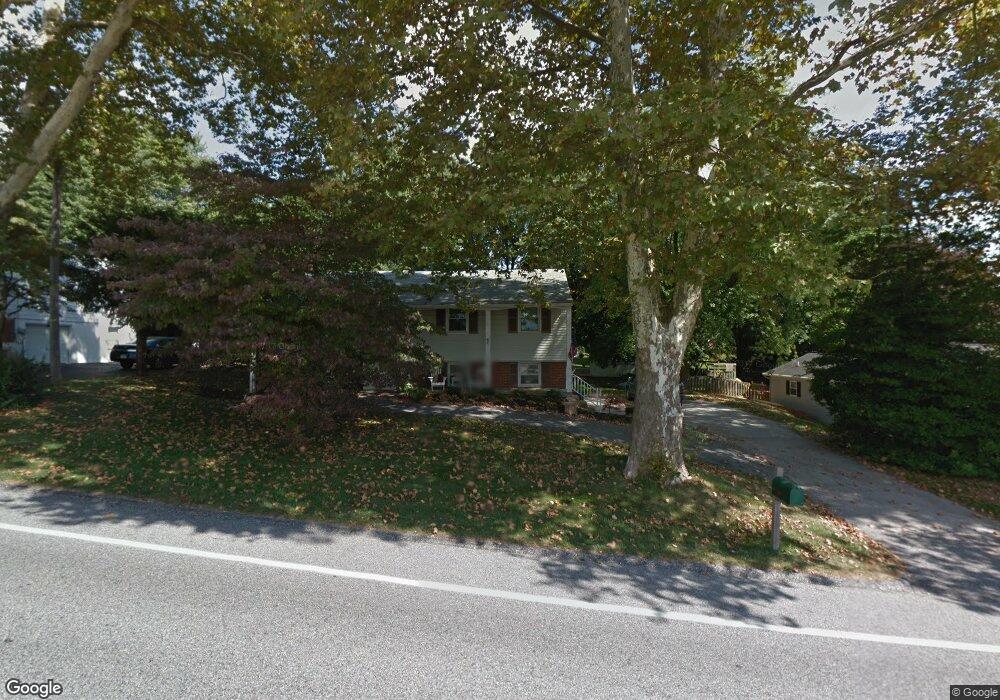
651 S Main St Shrewsbury, PA 17361
Estimated Value: $310,420 - $355,000
3
Beds
2
Baths
1,628
Sq Ft
$200/Sq Ft
Est. Value
About This Home
This home is located at 651 S Main St, Shrewsbury, PA 17361 and is currently estimated at $326,355, approximately $200 per square foot. 651 S Main St is a home located in York County with nearby schools including Susquehannock High School, Shrewsbury Christian Academy, and St John The Baptist Catholic School.
Ownership History
Date
Name
Owned For
Owner Type
Purchase Details
Closed on
Jun 26, 2006
Sold by
Livermore Marjorie B
Bought by
Platt Philip E
Current Estimated Value
Home Financials for this Owner
Home Financials are based on the most recent Mortgage that was taken out on this home.
Original Mortgage
$168,000
Outstanding Balance
$99,462
Interest Rate
6.6%
Mortgage Type
Purchase Money Mortgage
Estimated Equity
$226,893
Purchase Details
Closed on
Nov 18, 1982
Bought by
Livermore Eugene M and Livermore Marjorie
Create a Home Valuation Report for This Property
The Home Valuation Report is an in-depth analysis detailing your home's value as well as a comparison with similar homes in the area
Home Values in the Area
Average Home Value in this Area
Purchase History
| Date | Buyer | Sale Price | Title Company |
|---|---|---|---|
| Platt Philip E | $210,000 | Lawyers Title Insurance Corp | |
| Livermore Eugene M | $65,000 | -- |
Source: Public Records
Mortgage History
| Date | Status | Borrower | Loan Amount |
|---|---|---|---|
| Open | Platt Philip E | $168,000 |
Source: Public Records
Tax History Compared to Growth
Tax History
| Year | Tax Paid | Tax Assessment Tax Assessment Total Assessment is a certain percentage of the fair market value that is determined by local assessors to be the total taxable value of land and additions on the property. | Land | Improvement |
|---|---|---|---|---|
| 2025 | $4,319 | $149,280 | $39,960 | $109,320 |
| 2024 | $4,256 | $149,280 | $39,960 | $109,320 |
| 2023 | $4,256 | $149,280 | $39,960 | $109,320 |
| 2022 | $4,256 | $149,280 | $39,960 | $109,320 |
| 2021 | $4,092 | $149,280 | $39,960 | $109,320 |
| 2020 | $4,092 | $149,280 | $39,960 | $109,320 |
| 2019 | $4,077 | $149,280 | $39,960 | $109,320 |
| 2018 | $4,007 | $149,280 | $39,960 | $109,320 |
| 2017 | $3,875 | $149,280 | $39,960 | $109,320 |
| 2016 | $0 | $149,280 | $39,960 | $109,320 |
| 2015 | -- | $149,280 | $39,960 | $109,320 |
| 2014 | -- | $149,280 | $39,960 | $109,320 |
Source: Public Records
Map
Nearby Homes
- 20 Culpepper Rd
- 43 Virginia Ave
- 23 Harrison Rd
- Lot #1 Norland Way Unit COVINGTON
- 17318 Kennebeck Ln
- 17315 Kennebeck Ln
- 653 Sunglow Dr
- 17555 Snowden Terrace
- 671 Sunglow Dr
- 17181 Mount Airy Rd
- 610 E Tolna Rd Unit DEVONSHIRE
- 610 E Tolna Rd Unit HAWTHORNE
- 610 E Tolna Rd Unit SAVANNAH
- 610 E Tolna Rd Unit ADDISON
- 407 Peggy Ln
- 524 Well Dr
- 16756 Mount Airy Rd
- Kipling Plan at Foxhaven
- Hawthorne Plan at Foxhaven
- Woodford Plan at Foxhaven
- 649 S Main St
- 653 S Main St
- 16 Culpepper Rd
- 14 Culpepper Rd
- 18 Culpepper Rd
- 647 S Main St
- 655 S Main St
- 12 Culpepper Rd
- 645 S Main St
- 657 S Main St
- 10 Culpepper Rd
- 22 Culpepper Rd
- 15 Culpepper Rd
- 13 Culpepper Rd
- 17 Culpepper Rd
- 659 S Main St
- 643 S Main St
- 11 Culpepper Rd
- 24 Culpepper Rd
- 19 Culpepper Rd