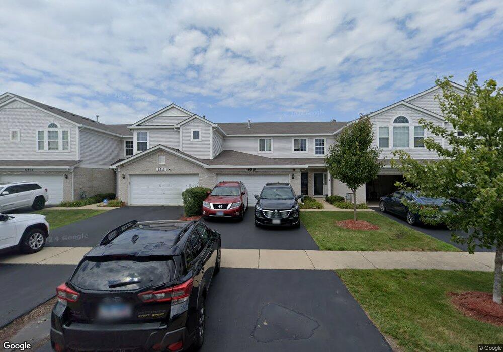
6510 Blue Sky Ln Matteson, IL 60443
West Matteson NeighborhoodEstimated Value: $174,000 - $242,000
2
Beds
2
Baths
954
Sq Ft
$221/Sq Ft
Est. Value
About This Home
This home is located at 6510 Blue Sky Ln, Matteson, IL 60443 and is currently estimated at $210,609, approximately $220 per square foot. 6510 Blue Sky Ln is a home located in Cook County with nearby schools including Colin Powell Middle School.
Ownership History
Date
Name
Owned For
Owner Type
Purchase Details
Closed on
May 17, 2023
Sold by
Amoah Maxwell K
Bought by
Amoahkwesi Living Trust and Amoah
Current Estimated Value
Purchase Details
Closed on
Mar 13, 2017
Sold by
Calvin Virginia
Bought by
Amoah Maxwell
Purchase Details
Closed on
Apr 16, 2012
Sold by
Fannie Mae
Bought by
Calvin Virginia
Purchase Details
Closed on
Nov 28, 2011
Sold by
Cook
Bought by
Federal National Mortgage Association
Purchase Details
Closed on
Jul 25, 2007
Sold by
Montalbano Builders Inc
Bought by
Cook Jason Lavell
Home Financials for this Owner
Home Financials are based on the most recent Mortgage that was taken out on this home.
Original Mortgage
$184,357
Interest Rate
6.76%
Mortgage Type
Unknown
Create a Home Valuation Report for This Property
The Home Valuation Report is an in-depth analysis detailing your home's value as well as a comparison with similar homes in the area
Home Values in the Area
Average Home Value in this Area
Purchase History
| Date | Buyer | Sale Price | Title Company |
|---|---|---|---|
| Amoahkwesi Living Trust | -- | None Listed On Document | |
| Amoah Maxwell | $82,000 | Chicago Title | |
| Calvin Virginia | $51,000 | Attorneys Title Guaranty Fun | |
| Federal National Mortgage Association | -- | None Available | |
| Cook Jason Lavell | $184,500 | Cti |
Source: Public Records
Mortgage History
| Date | Status | Borrower | Loan Amount |
|---|---|---|---|
| Previous Owner | Cook Jason Lavell | $184,357 |
Source: Public Records
Tax History Compared to Growth
Tax History
| Year | Tax Paid | Tax Assessment Tax Assessment Total Assessment is a certain percentage of the fair market value that is determined by local assessors to be the total taxable value of land and additions on the property. | Land | Improvement |
|---|---|---|---|---|
| 2024 | $5,748 | $17,183 | $4,414 | $12,769 |
| 2023 | $4,019 | $17,183 | $4,414 | $12,769 |
| 2022 | $4,019 | $10,928 | $1,385 | $9,543 |
| 2021 | $4,105 | $10,926 | $1,384 | $9,542 |
| 2020 | $4,086 | $10,926 | $1,384 | $9,542 |
| 2019 | $3,391 | $9,636 | $1,298 | $8,338 |
| 2018 | $3,339 | $9,636 | $1,298 | $8,338 |
| 2017 | $5,045 | $9,636 | $1,298 | $8,338 |
| 2016 | $3,968 | $7,667 | $1,211 | $6,456 |
| 2015 | $1,529 | $9,421 | $1,211 | $8,210 |
| 2014 | $1,777 | $7,349 | $1,211 | $6,138 |
| 2013 | $1,815 | $8,454 | $1,211 | $7,243 |
Source: Public Records
Map
Nearby Homes
- 6423 Gray Hawk Dr Unit 2716
- 6520 Bridle Path Dr
- 6500 Pasture Side Trail
- 6608 Pasture Side Trail
- 6409 Old Plank Blvd
- 6508 Fawn Ct
- 921 Fieldside Dr Unit 1231
- 21222 Whitney Ave
- 101 Candlegate Cir
- 906 Eagle Point Dr
- 126 Knollwood Cir
- 66 Candlegate Cir
- 44 Petunia Cir
- 62 Brushwood Dr
- 51 Brushwood Dr
- 6201 Old Plank Blvd
- 52 Crocus Ln
- 21206 Sophia Dr
- 1008 Willow Rd
- 237 Blackthorn Rd
- 6510 Blue Sky Ln Unit 263-4
- 6512 Blue Sky Ln
- 6512 Blue Sky Ln Unit 3
- 6508 Blue Sky Ln Unit 2635
- 6514 Blue Sky Ln Unit 2632
- 6516 Blue Sky Ln Unit 2631
- 2603 Blue Sky Ln Unit 2505
- 6513 Gray Hawk Dr Unit 2691
- 6504 Blue Sky Ln Unit 2621
- 6506 Blue Sky Ln Unit 6506
- 6515 Gray Hawk Dr Unit 2692
- 6502 Blue Sky Ln Unit 2622
- 6517 Gray Hawk Dr Unit 2693
- 6511 Gray Hawk Dr Unit 2706
- 6518 Blue Sky Ln Unit 2646
- 6524 Blue Sky Ln Unit 2643
- 6520 Blue Sky Ln Unit 2645
- 6519 Gray Hawk Dr Unit 2694
- 6509 Gray Hawk Dr Unit 2705
- 6500 Blue Sky Ln Unit 2623