Estimated Value: $316,468 - $331,000
3
Beds
2
Baths
1,366
Sq Ft
$238/Sq Ft
Est. Value
About This Home
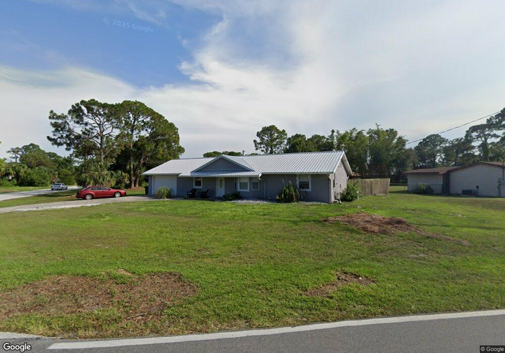
This home is located at 6510 Ember Ave, Cocoa, FL 32927 and is currently estimated at $325,117, approximately $238 per square foot. 6510 Ember Ave is a home located in Brevard County with nearby schools including Enterprise Elementary School, Space Coast Junior/Senior High School, and Sculptor Charter School.
Ownership History
Date
Name
Owned For
Owner Type
Purchase Details
Closed on
May 12, 2023
Sold by
Unkel Vera J
Bought by
Unkel Vera J and Strobel Alecia S
Current Estimated Value
Purchase Details
Closed on
Mar 16, 2015
Sold by
U S Bank National Association
Bought by
Kaufold Richard N and Kaufold Nicholla A
Purchase Details
Closed on
Jan 6, 2015
Sold by
Garland Randy and Fraga Kathleen S
Bought by
U S Bank National Association
Purchase Details
Closed on
Apr 19, 2014
Sold by
Kaufold Richard N and Kaufold Nicholla A
Bought by
Unkel Vera J
Home Financials for this Owner
Home Financials are based on the most recent Mortgage that was taken out on this home.
Original Mortgage
$145,350
Interest Rate
3.71%
Mortgage Type
New Conventional
Purchase Details
Closed on
Jan 6, 2005
Sold by
Fraga Kathleen S and Garland Kathleen S
Bought by
Garland Randy and Garland Kathleen S
Home Financials for this Owner
Home Financials are based on the most recent Mortgage that was taken out on this home.
Original Mortgage
$101,250
Interest Rate
9.15%
Create a Home Valuation Report for This Property
The Home Valuation Report is an in-depth analysis detailing your home's value as well as a comparison with similar homes in the area
Home Values in the Area
Average Home Value in this Area
Purchase History
| Date | Buyer | Sale Price | Title Company |
|---|---|---|---|
| Unkel Vera J | $100 | None Listed On Document | |
| Kaufold Richard N | $61,100 | Bay National Title Company | |
| U S Bank National Association | -- | None Available | |
| Unkel Vera J | $153,000 | Fidelity National Title Of F | |
| Garland Randy | $46,500 | Residential Title Svcs Inc |
Source: Public Records
Mortgage History
| Date | Status | Borrower | Loan Amount |
|---|---|---|---|
| Previous Owner | Unkel Vera J | $145,350 | |
| Previous Owner | Garland Randy | $101,250 |
Source: Public Records
Tax History
| Year | Tax Paid | Tax Assessment Tax Assessment Total Assessment is a certain percentage of the fair market value that is determined by local assessors to be the total taxable value of land and additions on the property. | Land | Improvement |
|---|---|---|---|---|
| 2025 | $3,426 | $260,850 | -- | -- |
| 2024 | $3,398 | $265,610 | -- | -- |
| 2023 | $3,398 | $240,630 | $0 | $0 |
| 2022 | $3,073 | $228,230 | $0 | $0 |
| 2021 | $2,791 | $171,630 | $42,000 | $129,630 |
| 2020 | $2,565 | $152,290 | $40,000 | $112,290 |
| 2019 | $2,489 | $147,400 | $35,000 | $112,400 |
| 2018 | $2,361 | $135,060 | $27,000 | $108,060 |
| 2017 | $2,236 | $119,830 | $24,000 | $95,830 |
| 2016 | $2,037 | $102,570 | $18,000 | $84,570 |
| 2015 | $923 | $67,440 | $15,000 | $52,440 |
| 2014 | $927 | $66,910 | $11,000 | $55,910 |
Source: Public Records
Map
Nearby Homes
- 6450 Ember Ave
- 6615 Dock Ave
- 00 Unknown
- 6760 Cairo Rd
- 6815 Bryant Rd
- 6581 Bancroft Ave
- 6481 La Brea Ave
- 6438 Hudson Rd
- 5095 Hogan Place
- 5220 Holden Rd
- 6620 Grissom Pkwy
- 0000 Grissom Pkwy
- 6375 Cable Ave
- 5680 Banos Ave
- 5715 Fairbridge St
- 5215 Holden Rd
- 5555 Brandon St
- 7065 Hundred Acre Dr
- 5155 Mayflower St
- 5221 Carrick Rd
- 5375 Curtis Blvd
- 5385 Curtis Blvd
- 5315 Curtis Blvd
- 5300 Fruitport St
- 5310 Fruitport St
- 5360 Curtis Blvd
- 6555 Elliott Ave
- 6555 Elliot Ave
- 5330 Curtis Blvd Unit 7
- 5320 Fruitport St
- 5395 Curtis Blvd
- 5305 Curtis Blvd
- 5300 Curtis Blvd
- 5290 Fruitport St
- 5330 Fruitport St
- 6565 Elliott Ave
- 0 Fairchild Ave
- 6550 Elliot
- 6550 Elliott Ave Unit 7
- 5405 Curtis Blvd
Your Personal Tour Guide
Ask me questions while you tour the home.