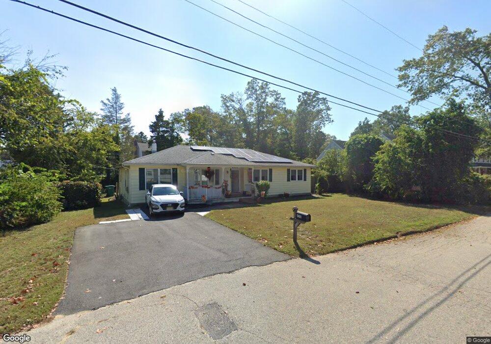
6510 Tunney Ave Mays Landing, NJ 08330
Estimated Value: $312,000 - $339,000
4
Beds
2
Baths
1,644
Sq Ft
$199/Sq Ft
Est. Value
About This Home
This home is located at 6510 Tunney Ave, Mays Landing, NJ 08330 and is currently estimated at $327,659, approximately $199 per square foot. 6510 Tunney Ave is a home located in Atlantic County with nearby schools including Joseph Shaner School, George L. Hess Educational Complex, and William Davies Middle School.
Ownership History
Date
Name
Owned For
Owner Type
Purchase Details
Closed on
Mar 27, 1997
Sold by
Kowalenko Valentina and Ivanov Eugenia
Bought by
Hyer Dennis and Hyer Kathleen
Current Estimated Value
Home Financials for this Owner
Home Financials are based on the most recent Mortgage that was taken out on this home.
Original Mortgage
$93,252
Outstanding Balance
$11,741
Interest Rate
7.59%
Estimated Equity
$315,918
Create a Home Valuation Report for This Property
The Home Valuation Report is an in-depth analysis detailing your home's value as well as a comparison with similar homes in the area
Home Values in the Area
Average Home Value in this Area
Purchase History
| Date | Buyer | Sale Price | Title Company |
|---|---|---|---|
| Hyer Dennis | $95,000 | Congress Title Corp |
Source: Public Records
Mortgage History
| Date | Status | Borrower | Loan Amount |
|---|---|---|---|
| Open | Hyer Dennis | $93,252 |
Source: Public Records
Tax History Compared to Growth
Tax History
| Year | Tax Paid | Tax Assessment Tax Assessment Total Assessment is a certain percentage of the fair market value that is determined by local assessors to be the total taxable value of land and additions on the property. | Land | Improvement |
|---|---|---|---|---|
| 2025 | $5,812 | $169,400 | $57,600 | $111,800 |
| 2024 | $5,812 | $169,400 | $57,600 | $111,800 |
| 2023 | $5,465 | $169,400 | $57,600 | $111,800 |
| 2022 | $5,465 | $169,400 | $57,600 | $111,800 |
| 2021 | $5,453 | $169,400 | $57,600 | $111,800 |
| 2020 | $5,453 | $169,400 | $57,600 | $111,800 |
| 2019 | $5,467 | $169,400 | $57,600 | $111,800 |
| 2018 | $5,275 | $169,400 | $57,600 | $111,800 |
| 2017 | $5,192 | $169,400 | $57,600 | $111,800 |
| 2016 | $5,046 | $169,400 | $57,600 | $111,800 |
| 2015 | $4,875 | $169,400 | $57,600 | $111,800 |
| 2014 | $4,936 | $187,900 | $67,600 | $120,300 |
Source: Public Records
Map
Nearby Homes
- 850 Morningside Dr
- 565 Park Rd
- 535 Park Rd
- 526 Bainbridge Ave
- 1st First Ave
- Lot:11.02-12.02 Estelle Ave
- B:534 L:11.01 Estelle Ave
- B:534 L:12.02 Estelle Ave
- B:534 L:11.02 Estelle Ave
- 80 Mill St
- Bl 531 Lot 8&9 Adams Ave
- 0 Cape May Ave
- Rt 50 and Old Mays Landing Rd
- 204 Route 50
- 0 3rd St
- Rt 50 and Old Mays Landing Rd
- 42 Ernst Ct
- 22 Ernst Ct
- 5745 2nd St
- 6126 Longwood Ave
- 6511 Rundle Ave
- 6506 Tunney Ave
- 6514 Tunney Ave
- 6507 Rundle Ave
- 6515 Rundle Ave
- 6511 Tunney Ave
- 6515 Tunney Ave
- 6507 Tunney Ave
- 6502 Tunney Ave
- 6518 Tunney Ave
- 707 Park Rd
- 6519 Rundle Ave
- 6519 Tunney Ave
- 6508 Rundle Ave
- 6518 Rundle Ave
- 0 Park Rd
- 6522 Tunney Ave
- 6523 Rundle Ave
- 697 Park Rd
- 6523 Tunney Ave