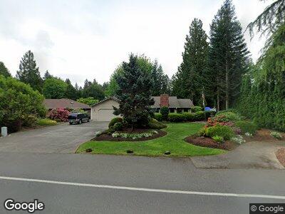
6514 Miner Dr SW Tumwater, WA 98512
Littlerock NeighborhoodEstimated Value: $592,000 - $648,000
3
Beds
2
Baths
2,298
Sq Ft
$271/Sq Ft
Est. Value
About This Home
This home is located at 6514 Miner Dr SW, Tumwater, WA 98512 and is currently estimated at $622,995, approximately $271 per square foot. 6514 Miner Dr SW is a home located in Thurston County with nearby schools including Michael T. Simmons Elementary School, Tumwater Middle School, and A.G. West Black Hills High School.
Ownership History
Date
Name
Owned For
Owner Type
Purchase Details
Closed on
Jan 22, 2003
Sold by
Lower Donald W and Lower Shirlee A
Bought by
Carlin Richard P and Carlin Deborah M
Current Estimated Value
Purchase Details
Closed on
Jan 4, 1999
Sold by
Lower Shirlee A and Lower Donald W
Bought by
Carlin Richard P and Carlin Deborah M
Home Financials for this Owner
Home Financials are based on the most recent Mortgage that was taken out on this home.
Original Mortgage
$160,000
Interest Rate
7%
Create a Home Valuation Report for This Property
The Home Valuation Report is an in-depth analysis detailing your home's value as well as a comparison with similar homes in the area
Home Values in the Area
Average Home Value in this Area
Purchase History
| Date | Buyer | Sale Price | Title Company |
|---|---|---|---|
| Carlin Richard P | -- | First American Title | |
| Carlin Richard P | $178,000 | Thurston County Title Co |
Source: Public Records
Mortgage History
| Date | Status | Borrower | Loan Amount |
|---|---|---|---|
| Open | Carlin Richard P | $215,175 | |
| Closed | Carlin Richard P | $30,000 | |
| Closed | Carlin Richard P | $232,000 | |
| Closed | Carlin Richard P | $23,177 | |
| Closed | Carlin Richard P | $193,600 | |
| Previous Owner | Carlin Richard P | $160,000 |
Source: Public Records
Tax History Compared to Growth
Tax History
| Year | Tax Paid | Tax Assessment Tax Assessment Total Assessment is a certain percentage of the fair market value that is determined by local assessors to be the total taxable value of land and additions on the property. | Land | Improvement |
|---|---|---|---|---|
| 2024 | $5,934 | $603,100 | $194,300 | $408,800 |
| 2023 | $5,934 | $593,000 | $172,600 | $420,400 |
| 2022 | $5,545 | $507,000 | $136,700 | $370,300 |
| 2021 | $5,078 | $471,300 | $115,900 | $355,400 |
| 2020 | $5,045 | $395,900 | $118,600 | $277,300 |
| 2019 | $4,449 | $381,300 | $89,800 | $291,500 |
| 2018 | $4,397 | $340,700 | $86,700 | $254,000 |
| 2017 | $3,615 | $275,550 | $84,350 | $191,200 |
| 2016 | $3,623 | $258,100 | $85,800 | $172,300 |
| 2014 | -- | $266,000 | $85,800 | $180,200 |
Source: Public Records
Map
Nearby Homes
- 6623 Glenwood Dr SW
- 2813 Foster Ct SW
- 2535 70th Ave SW Unit 9
- 2535 70th Ave SW Unit 12
- 6445 Brycen Ln SW Unit 103
- 7115 Mirasett St SW
- 1841 Trosper Rd SW Unit 38
- 1841 Trosper Rd SW Unit 30
- 1841 Trosper Rd SW Unit 24
- 3215 64th Ln SW
- 3234 64th Ln SW
- 6137 Kirsop Rd SW
- 3305 63rd Ave SW
- 2890 75th Ave SW Unit Lot 61
- 6702 Kirsop Village Dr SW
- 5279 Bald Eagle Ln SW
- 5302 E Eagle Ln SW
- 6141 Kirsop Rd SW
- 2905 75th Ave SW Unit Lot 56
- 2913 75th Ave SW Unit Lot 57
- 6514 Miner Dr SW
- 6524 Miner Dr SW
- 6508 Miner Dr SW
- 2425 65th Ct SW
- 6600 Miner Dr SW
- 6504 Miner Dr SW
- 6511 Miner Dr SW
- 6519 Miner Dr SW
- 6509 Miner Dr SW
- 2421 65th Ct SW
- 6503 Miner Dr SW
- 6603 Miner Dr SW
- 6428 Miner Dr SW
- 6431 Miner Dr SW
- 6609 Miner Dr SW
- 6612 Miner Dr SW
- 2405 65th Ct SW
- 6524 Restawhile Ct SW
- 6424 Miner Dr SW
- 6615 Miner Dr SW