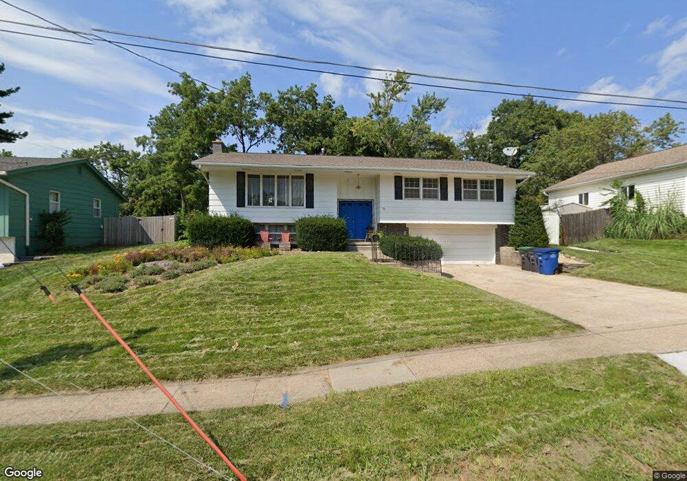
6515 Sheridan Ave Des Moines, IA 50322
Merle Hay NeighborhoodEstimated Value: $295,000 - $336,000
3
Beds
3
Baths
1,435
Sq Ft
$219/Sq Ft
Est. Value
About This Home
This home is located at 6515 Sheridan Ave, Des Moines, IA 50322 and is currently estimated at $314,696, approximately $219 per square foot. 6515 Sheridan Ave is a home located in Polk County with nearby schools including Hillis Elementary School, Meredith Middle School, and Hoover High School.
Ownership History
Date
Name
Owned For
Owner Type
Purchase Details
Closed on
May 4, 2020
Sold by
Mahany Patrick E and Mahany Sarah
Bought by
Mahany Patrick E and Mahany Sarah
Current Estimated Value
Home Financials for this Owner
Home Financials are based on the most recent Mortgage that was taken out on this home.
Original Mortgage
$135,000
Outstanding Balance
$119,366
Interest Rate
3.3%
Mortgage Type
New Conventional
Estimated Equity
$195,330
Purchase Details
Closed on
May 10, 2000
Sold by
Zenor Mildred E
Bought by
Mahany Patrick E and Mahany Tamara L
Home Financials for this Owner
Home Financials are based on the most recent Mortgage that was taken out on this home.
Original Mortgage
$125,050
Interest Rate
7.25%
Create a Home Valuation Report for This Property
The Home Valuation Report is an in-depth analysis detailing your home's value as well as a comparison with similar homes in the area
Home Values in the Area
Average Home Value in this Area
Purchase History
| Date | Buyer | Sale Price | Title Company |
|---|---|---|---|
| Mahany Patrick E | -- | None Available | |
| Mahany Patrick E | $135,000 | -- |
Source: Public Records
Mortgage History
| Date | Status | Borrower | Loan Amount |
|---|---|---|---|
| Open | Mahany Patrick E | $135,000 | |
| Closed | Mahany Patrick E | $125,050 |
Source: Public Records
Tax History Compared to Growth
Tax History
| Year | Tax Paid | Tax Assessment Tax Assessment Total Assessment is a certain percentage of the fair market value that is determined by local assessors to be the total taxable value of land and additions on the property. | Land | Improvement |
|---|---|---|---|---|
| 2025 | $5,600 | $319,700 | $61,000 | $258,700 |
| 2024 | $5,600 | $292,500 | $55,100 | $237,400 |
| 2023 | $5,678 | $292,500 | $55,100 | $237,400 |
| 2022 | $5,630 | $247,600 | $47,900 | $199,700 |
| 2021 | $5,482 | $247,600 | $47,900 | $199,700 |
| 2020 | $5,688 | $226,400 | $43,700 | $182,700 |
| 2019 | $5,292 | $226,400 | $43,700 | $182,700 |
| 2018 | $5,230 | $203,700 | $38,500 | $165,200 |
| 2017 | $4,822 | $203,700 | $38,500 | $165,200 |
| 2016 | $4,686 | $185,400 | $34,300 | $151,100 |
| 2015 | $4,686 | $185,400 | $34,300 | $151,100 |
| 2014 | $4,012 | $164,100 | $29,900 | $134,200 |
Source: Public Records
Map
Nearby Homes
- 2610 Westover Blvd
- 2729 67th St
- 6700 Sheridan Ave
- 2708 68th St
- 7005 Sheridan Cir
- 6620 Boston Ave
- 2325 61st St
- 2621 60th St
- 6316 Clearview Cir
- 7004 Holcomb Ave
- 3206 68th St
- 2615 59th St
- 7051 Oak Brook Dr
- 3233 68th St
- 3116 61st St
- 2250 70th St
- 5820 Urbandale Ave
- 2218 70th St
- 2131 70th St
- 7100 Holcomb Ave
- 6521 Sheridan Ave
- 2706 Westover Blvd
- 6503 Sheridan Ave
- 2712 Westover Blvd
- 2707 67th St
- 6603 Sheridan Ave
- 2716 Westover Blvd
- 2711 67th St
- 6502 Sheridan Ave
- 2717 67th St
- 6514 Sheridan Ave
- 6520 Sheridan Ave
- 6600 Sheridan Ave
- 2723 67th St
- 2720 Westover Blvd
- 2614 Westover Blvd
- 6606 Sheridan Ave
- 2629 Westover Blvd
- 2707 Westover Blvd
- 6615 Holcomb Ave