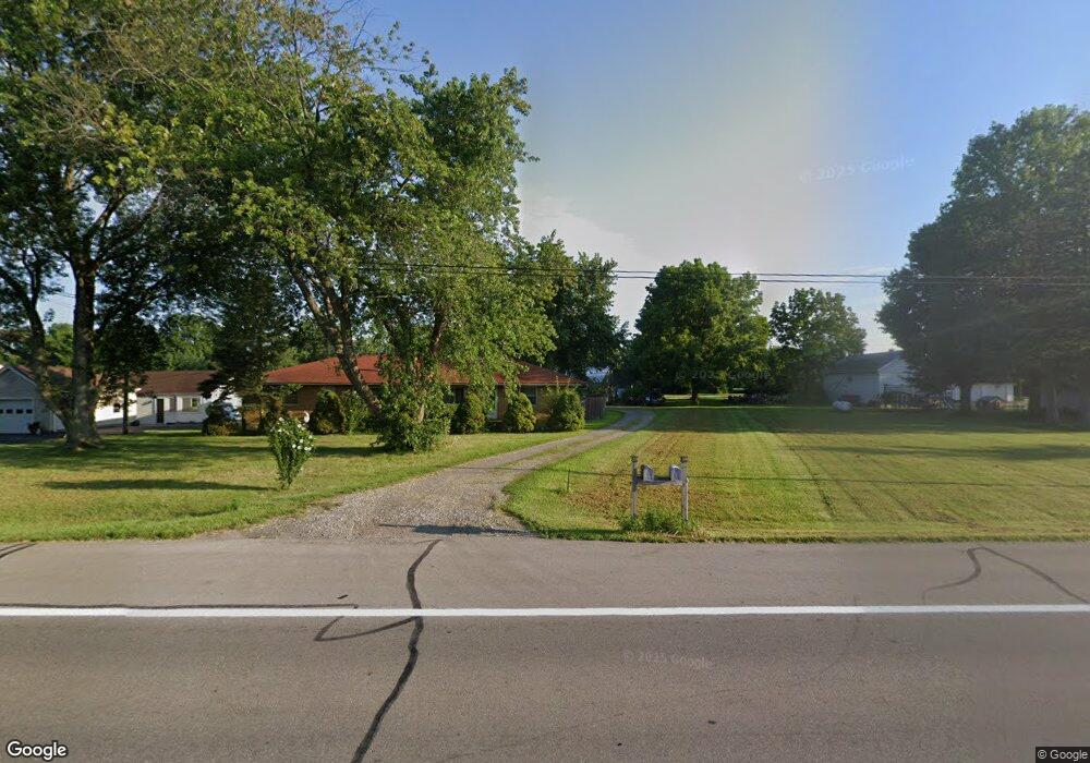
6515 W Us Route 36 Covington, OH 45318
Estimated Value: $201,706 - $257,000
4
Beds
2
Baths
2,070
Sq Ft
$112/Sq Ft
Est. Value
About This Home
This home is located at 6515 W Us Route 36, Covington, OH 45318 and is currently estimated at $231,927, approximately $112 per square foot. 6515 W Us Route 36 is a home located in Miami County with nearby schools including Covington Elementary/Junior High School, Covington Junior High School, and Covington High School.
Ownership History
Date
Name
Owned For
Owner Type
Purchase Details
Closed on
Nov 22, 2011
Sold by
Olds John S
Bought by
Swartz Robert L and Swartz Valerie G
Current Estimated Value
Home Financials for this Owner
Home Financials are based on the most recent Mortgage that was taken out on this home.
Original Mortgage
$74,376
Outstanding Balance
$50,595
Interest Rate
3.97%
Mortgage Type
VA
Estimated Equity
$181,332
Purchase Details
Closed on
Apr 26, 2011
Sold by
Kiefer Jaimie R
Bought by
Olds John S
Purchase Details
Closed on
Apr 20, 2011
Sold by
Olds John T
Bought by
Olds John S and Kiefer Jaimie R
Purchase Details
Closed on
Apr 1, 1992
Bought by
Olds John T
Create a Home Valuation Report for This Property
The Home Valuation Report is an in-depth analysis detailing your home's value as well as a comparison with similar homes in the area
Home Values in the Area
Average Home Value in this Area
Purchase History
| Date | Buyer | Sale Price | Title Company |
|---|---|---|---|
| Swartz Robert L | $72,000 | -- | |
| Olds John S | $50,000 | -- | |
| Olds John S | -- | -- | |
| Olds John T | -- | -- |
Source: Public Records
Mortgage History
| Date | Status | Borrower | Loan Amount |
|---|---|---|---|
| Open | Olds John S | $74,376 |
Source: Public Records
Tax History Compared to Growth
Tax History
| Year | Tax Paid | Tax Assessment Tax Assessment Total Assessment is a certain percentage of the fair market value that is determined by local assessors to be the total taxable value of land and additions on the property. | Land | Improvement |
|---|---|---|---|---|
| 2024 | $1,548 | $45,850 | $9,100 | $36,750 |
| 2023 | $1,548 | $45,850 | $9,100 | $36,750 |
| 2022 | $1,568 | $45,850 | $9,100 | $36,750 |
| 2021 | $1,292 | $35,280 | $7,000 | $28,280 |
| 2020 | $1,295 | $35,280 | $7,000 | $28,280 |
| 2019 | $1,291 | $35,280 | $7,000 | $28,280 |
| 2018 | $960 | $26,640 | $6,860 | $19,780 |
| 2017 | $980 | $26,640 | $6,860 | $19,780 |
| 2016 | $941 | $26,640 | $6,860 | $19,780 |
| 2015 | $893 | $25,140 | $6,480 | $18,660 |
| 2014 | $893 | $25,140 | $6,480 | $18,660 |
| 2013 | $898 | $25,140 | $6,480 | $18,660 |
Source: Public Records
Map
Nearby Homes
- 698 E Broadway St
- 271 N Ludlow St
- 520 N Pearl St
- 731 N Pearl St
- 501 N Main St Unit C1
- 00 W Piqua Clay Rd
- 223 Henry Ct
- 124 N Main St
- 133 W Broadway St
- 212 Charles Ct
- 210 Charles Ct
- 207 Charles Ct
- 208 Charles Ct
- 205 Charles Ct
- 206 Charles Ct
- 204 Charles Ct
- 221 S High St
- 219 Henry Ct
- 221 Henry Ct
- 203 Charles Ct
- 6515 U S 36
- 6545 W Us Route 36
- 6335 W Us Route 36
- 6373 W Us Route 36
- 6245 W Us Route 36
- 6172 Mulberry Grove-Rakestraw Rd
- 6565 W Us Route 36
- 6565 U S 36
- 6172 N Mlberry Grove Rakestr Rd
- 6172 N Mlbry Grv Rkstrw Rd
- 6172 N Mulberry Grove Rakestraw Rd
- 6172 N Mulberry Grv Rake Rd
- 6581 W Us Route 36
- 6581 W Us Route 36
- 6591 U S 36
- 6591 W Us Route 36
- 6473 W Us Route 36
- 6125 Rakestraw Rd
- 6609 W Us Route 36
- 6637 W Us Route 36