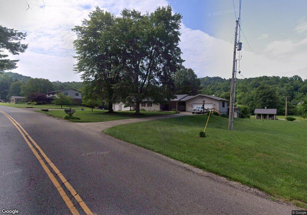
6516 Wolf Run Rd SE Dennison, OH 44621
Estimated Value: $327,000 - $367,000
3
Beds
3
Baths
2,491
Sq Ft
$137/Sq Ft
Est. Value
About This Home
This home is located at 6516 Wolf Run Rd SE, Dennison, OH 44621 and is currently estimated at $342,113, approximately $137 per square foot. 6516 Wolf Run Rd SE is a home located in Tuscarawas County with nearby schools including Claymont High School and Immaculate Conception School.
Ownership History
Date
Name
Owned For
Owner Type
Purchase Details
Closed on
Apr 20, 2022
Sold by
Buford Oil & Gas Ltd
Bought by
Caldwell Family Irrevocable Trust
Current Estimated Value
Purchase Details
Closed on
Apr 19, 2022
Sold by
6364 Wolfe Drive Se Land Trust
Bought by
Caldwell Family Irrevocable Trust
Purchase Details
Closed on
Apr 9, 2014
Sold by
Kuba Donald C and Kuba Tammy M
Bought by
Buford Oil & Gas Ltd
Create a Home Valuation Report for This Property
The Home Valuation Report is an in-depth analysis detailing your home's value as well as a comparison with similar homes in the area
Home Values in the Area
Average Home Value in this Area
Purchase History
| Date | Buyer | Sale Price | Title Company |
|---|---|---|---|
| Caldwell Family Irrevocable Trust | $375 | Petit John M | |
| Caldwell Family Irrevocable Trust | -- | -- | |
| Caldwell Family Irrevocable Trust | -- | None Listed On Document | |
| Buford Oil & Gas Ltd | $18,900 | None Available |
Source: Public Records
Tax History Compared to Growth
Tax History
| Year | Tax Paid | Tax Assessment Tax Assessment Total Assessment is a certain percentage of the fair market value that is determined by local assessors to be the total taxable value of land and additions on the property. | Land | Improvement |
|---|---|---|---|---|
| 2024 | $2,518 | $81,400 | $8,260 | $73,140 |
| 2023 | $2,518 | $232,570 | $23,610 | $208,960 |
| 2022 | $2,509 | $81,400 | $8,264 | $73,136 |
| 2021 | $2,484 | $72,374 | $7,816 | $64,558 |
| 2020 | $2,497 | $71,068 | $6,510 | $64,558 |
| 2019 | $2,377 | $71,068 | $6,510 | $64,558 |
| 2018 | $2,285 | $67,950 | $6,230 | $61,720 |
| 2017 | $2,288 | $67,950 | $6,230 | $61,720 |
| 2016 | $2,292 | $67,950 | $6,230 | $61,720 |
| 2014 | $2,178 | $62,480 | $5,530 | $56,950 |
| 2013 | $2,202 | $62,480 | $5,530 | $56,950 |
Source: Public Records
Map
Nearby Homes
- 1000 N 2nd St
- 1508 Roanoke Ave
- 1221 Eastport Ave
- 2025 N Water Street Extension
- 3264 Simpson Rd SE
- 717 N 4th St
- 523 N 1st St
- 4161 Indian Hill Rd SE
- 934 Parrish St
- 834 N Water St
- 620 Gorley St
- 318 N 5th St
- 123 E 7th St
- 518 N Uhrich St
- 0 Irish Run Rd SE
- 612 Grant St
- 113 E 4th St
- 5 S 2nd St
- 1870 Midvale Mine Rd SE
- 212 Thompson St
- 6436 Wolf Run Rd SE
- 6536 Wolf Run Rd SE
- 6498 Wolf Run Rd SE
- 6462 Wolf Run Rd SE
- 6610 Wolf Run Rd SE
- 6364 Wolf Run Rd SE
- 6414 Wolf Run Rd SE
- 6580 Wolf Run Rd SE
- 6650 Wolf Run Rd SE
- 6417 Wolf Run Rd SE
- 6370 Wolf Run Rd SE
- 6686 Wolf Run Rd SE
- 6298 Wolf Run Rd SE
- 6270 Wolf Run Rd SE
- 6845 Wolf Run Rd SE
- 6772 Wolf Run Rd SE
- 6238 Wolf Run Rd SE
- 3683 Eastport Rd SE
- 6204 Wolf Run Rd SE
- 6219 Wolf Run Rd SE