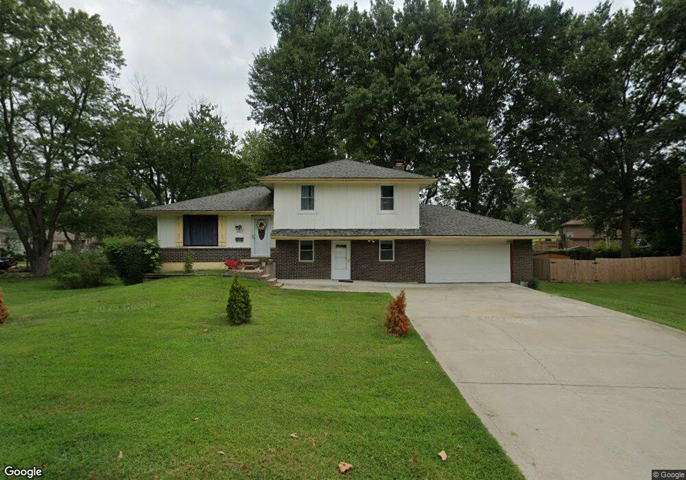
6517 E 129th Place Grandview, MO 64030
Estimated Value: $230,000 - $259,000
3
Beds
3
Baths
1,192
Sq Ft
$203/Sq Ft
Est. Value
About This Home
This home is located at 6517 E 129th Place, Grandview, MO 64030 and is currently estimated at $242,513, approximately $203 per square foot. 6517 E 129th Place is a home located in Jackson County with nearby schools including Conn-West Elementary School, Grandview Middle, and Grandview High School.
Ownership History
Date
Name
Owned For
Owner Type
Purchase Details
Closed on
Mar 1, 2019
Sold by
Woods Demicco E
Bought by
Witherspoon Frankie L and Witherspoon Yvetta B
Current Estimated Value
Purchase Details
Closed on
May 24, 2006
Sold by
Witherspoon Frank L and Witherspoon Yvette B
Bought by
Woods Demicco E
Home Financials for this Owner
Home Financials are based on the most recent Mortgage that was taken out on this home.
Original Mortgage
$108,300
Interest Rate
6.5%
Mortgage Type
FHA
Create a Home Valuation Report for This Property
The Home Valuation Report is an in-depth analysis detailing your home's value as well as a comparison with similar homes in the area
Home Values in the Area
Average Home Value in this Area
Purchase History
| Date | Buyer | Sale Price | Title Company |
|---|---|---|---|
| Witherspoon Frankie L | -- | None Available | |
| Witherspoon Frankie L | -- | None Available | |
| Woods Demicco E | -- | Commonwealth Land Title Insu |
Source: Public Records
Mortgage History
| Date | Status | Borrower | Loan Amount |
|---|---|---|---|
| Previous Owner | Woods Demicco E | $108,300 |
Source: Public Records
Tax History
| Year | Tax Paid | Tax Assessment Tax Assessment Total Assessment is a certain percentage of the fair market value that is determined by local assessors to be the total taxable value of land and additions on the property. | Land | Improvement |
|---|---|---|---|---|
| 2025 | $2,641 | $31,409 | $6,061 | $25,348 |
| 2024 | $2,596 | $32,481 | $7,746 | $24,735 |
| 2023 | $2,596 | $32,481 | $6,641 | $25,840 |
| 2022 | $2,039 | $23,750 | $4,703 | $19,047 |
| 2021 | $2,037 | $23,750 | $4,703 | $19,047 |
| 2020 | $1,832 | $22,627 | $4,703 | $17,924 |
| 2019 | $1,767 | $22,627 | $4,703 | $17,924 |
| 2018 | $1,022,594 | $19,465 | $3,416 | $16,049 |
| 2017 | $1,634 | $19,465 | $3,416 | $16,049 |
| 2016 | $1,626 | $18,977 | $3,352 | $15,625 |
Source: Public Records
Map
Nearby Homes
- 6614 E 128th St
- 12200 Craig Dr
- 12709 Applewood Dr
- 6701 E 127 St
- 12701 Applewood Dr
- 6134 E 127th St
- 12217 Bennington Ave
- 5956 E 129th St
- 12704 Bristol Ave
- 12801 Corrington Ave
- 13008 Corrington Ave
- 7305 E 129th St
- 12718 Oakland Ave
- 13218 Craig Ave
- 14925 S U S 71 Hwy
- 13205 Byars Rd
- 7601 High Grove Rd
- 13420 Belmead Ave
- 13424 Parker Ave
- 13408 Bristol Ave
- 6513 E 129th Place
- 6601 E 129th St
- 6511 E 129th St
- 6509 E 129th Place
- 12916 Craig Ave
- 6605 E 129th St
- 12920 Craig Ave
- 6507 E 129th St
- 12924 Craig Ave
- 12916 Craig Dr
- 6504 E 129th Place
- 6505 E 129th Place
- 12912 Craig Ave
- 6512 E 129th St
- 6600 E 129th St
- 6516 E 129th St
- 12928 Craig Ave
- 6503 E 129th St
- 6508 E 129th St
- 6604 E 129th St