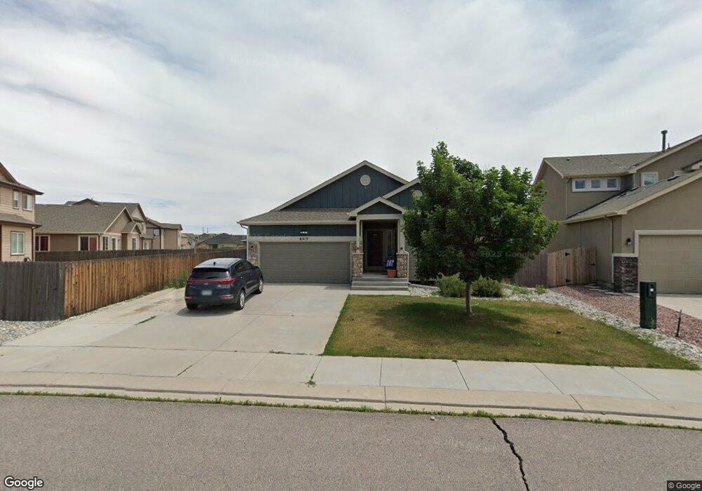
6519 Stingray Ln Colorado Springs, CO 80925
Widefield NeighborhoodEstimated Value: $427,466 - $494,000
4
Beds
3
Baths
1,604
Sq Ft
$288/Sq Ft
Est. Value
About This Home
This home is located at 6519 Stingray Ln, Colorado Springs, CO 80925 and is currently estimated at $461,617, approximately $287 per square foot. 6519 Stingray Ln is a home with nearby schools including Grand Mountain School, Mesa Ridge High School, and Valley Christian Academy.
Ownership History
Date
Name
Owned For
Owner Type
Purchase Details
Closed on
Jun 22, 2022
Sold by
Gostnell Brandon M
Bought by
Rhodes Donald W and Rhodes Lisa L
Current Estimated Value
Purchase Details
Closed on
Oct 20, 2014
Sold by
Saint Aubyn Homes Llc
Bought by
Gostnell Brandon M and Gostnell Julie N
Home Financials for this Owner
Home Financials are based on the most recent Mortgage that was taken out on this home.
Original Mortgage
$274,200
Interest Rate
4.16%
Mortgage Type
FHA
Create a Home Valuation Report for This Property
The Home Valuation Report is an in-depth analysis detailing your home's value as well as a comparison with similar homes in the area
Home Values in the Area
Average Home Value in this Area
Purchase History
| Date | Buyer | Sale Price | Title Company |
|---|---|---|---|
| Rhodes Donald W | $420,000 | Stewart Title Company | |
| Gostnell Brandon M | $279,300 | Heritage Title |
Source: Public Records
Mortgage History
| Date | Status | Borrower | Loan Amount |
|---|---|---|---|
| Previous Owner | Gostnell Brandon M | $274,200 |
Source: Public Records
Tax History Compared to Growth
Tax History
| Year | Tax Paid | Tax Assessment Tax Assessment Total Assessment is a certain percentage of the fair market value that is determined by local assessors to be the total taxable value of land and additions on the property. | Land | Improvement |
|---|---|---|---|---|
| 2025 | $4,690 | $33,650 | -- | -- |
| 2024 | $4,649 | $34,870 | $6,040 | $28,830 |
| 2022 | $3,421 | $24,710 | $4,810 | $19,900 |
| 2021 | $3,562 | $25,420 | $4,950 | $20,470 |
| 2020 | $3,482 | $24,590 | $4,330 | $20,260 |
| 2019 | $3,470 | $24,590 | $4,330 | $20,260 |
| 2018 | $2,917 | $20,350 | $4,360 | $15,990 |
| 2017 | $2,978 | $20,350 | $4,360 | $15,990 |
| 2016 | $2,948 | $22,780 | $4,380 | $18,400 |
| 2015 | $3,106 | $22,780 | $4,380 | $18,400 |
| 2014 | $1,474 | $10,860 | $10,860 | $0 |
Source: Public Records
Map
Nearby Homes
- 10634 Abrams Dr
- 10525 Abrams Dr
- 10405 Abrams Dr
- 6572 Justice Way
- 10670 Abrams Dr
- 10442 Abrams Dr
- 10394 Abrams Dr
- 6579 Lamine Dr
- 10604 Deer Meadow Cir
- 10648 Desert Bloom Way
- 10721 Yuba Dr
- 10568 Kalama Dr
- 6484 Chaplin Dr
- 6716 Volga Dr
- 10732 Deer Meadow Cir
- 10202 Abrams Dr
- 10867 Matta Dr
- 10208 Abrams Dr
- 10420 Deer Meadow Cir
- 10179 Seawolf Dr
- 6531 Stingray Ln
- 6543 Stingray Ln
- 10509 Declaration Dr
- 10503 Declaration Dr
- 10621 Abrams Dr
- 10633 Abrams Dr
- 10615 Abrams Dr
- 10515 Declaration Dr
- 6555 Stingray Ln
- 10449 Declaration Dr
- 10639 Abrams Dr
- 10443 Declaration Dr
- 6567 Stingray Ln
- 10521 Declaration Dr
- 6471 Stingray Ln
- 6579 Stingray Ln
- 10437 Declaration Dr
- 6458 Stingray Ln
- 10628 Abrams Dr
- 10616 Abrams Dr