Estimated Value: $123,000 - $257,000
3
Beds
1
Bath
2,545
Sq Ft
$80/Sq Ft
Est. Value
About This Home
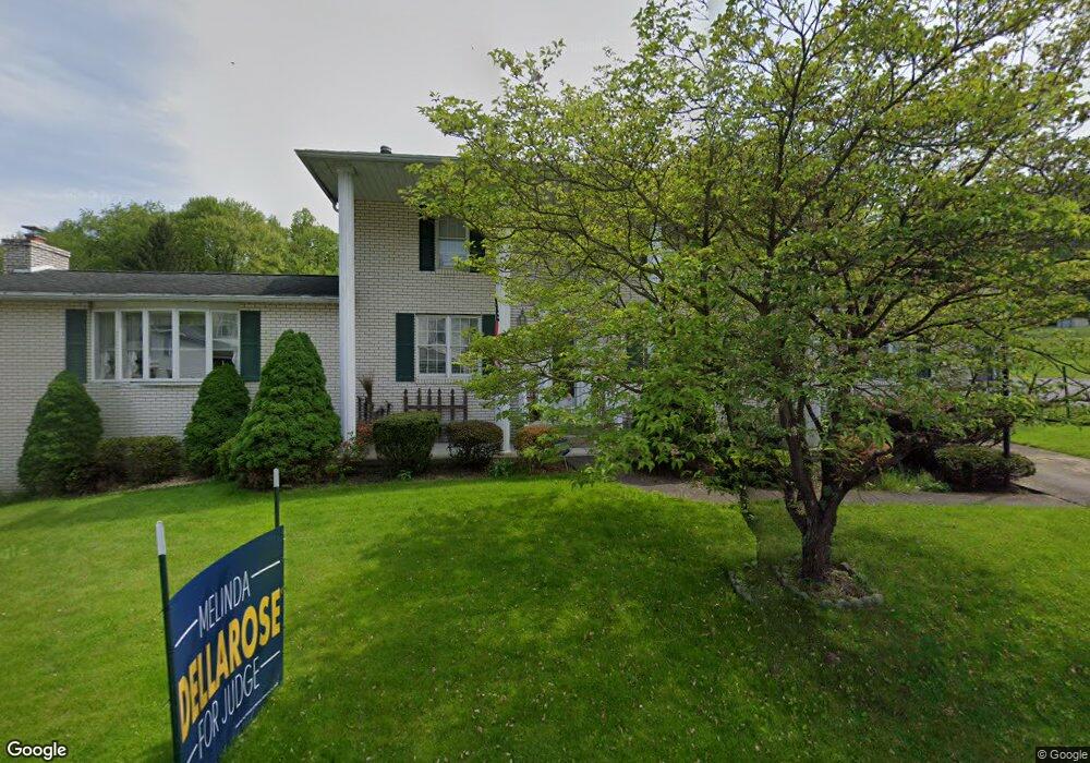
This home is located at 652 Upper Middletown Rd, Smock, PA 15480 and is currently estimated at $202,849, approximately $79 per square foot. 652 Upper Middletown Rd is a home located in Fayette County with nearby schools including Uniontown Area Senior High School.
Ownership History
Date
Name
Owned For
Owner Type
Purchase Details
Closed on
Apr 26, 2021
Sold by
Sampey Donald D and Sampey Linda L
Bought by
Sampey Donald D and Gibson Sampey Linda
Current Estimated Value
Purchase Details
Closed on
Jan 31, 2021
Sold by
Sampey Linda L
Bought by
Gibson-Sampey Revocable Trust
Purchase Details
Closed on
Jun 8, 2004
Bought by
Sampey Linda L and Sampey Donald D
Create a Home Valuation Report for This Property
The Home Valuation Report is an in-depth analysis detailing your home's value as well as a comparison with similar homes in the area
Home Values in the Area
Average Home Value in this Area
Purchase History
| Date | Buyer | Sale Price | Title Company |
|---|---|---|---|
| Sampey Donald D | -- | None Available | |
| Gibson-Sampey Revocable Trust | -- | None Listed On Document | |
| Sampey Linda L | $1,900 | -- |
Source: Public Records
Tax History
| Year | Tax Paid | Tax Assessment Tax Assessment Total Assessment is a certain percentage of the fair market value that is determined by local assessors to be the total taxable value of land and additions on the property. | Land | Improvement |
|---|---|---|---|---|
| 2025 | $1,192 | $46,635 | $8,270 | $38,365 |
| 2024 | $1,136 | $46,635 | $8,270 | $38,365 |
| 2023 | $2,273 | $46,635 | $8,270 | $38,365 |
| 2022 | $2,273 | $46,635 | $8,270 | $38,365 |
| 2021 | $2,273 | $46,635 | $8,270 | $38,365 |
| 2020 | $2,221 | $46,635 | $8,270 | $38,365 |
| 2019 | $2,059 | $46,635 | $8,270 | $38,365 |
| 2018 | $1,950 | $46,635 | $8,270 | $38,365 |
| 2017 | $1,950 | $46,635 | $8,270 | $38,365 |
| 2016 | -- | $46,635 | $8,270 | $38,365 |
| 2015 | -- | $46,635 | $8,270 | $38,365 |
| 2014 | -- | $93,270 | $16,540 | $76,730 |
Source: Public Records
Map
Nearby Homes
- 0 Alpine Ln Unit 1706795
- 912 Keisterville Rd
- 1204 Pittsburgh Rd
- SR 51 Vances Mill Rd
- - Old Pittsburgh Rd
- TR986 Old Pittsburgh Rd
- 239 Main St
- 218 Hatfield Rd
- 176 Lower Oliver 3
- 34 Lexington Ave
- 316 Bute Rd
- 1008 Colonial Dr
- 224 Main St
- 405 1st St
- 22 Fairview St
- 0 Concord Unit 1743888
- 206 Fairview St
- 32 Springer Ave
- 390 Snuff Ridge Rd
- 20 Crawford St
- 656 Upper Middletown Rd
- 644 Upper Middletown Rd
- 470 Old Route 51 Rd
- 647 Upper Middletown Rd
- 653 Upper Middletown Rd
- 472 Old Route 51 Rd
- 657 Upper Middletown Rd
- 649 Upper Middletown Rd
- 468 Old Route 51 Rd
- 639 Upper Middletown Rd
- 467 Old Route 51 Rd
- 452 Old Route 51 Rd
- 661 Upper Middletown Rd
- 457 Old
- 665 Upper Middletown Rd
- 629 Upper Middletown Rd
- 624 Upper Middletown Rd
- 669 Upper Middletown Rd
- 442 Old Route 51 Rd
- 620 Upper Middletown Rd
Your Personal Tour Guide
Ask me questions while you tour the home.