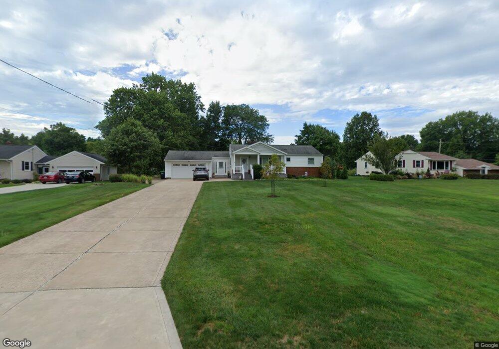
6520 Brookside Rd Independence, OH 44131
Estimated Value: $282,000 - $342,000
3
Beds
3
Baths
1,611
Sq Ft
$195/Sq Ft
Est. Value
About This Home
This home is located at 6520 Brookside Rd, Independence, OH 44131 and is currently estimated at $313,534, approximately $194 per square foot. 6520 Brookside Rd is a home located in Cuyahoga County with nearby schools including Independence Primary School, Independence Middle School, and Independence High School.
Ownership History
Date
Name
Owned For
Owner Type
Purchase Details
Closed on
May 12, 2006
Sold by
Rice Phillip A
Bought by
Solomon John D and Solomon Janet
Current Estimated Value
Home Financials for this Owner
Home Financials are based on the most recent Mortgage that was taken out on this home.
Original Mortgage
$110,400
Outstanding Balance
$64,740
Interest Rate
6.62%
Mortgage Type
Fannie Mae Freddie Mac
Estimated Equity
$248,794
Purchase Details
Closed on
Dec 29, 1980
Sold by
Chopowski John J and Chopowski Helene M
Bought by
Chopowsky John J M
Purchase Details
Closed on
Jan 1, 1975
Bought by
Chopowski John J and Chopowski Helene M
Create a Home Valuation Report for This Property
The Home Valuation Report is an in-depth analysis detailing your home's value as well as a comparison with similar homes in the area
Home Values in the Area
Average Home Value in this Area
Purchase History
| Date | Buyer | Sale Price | Title Company |
|---|---|---|---|
| Solomon John D | $138,000 | Revere | |
| Chopowsky John J M | -- | -- | |
| Chopowski John J | -- | -- |
Source: Public Records
Mortgage History
| Date | Status | Borrower | Loan Amount |
|---|---|---|---|
| Open | Solomon John D | $110,400 |
Source: Public Records
Tax History
| Year | Tax Paid | Tax Assessment Tax Assessment Total Assessment is a certain percentage of the fair market value that is determined by local assessors to be the total taxable value of land and additions on the property. | Land | Improvement |
|---|---|---|---|---|
| 2024 | $4,280 | $99,295 | $19,040 | $80,255 |
| 2023 | $3,767 | $71,580 | $19,390 | $52,190 |
| 2022 | $3,747 | $71,580 | $19,390 | $52,190 |
| 2021 | $3,692 | $71,580 | $19,390 | $52,190 |
| 2020 | $3,610 | $65,660 | $17,780 | $47,880 |
| 2019 | $3,484 | $187,600 | $50,800 | $136,800 |
| 2018 | $3,323 | $65,660 | $17,780 | $47,880 |
| 2017 | $3,195 | $57,510 | $14,980 | $42,530 |
| 2016 | $3,163 | $57,510 | $14,980 | $42,530 |
| 2015 | $2,926 | $57,510 | $14,980 | $42,530 |
| 2014 | $2,926 | $53,240 | $13,860 | $39,380 |
Source: Public Records
Map
Nearby Homes
- 6312 E Pleasant Valley Rd
- SL 23 Kingscote Park
- 7003 Brecksville Rd
- 7311 Brecksville Rd
- 6119 E Sprague Rd
- 6626 Hawthorne Dr
- 6752 Rivercrest Dr
- 7477 Ludwin Dr
- 6990 S Great Oaks Pkwy
- VL TBB Laura Lee Ln
- 6895 Carriage Hill Dr Unit E77
- VL Laura Lee Ln
- 6930 Carriage Hill Dr Unit 101
- 6910 Carriage Hill Dr Unit 104
- 7030 Carriage Hill Dr Unit 202
- 7840 Mccreary Rd
- 0 Brecksville Rd
- 1915 E Wallings Rd
- 5108 Great Oaks Pkwy
- 8420 Stone Rd
- 6528 Brookside Rd
- 6508 Brookside Rd
- 7533 Midland Rd
- 6608 Brookside Rd
- 6523 Brookside Rd
- 6515 Brookside Rd
- 7545 Midland Rd
- 6408 Brookside Rd
- 6531 Brookside Rd
- 6507 Brookside Rd
- 6690 Brookside Rd
- 6607 Brookside Rd
- 6423 Ranchview Dr
- 6613 Brookside Rd
- 6419 Brookside Rd
- 7557 Midland Rd
- 6419 Brookside Rd
- 6404 Brookside Rd
- 7471 Midland Rd
- 6700 Brookside Rd
Your Personal Tour Guide
Ask me questions while you tour the home.