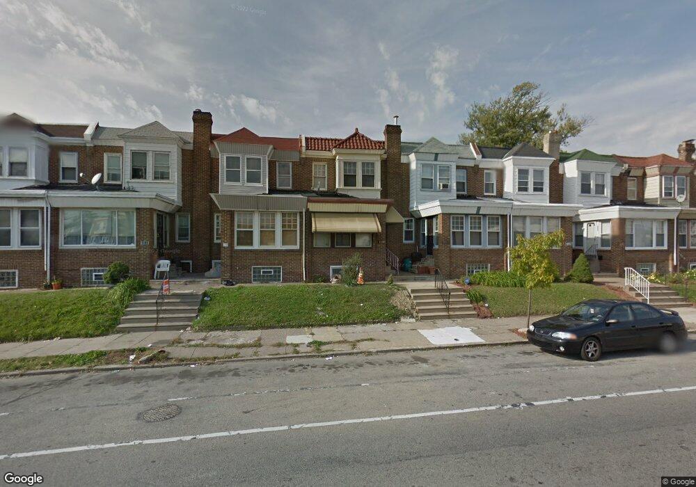
6520 Wyncote Ave Philadelphia, PA 19138
East Germantown NeighborhoodEstimated Value: $142,498 - $188,000
3
Beds
1
Bath
1,008
Sq Ft
$162/Sq Ft
Est. Value
About This Home
This home is located at 6520 Wyncote Ave, Philadelphia, PA 19138 and is currently estimated at $163,125, approximately $161 per square foot. 6520 Wyncote Ave is a home located in Philadelphia County with nearby schools including Martin Luther King High School, West Oak Lane Charter School, and Mastery Charter School - Francis D. Pastorius Elemen.
Ownership History
Date
Name
Owned For
Owner Type
Purchase Details
Closed on
Jul 25, 2003
Sold by
Outlaw Whit and Outlaw Lillie Mary
Bought by
Bynum Colleen R
Current Estimated Value
Home Financials for this Owner
Home Financials are based on the most recent Mortgage that was taken out on this home.
Original Mortgage
$65,250
Outstanding Balance
$27,783
Interest Rate
5.28%
Mortgage Type
VA
Estimated Equity
$135,342
Create a Home Valuation Report for This Property
The Home Valuation Report is an in-depth analysis detailing your home's value as well as a comparison with similar homes in the area
Home Values in the Area
Average Home Value in this Area
Purchase History
| Date | Buyer | Sale Price | Title Company |
|---|---|---|---|
| Bynum Colleen R | $64,000 | Security Search & Abstract C |
Source: Public Records
Mortgage History
| Date | Status | Borrower | Loan Amount |
|---|---|---|---|
| Open | Bynum Colleen R | $65,250 |
Source: Public Records
Tax History Compared to Growth
Tax History
| Year | Tax Paid | Tax Assessment Tax Assessment Total Assessment is a certain percentage of the fair market value that is determined by local assessors to be the total taxable value of land and additions on the property. | Land | Improvement |
|---|---|---|---|---|
| 2025 | $1,365 | $137,000 | $27,400 | $109,600 |
| 2024 | $1,365 | $137,000 | $27,400 | $109,600 |
| 2023 | $1,365 | $97,500 | $19,500 | $78,000 |
| 2022 | $319 | $52,500 | $19,500 | $33,000 |
| 2021 | $949 | $0 | $0 | $0 |
| 2020 | $949 | $0 | $0 | $0 |
| 2019 | $991 | $0 | $0 | $0 |
| 2018 | $648 | $0 | $0 | $0 |
| 2017 | $1,068 | $0 | $0 | $0 |
| 2016 | $648 | $0 | $0 | $0 |
| 2015 | $781 | $0 | $0 | $0 |
| 2014 | -- | $88,300 | $7,486 | $80,814 |
| 2012 | -- | $10,368 | $1,999 | $8,369 |
Source: Public Records
Map
Nearby Homes
- 2105 Stenton Ave
- 2115 Stenton Ave
- 2125 Stenton Ave
- 2120 66th Ave
- 6531 N Beechwood St
- 6534 N Lambert St
- 6603 N 21st St
- 2152 Stenton Ave
- 1914 W 65th Ave
- 6558 Limekiln Pike
- 2061 Independence St
- 6824 Rodney St
- 6420 N Woodstock St
- 5725 Crittenden St
- 6332 E Wister St
- 1344 Narragansett St
- 6600 N Opal St
- 2022 66th Ave
- 6329 N Beechwood St
- 5827 Crittenden St
- 6518 Wyncote Ave
- 6522 Wyncote Ave
- 6516 Wyncote Ave
- 6524 Wyncote Ave
- 6514 Wyncote Ave
- 6526 Wyncote Ave
- 6512 Wyncote Ave
- 6517 N Beechwood St
- 6528 Wyncote Ave
- 6519 N Beechwood St
- 6515 N Beechwood St
- 6521 N Beechwood St
- 6510 Wyncote Ave
- 6530 Wyncote Ave
- 6508 Wyncote Ave
- 6523 N Beechwood St
- 6532 Wyncote Ave
- 6525 N Beechwood St
- 6527 N Beechwood St
- 6529 N Beechwood St