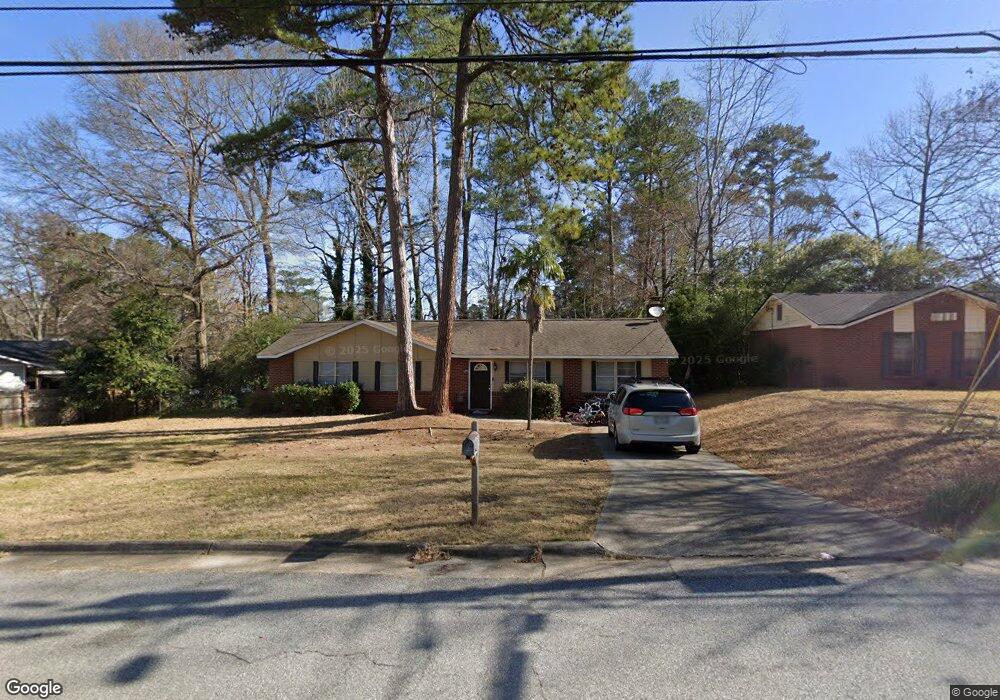
6524 Benson Dr Columbus, GA 31909
Northern Columbus NeighborhoodEstimated Value: $181,000 - $210,000
3
Beds
2
Baths
1,425
Sq Ft
$134/Sq Ft
Est. Value
About This Home
This home is located at 6524 Benson Dr, Columbus, GA 31909 and is currently estimated at $190,847, approximately $133 per square foot. 6524 Benson Dr is a home located in Muscogee County with nearby schools including Blanchard Elementary School, Blackmon Road Middle School, and Shaw High School.
Ownership History
Date
Name
Owned For
Owner Type
Purchase Details
Closed on
Jul 29, 2021
Sold by
Smith Kenneth W
Bought by
Carson Michael Thomas
Current Estimated Value
Home Financials for this Owner
Home Financials are based on the most recent Mortgage that was taken out on this home.
Original Mortgage
$104,000
Outstanding Balance
$78,627
Interest Rate
2.9%
Mortgage Type
New Conventional
Estimated Equity
$112,220
Purchase Details
Closed on
Sep 28, 2012
Sold by
Smith Jane M Vincent
Bought by
Smith Jane M and Smith Vincent
Create a Home Valuation Report for This Property
The Home Valuation Report is an in-depth analysis detailing your home's value as well as a comparison with similar homes in the area
Home Values in the Area
Average Home Value in this Area
Purchase History
| Date | Buyer | Sale Price | Title Company |
|---|---|---|---|
| Carson Michael Thomas | $130,000 | -- | |
| Smith Jane M | -- | -- |
Source: Public Records
Mortgage History
| Date | Status | Borrower | Loan Amount |
|---|---|---|---|
| Open | Carson Michael Thomas | $104,000 |
Source: Public Records
Tax History Compared to Growth
Tax History
| Year | Tax Paid | Tax Assessment Tax Assessment Total Assessment is a certain percentage of the fair market value that is determined by local assessors to be the total taxable value of land and additions on the property. | Land | Improvement |
|---|---|---|---|---|
| 2025 | $2,520 | $64,372 | $9,912 | $54,460 |
| 2024 | $2,385 | $60,936 | $9,912 | $51,024 |
| 2023 | $2,400 | $60,936 | $9,912 | $51,024 |
| 2022 | $1,900 | $46,544 | $9,912 | $36,632 |
| 2021 | $1,372 | $33,596 | $9,912 | $23,684 |
| 2020 | $1,372 | $33,596 | $9,912 | $23,684 |
| 2019 | $1,376 | $33,596 | $9,912 | $23,684 |
| 2018 | $1,376 | $33,596 | $9,912 | $23,684 |
| 2017 | $1,381 | $33,596 | $9,912 | $23,684 |
| 2016 | $1,385 | $33,571 | $6,539 | $27,032 |
| 2015 | $555 | $33,571 | $6,539 | $27,032 |
| 2014 | $555 | $33,571 | $6,539 | $27,032 |
| 2013 | -- | $33,571 | $6,539 | $27,032 |
Source: Public Records
Map
Nearby Homes
- 4627 Wimbish Ct
- 4417 Sibley St
- 6500 Charter Oaks Cir
- 4245 N Oaks Dr
- 6736 Charter Oaks Cir
- 4715 Teak Dr
- 6136 Morningside Dr
- 4454 Weems Rd
- 6630 Lemans Ln
- 5011 Montego Dr
- 6717 Moon Cir
- 5041 Montego Dr
- 6158 Arrington Dr
- 5042 Foxfire Dr
- 4202 Cheshire Bridge Rd
- 5045 Old Post Rd
- 3919 Gray Fox Dr
- 4320 Canady St
- 209 Plum Ct
- 6104 Candlestick Loop
- 6518 Benson Dr
- 4506 Randall Dr
- 4500 Randall Dr
- 4512 Randall Dr
- 6512 Benson Dr
- 6525 Benson Dr
- 4518 Randall Dr
- 6531 Benson Dr
- 4422 Randall Dr
- 4516 N Oaks Dr
- 4600 Wimbish Ct
- 6506 Benson Dr
- 4604 Wimbish Ct
- 4524 Randall Dr
- 4501 Randall Dr
- 4507 N Oaks Dr
- 4416 Randall Dr
- 4509 Randall Dr
- 4510 N Oaks Dr
- 6500 Benson Dr