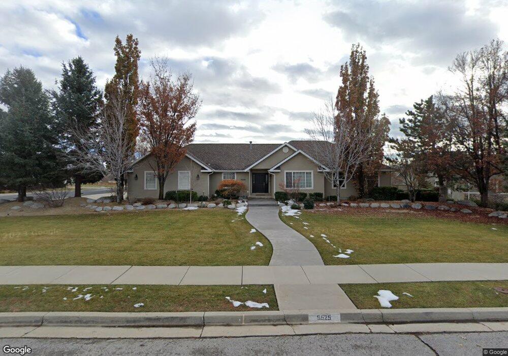
6525 W 10760 N Highland, UT 84003
Estimated Value: $922,000 - $1,159,000
6
Beds
4
Baths
1,842
Sq Ft
$560/Sq Ft
Est. Value
About This Home
This home is located at 6525 W 10760 N, Highland, UT 84003 and is currently estimated at $1,031,541, approximately $560 per square foot. 6525 W 10760 N is a home located in Utah County with nearby schools including Highland Elementary School, Mountain Ridge Junior High School, and Lone Peak High School.
Ownership History
Date
Name
Owned For
Owner Type
Purchase Details
Closed on
Jul 20, 2007
Sold by
Broadbent Lynn C and Broadbent Merle
Bought by
Lofgreen Vikki L and Lofgreen Larry A
Current Estimated Value
Create a Home Valuation Report for This Property
The Home Valuation Report is an in-depth analysis detailing your home's value as well as a comparison with similar homes in the area
Home Values in the Area
Average Home Value in this Area
Purchase History
| Date | Buyer | Sale Price | Title Company |
|---|---|---|---|
| Lofgreen Vikki L | -- | Us Title Utah |
Source: Public Records
Mortgage History
| Date | Status | Borrower | Loan Amount |
|---|---|---|---|
| Closed | Lofgreen Vikki L | $0 |
Source: Public Records
Tax History Compared to Growth
Tax History
| Year | Tax Paid | Tax Assessment Tax Assessment Total Assessment is a certain percentage of the fair market value that is determined by local assessors to be the total taxable value of land and additions on the property. | Land | Improvement |
|---|---|---|---|---|
| 2025 | $3,860 | $549,890 | $369,200 | $630,600 |
| 2024 | $3,860 | $476,795 | $0 | $0 |
| 2023 | $3,450 | $459,745 | $0 | $0 |
| 2022 | $3,503 | $452,595 | $0 | $0 |
| 2021 | $3,434 | $660,900 | $257,700 | $403,200 |
| 2020 | $3,262 | $615,600 | $224,100 | $391,500 |
| 2019 | $3,069 | $606,000 | $224,100 | $381,900 |
| 2018 | $2,915 | $546,900 | $214,800 | $332,100 |
| 2017 | $2,542 | $254,540 | $0 | $0 |
| 2016 | $2,387 | $223,410 | $0 | $0 |
| 2015 | $2,518 | $223,410 | $0 | $0 |
| 2014 | -- | $205,810 | $0 | $0 |
Source: Public Records
Map
Nearby Homes
- 6271 W 10830 St N
- 6373 W 10500 N
- 10434 N 6400 W
- 6372 W 10400 N
- 1610 E Center Pointe Dr
- 1602 E Center Pointe Dr
- 1602 E Center Pointe Dr Unit 1
- 10818 N 6000 W
- 6399 W 10150 N
- 6602 W Normandy Way
- 11248 Hawkstone Way Unit 109
- 6024 Hawkstone Way Unit 108
- 11228 Hawkstone Way Unit 110
- 11124 N 6000 W
- 6190 W 10050 N
- 11337 N 5950 W Unit 7
- 9967 N 6670 W
- 975 E 2850 N
- 9924 N 6630 W Unit 9
- 11572 N Maple Hollow Ct
- 6545 W 10760 N
- 6505 W 10760 N
- 10744 N 6510 W
- 10724 N 6510 W
- 6565 W 10760 N
- 6619 W 10760 N
- 6526 W 10760 N
- 6516 W 10760 N
- 6546 W 10760 N
- 6589 W 10760 N
- 6475 W 10760 N
- 6566 W 10760 N
- 6645 W 10760 N
- 6496 W 10760 N
- 6455 W 10760 N
- 6609 W 10760 N
- 10827 Natalie Ct
- 6476 W 10760 N
- 6616 W 10760 N
- 6456 W 10760 N