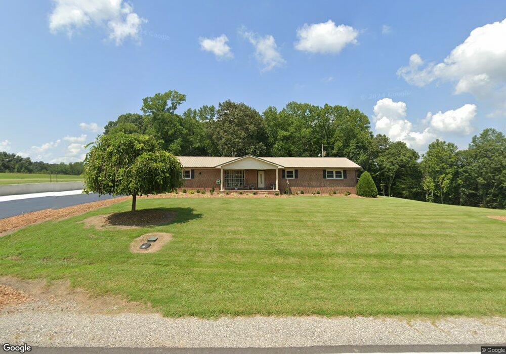
6529 Chestnut Ridge Rd Winchester, TN 37398
Estimated Value: $358,534 - $575,000
--
Bed
2
Baths
1,775
Sq Ft
$270/Sq Ft
Est. Value
About This Home
This home is located at 6529 Chestnut Ridge Rd, Winchester, TN 37398 and is currently estimated at $479,134, approximately $269 per square foot. 6529 Chestnut Ridge Rd is a home located in Franklin County with nearby schools including South Middle School and Franklin County High School.
Ownership History
Date
Name
Owned For
Owner Type
Purchase Details
Closed on
Nov 8, 2017
Sold by
Solomon Alisa Lynn
Bought by
Solomon James Michael
Current Estimated Value
Purchase Details
Closed on
Aug 16, 2012
Sold by
Solomon James Michael
Bought by
Solomon James Michael and Solomon Alisa Lynn
Purchase Details
Closed on
Jun 14, 1996
Sold by
Solomon James Michael
Bought by
Solomon James Michael
Purchase Details
Closed on
Oct 13, 1992
Bought by
Solomon James Michael
Purchase Details
Closed on
Feb 20, 1992
Bought by
Solomon James Michael
Purchase Details
Closed on
May 27, 1988
Bought by
Luttrell William K & Aedc Federal Cu
Create a Home Valuation Report for This Property
The Home Valuation Report is an in-depth analysis detailing your home's value as well as a comparison with similar homes in the area
Home Values in the Area
Average Home Value in this Area
Purchase History
| Date | Buyer | Sale Price | Title Company |
|---|---|---|---|
| Solomon James Michael | -- | None Available | |
| Solomon James Michael | -- | -- | |
| Solomon James Michael | -- | -- | |
| Solomon James Michael | -- | -- | |
| Solomon James Michael | $68,000 | -- | |
| Luttrell William K & Aedc Federal Cu | $57,000 | -- |
Source: Public Records
Tax History Compared to Growth
Tax History
| Year | Tax Paid | Tax Assessment Tax Assessment Total Assessment is a certain percentage of the fair market value that is determined by local assessors to be the total taxable value of land and additions on the property. | Land | Improvement |
|---|---|---|---|---|
| 2024 | $1,528 | $76,575 | $16,475 | $60,100 |
| 2023 | $1,450 | $76,575 | $16,475 | $60,100 |
| 2022 | $1,362 | $72,650 | $16,475 | $56,175 |
| 2021 | $1,195 | $72,650 | $16,475 | $56,175 |
| 2020 | $1,195 | $41,500 | $4,775 | $36,725 |
| 2019 | $1,195 | $41,500 | $4,775 | $36,725 |
| 2018 | $1,110 | $41,500 | $4,775 | $36,725 |
| 2017 | $1,110 | $41,500 | $4,775 | $36,725 |
| 2016 | $943 | $35,275 | $4,400 | $30,875 |
| 2015 | $943 | $35,275 | $4,400 | $30,875 |
| 2014 | $943 | $35,264 | $0 | $0 |
Source: Public Records
Map
Nearby Homes
- 247 Golf Shores Dr
- 442 Golf Shores Dr
- 500 Golf Shores Dr
- 7542 Chestnut Ridge Rd
- 0 Gennies Way Unit RTC3003167
- 1517 Ridgeview Run
- 1530 Ridgeview Run
- 0 J D Ln
- 560 Lake Haven Dr
- 1157 Majors Cemetery Rd
- 885 Majors Cemetery Rd
- 1080 Turkey Creek Boat Dock Rd
- 1048 Turkey Creek Boat Dock Rd
- 236 Tims Ford Dr
- 0 Lake Court Dr
- 4516 Mansford Rd
- 0 Majors Cemetery Rd Unit RTC2808021
- 1657 Boswell Rd
- 0 Andy Anderson Rd Unit RTC3017364
- 3T Barnes Ln
- 6540 Chestnut Ridge Rd
- 70 Mitchell Ln
- 144 Find Out Ln
- 6293 Mansford Rd
- 245 D Ln N
- 254 D Ln N
- 6320 Mansford Rd
- 254 D North Ln
- 0 Golf Shores Dr Unit 1929435
- 0 Golf Shores Dr Unit 1929433
- 0 Golf Shores Dr Unit 1903299
- 0 Golf Shores Dr Unit 1377330
- 0 Golf Shores Dr Unit 1770603
- 0 Golf Shores Dr Unit 4 1106758
- 0 Golf Shores Dr Unit 2 & 3 1106748
- 0 Golf Shores Dr- Lots 2-4
- 0 Golf Shores Dr
- 0 Golf Shores Dr Unit RTC1762220
- 0 Golf Shores Dr Unit RTC2578797
- 0 Golf Shores Dr Unit RTC2540212