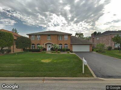
6529 Fox Ln Palos Heights, IL 60463
Westgate Valley NeighborhoodEstimated Value: $588,727 - $715,000
4
Beds
3
Baths
3,974
Sq Ft
$166/Sq Ft
Est. Value
About This Home
This home is located at 6529 Fox Ln, Palos Heights, IL 60463 and is currently estimated at $658,182, approximately $165 per square foot. 6529 Fox Ln is a home located in Cook County with nearby schools including Chippewa Elementary School, Navajo Heights Elementary School, and Independence Jr High School.
Ownership History
Date
Name
Owned For
Owner Type
Purchase Details
Closed on
Sep 25, 1995
Sold by
Stansbury Douglas A and Stansbury Arlene
Bought by
Chionis Nicholas D and Chionis Melanie
Current Estimated Value
Home Financials for this Owner
Home Financials are based on the most recent Mortgage that was taken out on this home.
Original Mortgage
$250,000
Interest Rate
6.9%
Create a Home Valuation Report for This Property
The Home Valuation Report is an in-depth analysis detailing your home's value as well as a comparison with similar homes in the area
Home Values in the Area
Average Home Value in this Area
Purchase History
| Date | Buyer | Sale Price | Title Company |
|---|---|---|---|
| Chionis Nicholas D | $375,000 | -- |
Source: Public Records
Mortgage History
| Date | Status | Borrower | Loan Amount |
|---|---|---|---|
| Open | Chionis Nicholas D | $310,000 | |
| Closed | Chionis Nicholas D | $217,000 | |
| Closed | Chionis Dr Nicholas | $220,000 | |
| Closed | Chionis Nicholas | $240,000 | |
| Previous Owner | Chionis Nicholas D | $250,000 |
Source: Public Records
Tax History Compared to Growth
Tax History
| Year | Tax Paid | Tax Assessment Tax Assessment Total Assessment is a certain percentage of the fair market value that is determined by local assessors to be the total taxable value of land and additions on the property. | Land | Improvement |
|---|---|---|---|---|
| 2024 | $7,286 | $48,832 | $11,039 | $37,793 |
| 2023 | $7,286 | $48,832 | $11,039 | $37,793 |
| 2022 | $7,286 | $23,597 | $9,659 | $13,938 |
| 2021 | $6,987 | $23,596 | $9,659 | $13,937 |
| 2020 | $6,932 | $23,596 | $9,659 | $13,937 |
| 2019 | $16,495 | $53,221 | $8,831 | $44,390 |
| 2018 | $15,615 | $53,221 | $8,831 | $44,390 |
| 2017 | $15,621 | $53,221 | $8,831 | $44,390 |
| 2016 | $13,231 | $42,767 | $7,451 | $35,316 |
| 2015 | $12,915 | $42,767 | $7,451 | $35,316 |
| 2014 | $12,556 | $42,767 | $7,451 | $35,316 |
| 2013 | $11,723 | $43,177 | $7,451 | $35,726 |
Source: Public Records
Map
Nearby Homes
- 13001 S Westgate Dr
- 12907 S Ridgeland Ave
- 12650 W Navajo Dr
- 74 Spyglass Cir Unit 74
- 6709 W Menominee Pkwy
- 6231 W 125th St
- 6949 W Park Lane Dr
- 12901 S 70th Ct
- 3301 Spyglass Cir Unit 3301
- 12412 S Nagle Ave
- 2106 Medinah Ct Unit B
- 12607 S Meade Ave
- 33 Spyglass Cir Unit 33
- 13083 Timber Ct
- 13342 Forest Ridge Dr Unit 71
- 12840 S Mason Ave
- 6401 W 123rd St
- 12506 S Austin Ave
- 12332 S 68th Ct
- 13051 S Mason Ave