Estimated Value: $459,073 - $482,000
3
Beds
1
Bath
2,208
Sq Ft
$213/Sq Ft
Est. Value
About This Home
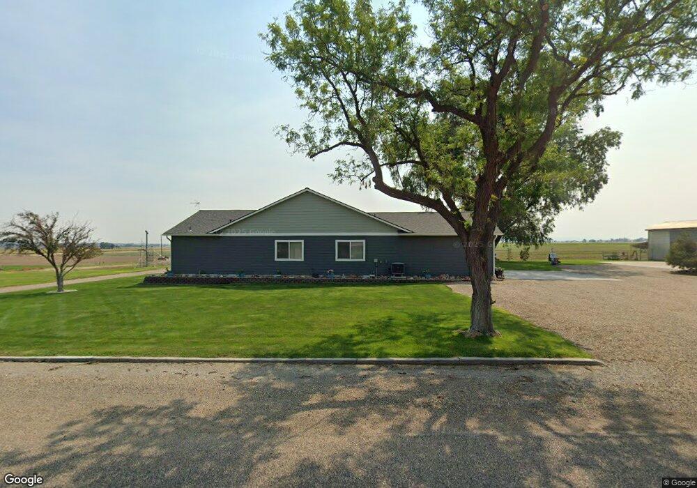
This home is located at 653 Cloverdale Ave, Nyssa, OR 97913 and is currently estimated at $470,537, approximately $213 per square foot. 653 Cloverdale Ave is a home located in Malheur County with nearby schools including Nyssa Elementary School, Nyssa Middle School, and Nyssa High School.
Ownership History
Date
Name
Owned For
Owner Type
Purchase Details
Closed on
Mar 9, 2022
Sold by
Holcomb and Lori
Bought by
Kent Holcomb And Lori Holcomb Living Trust
Current Estimated Value
Create a Home Valuation Report for This Property
The Home Valuation Report is an in-depth analysis detailing your home's value as well as a comparison with similar homes in the area
Home Values in the Area
Average Home Value in this Area
Purchase History
| Date | Buyer | Sale Price | Title Company |
|---|---|---|---|
| Kent Holcomb And Lori Holcomb Living Trust | -- | None Listed On Document |
Source: Public Records
Tax History Compared to Growth
Tax History
| Year | Tax Paid | Tax Assessment Tax Assessment Total Assessment is a certain percentage of the fair market value that is determined by local assessors to be the total taxable value of land and additions on the property. | Land | Improvement |
|---|---|---|---|---|
| 2024 | $3,732 | $254,679 | $36,994 | $217,685 |
| 2023 | $3,669 | $247,262 | $32,649 | $214,613 |
| 2022 | $3,668 | $240,061 | $34,003 | $206,058 |
| 2021 | $3,626 | $233,069 | $27,542 | $205,527 |
| 2020 | $3,553 | $226,281 | $29,056 | $197,225 |
| 2019 | $2,283 | $143,788 | $32,501 | $111,287 |
| 2018 | $1,501 | $94,114 | $31,554 | $62,560 |
| 2017 | $1,396 | $91,373 | $31,041 | $60,332 |
| 2016 | $1,412 | $88,712 | $27,431 | $61,281 |
| 2015 | $1,229 | $86,129 | $33,030 | $53,099 |
| 2014 | $1,354 | $83,621 | $30,939 | $52,682 |
Source: Public Records
Map
Nearby Homes
- 3091 Echo Rd
- 1815 Adrian Blvd
- 2867 Clark Blvd
- 926 Park Ave
- 803 Ehrgood Ave
- 621 King Ave
- lot3 plat 2411 Oregon 201
- lot2 plat 2411 Oregon 201
- lot1 plat 2411 Oregon 201
- 710 Emison Ave
- 617 Park Ave
- 214 S 4th St
- 307 N 4th St
- 208 N 4th St
- 213 Ehrgood Ave
- 525 N 4th St
- 524 N 4th St
- 710 N 5th St
- 111 Ehrgood Ave
- 416 N 2nd St
- 652 Cloverdale Ave
- 647 Cloverdale Ave
- 646 Cloverdale Ave
- 651 Cloverdale Ave
- 3038 Echo Rd
- 605 Cloverdale Ave
- 3011 Highway 201
- 3053 Clark Blvd
- 3064 Clark Blvd
- 2960 Echo Rd
- 651 Alberta Ave
- 643 Alberta Ave
- 3070 Clark Blvd
- TBD Alberta Ave
- 719 Alberta Ave
- 642 Alberta Ave
- 2951 Highway 201
- 681 Cloverdale Ave
- 2120 Stringer Rd
- 3097 Clark Blvd