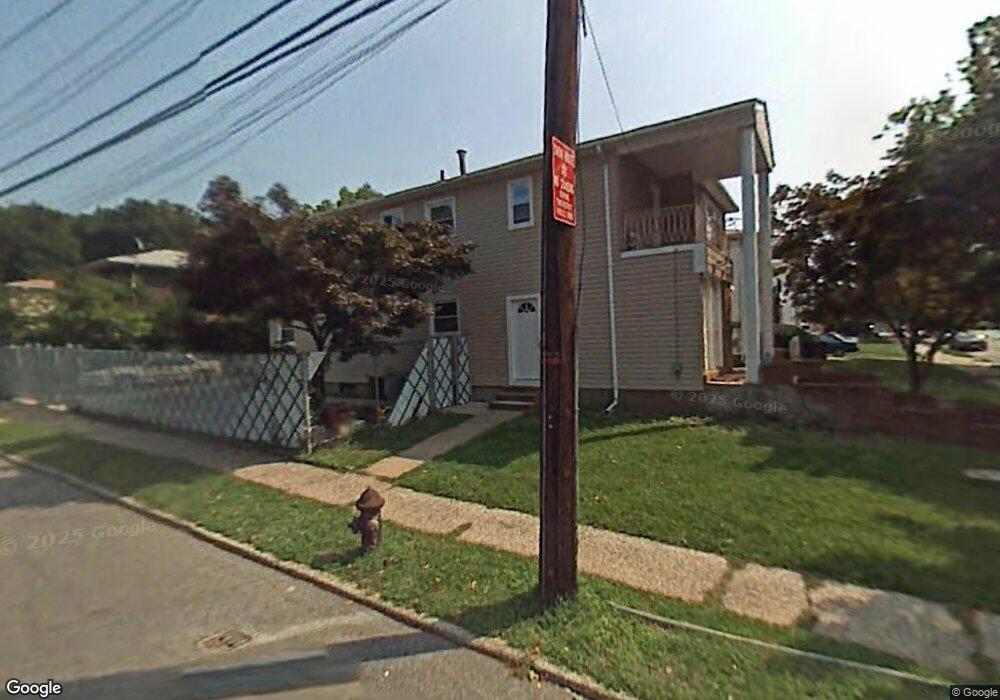
653 Collfield Ave Staten Island, NY 10314
Willowbrook NeighborhoodEstimated Value: $936,055 - $1,206,000
6
Beds
2
Baths
2,204
Sq Ft
$487/Sq Ft
Est. Value
About This Home
This home is located at 653 Collfield Ave, Staten Island, NY 10314 and is currently estimated at $1,073,264, approximately $486 per square foot. 653 Collfield Ave is a home located in Richmond County with nearby schools including P.S. 54 Charles W Leng, Is 72 Rocco Laurie, and Susan E Wagner High School.
Ownership History
Date
Name
Owned For
Owner Type
Purchase Details
Closed on
Aug 13, 2021
Sold by
Parente Louis and Parente Josephine
Bought by
Parente Louis
Current Estimated Value
Purchase Details
Closed on
Dec 21, 2006
Sold by
Parente Josephine
Bought by
Parente Louis and Parente Josephine
Purchase Details
Closed on
Mar 16, 2006
Sold by
Parente Josephine
Bought by
Parente Josephine
Purchase Details
Closed on
Oct 6, 1997
Sold by
Sunrise Hill Inc
Bought by
Scala Vincenzo and Scala Rose
Create a Home Valuation Report for This Property
The Home Valuation Report is an in-depth analysis detailing your home's value as well as a comparison with similar homes in the area
Home Values in the Area
Average Home Value in this Area
Purchase History
| Date | Buyer | Sale Price | Title Company |
|---|---|---|---|
| Parente Louis | -- | None Available | |
| Parente Louis | -- | The Judicial Title Insurance | |
| Parente Josephine | -- | None Available | |
| Scala Vincenzo | $20,000 | -- | |
| Scala Vincent | -- | -- |
Source: Public Records
Tax History Compared to Growth
Tax History
| Year | Tax Paid | Tax Assessment Tax Assessment Total Assessment is a certain percentage of the fair market value that is determined by local assessors to be the total taxable value of land and additions on the property. | Land | Improvement |
|---|---|---|---|---|
| 2025 | $8,415 | $58,920 | $9,861 | $49,059 |
| 2024 | $8,427 | $53,400 | $10,264 | $43,136 |
| 2023 | $8,011 | $40,846 | $9,101 | $31,745 |
| 2022 | $7,406 | $46,200 | $12,660 | $33,540 |
| 2021 | $7,806 | $46,920 | $12,660 | $34,260 |
| 2020 | $7,799 | $51,840 | $12,660 | $39,180 |
| 2019 | $7,255 | $53,820 | $12,660 | $41,160 |
| 2018 | $6,641 | $34,038 | $9,811 | $24,227 |
| 2017 | $6,246 | $32,112 | $9,877 | $22,235 |
| 2016 | $6,110 | $32,112 | $10,738 | $21,374 |
| 2015 | $5,465 | $31,869 | $9,857 | $22,012 |
| 2014 | $5,465 | $30,066 | $9,709 | $20,357 |
Source: Public Records
Map
Nearby Homes
- 0 Woodward Ave
- 27 Bascom Place
- 664 S Gannon Ave
- 490 Collfield Ave
- 592 Woolley Ave
- 591 Woolley Ave
- 274 Crafton Ave
- 207 Martin Ave
- 182 Ardmore Ave
- 97 Martin Ave
- 245 Martin Ave
- 777-805 Willowbrook Rd
- 523 Woolley Ave
- 35 Dreyer Ave Unit 7
- 37 Dreyer Ave Unit A
- 198 Warwick Ave
- 165 Warwick Ave
- 49 Sheraden Ave
- 58 Darcey Ave
- 15 Boone St
- 657 Collfield Ave
- 618 S Gannon Ave
- 661 Collfield Ave
- 663 Collfield Ave
- 614 S Gannon Ave
- 174 Woodward Ave
- 667 Collfield Ave
- 610 S Gannon Ave
- 180 Woodward Ave
- 650 Collfield Ave
- 656 Collfield Ave
- 660 Collfield Ave
- 184 Woodward Ave
- 671 Collfield Ave
- 188 Woodward Ave
- 670 Collfield Ave
- 648 S Gannon Ave
- 675 Collfield Ave
- 675 Collfield Ave Unit 1
- 11 Bascom Place