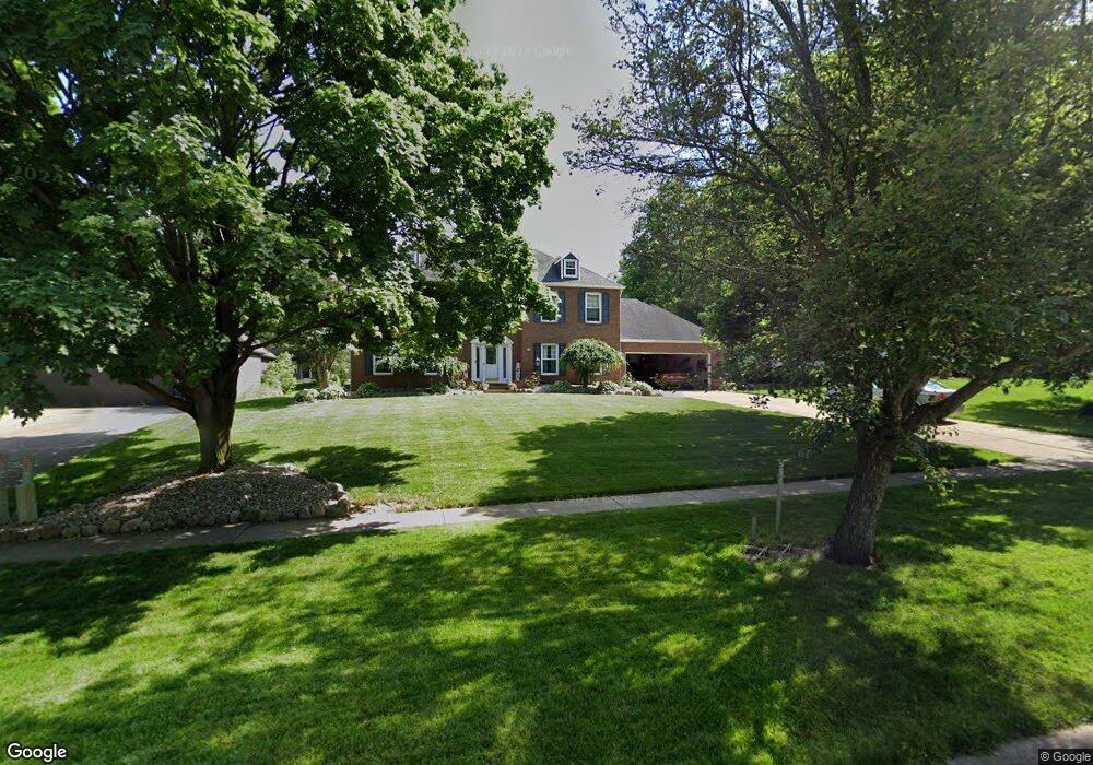
653 Farr Ave Wadsworth, OH 44281
Estimated Value: $425,049 - $473,000
4
Beds
4
Baths
2,743
Sq Ft
$166/Sq Ft
Est. Value
About This Home
This home is located at 653 Farr Ave, Wadsworth, OH 44281 and is currently estimated at $456,262, approximately $166 per square foot. 653 Farr Ave is a home located in Medina County with nearby schools including Overlook Elementary School, Wadsworth Middle School, and Central Intermediate School.
Ownership History
Date
Name
Owned For
Owner Type
Purchase Details
Closed on
Feb 10, 2001
Sold by
Mcgarry Kenneth C and Mcgarry Terry G
Bought by
Blair Jeffrey Michael and Blair Kristina Marie
Current Estimated Value
Home Financials for this Owner
Home Financials are based on the most recent Mortgage that was taken out on this home.
Original Mortgage
$180,750
Outstanding Balance
$65,387
Interest Rate
7.1%
Estimated Equity
$390,875
Purchase Details
Closed on
Jul 8, 1997
Sold by
Dold William E and Dold Blanche A
Bought by
Mcgarry Kenneth C and Mcgarry Terry G
Home Financials for this Owner
Home Financials are based on the most recent Mortgage that was taken out on this home.
Original Mortgage
$184,000
Interest Rate
6.75%
Create a Home Valuation Report for This Property
The Home Valuation Report is an in-depth analysis detailing your home's value as well as a comparison with similar homes in the area
Home Values in the Area
Average Home Value in this Area
Purchase History
| Date | Buyer | Sale Price | Title Company |
|---|---|---|---|
| Blair Jeffrey Michael | $241,000 | Endress/Lawyers Title | |
| Mcgarry Kenneth C | $230,000 | Resource Title Agency Inc |
Source: Public Records
Mortgage History
| Date | Status | Borrower | Loan Amount |
|---|---|---|---|
| Open | Blair Jeffrey Michael | $180,750 | |
| Closed | Mcgarry Kenneth C | $184,000 | |
| Closed | Blair Jeffrey Michael | $48,200 |
Source: Public Records
Tax History Compared to Growth
Tax History
| Year | Tax Paid | Tax Assessment Tax Assessment Total Assessment is a certain percentage of the fair market value that is determined by local assessors to be the total taxable value of land and additions on the property. | Land | Improvement |
|---|---|---|---|---|
| 2024 | $5,106 | $116,300 | $22,750 | $93,550 |
| 2023 | $5,106 | $116,300 | $22,750 | $93,550 |
| 2022 | $5,123 | $116,300 | $22,750 | $93,550 |
| 2021 | $4,840 | $93,040 | $18,200 | $74,840 |
| 2020 | $4,262 | $93,040 | $18,200 | $74,840 |
| 2019 | $4,308 | $93,920 | $18,200 | $75,720 |
| 2018 | $3,986 | $81,500 | $17,610 | $63,890 |
| 2017 | $3,987 | $81,500 | $17,610 | $63,890 |
| 2016 | $4,053 | $81,500 | $17,610 | $63,890 |
| 2015 | $3,922 | $74,770 | $16,150 | $58,620 |
| 2014 | $4,185 | $74,770 | $16,150 | $58,620 |
| 2013 | $3,991 | $74,770 | $16,150 | $58,620 |
Source: Public Records
Map
Nearby Homes
- 264 Windfall Ln
- 765 Broad St
- 493 Broad St Unit 495
- 637 Bent Creek Dr
- 684 Akron Rd
- 440 Dohner Dr
- 178 Fairlawn Ave
- 273 E Boyer St
- 105 Barkwood Dr
- 141 Humbolt Ave
- 137 Bay Hill Dr
- 878 Longbrook Dr
- 957 Devonwood Dr Unit 15
- 352 N Lyman St
- 411 Treeview Dr
- 118 E Prospect St
- 235 High St
- 140 W North St
- 729 Woodland Ave
- 0 Greenwich Rd