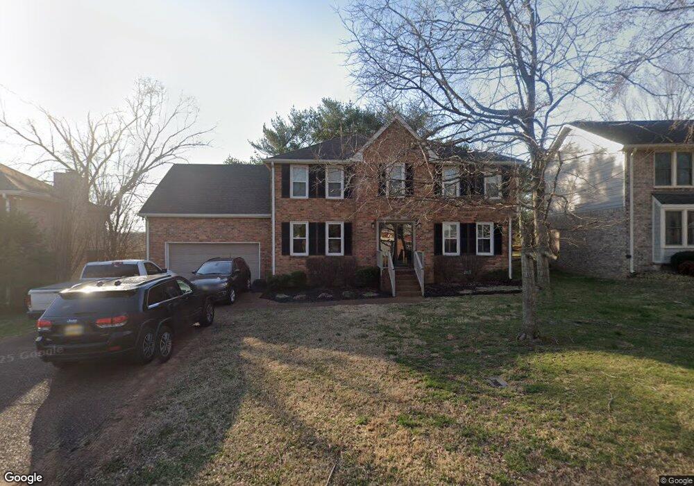
653 Watson Branch Dr Unit A5 Franklin, TN 37064
McEwen NeighborhoodEstimated Value: $774,000 - $860,000
Studio
3
Baths
2,982
Sq Ft
$268/Sq Ft
Est. Value
About This Home
This home is located at 653 Watson Branch Dr Unit A5, Franklin, TN 37064 and is currently estimated at $800,222, approximately $268 per square foot. 653 Watson Branch Dr Unit A5 is a home located in Williamson County with nearby schools including Moore Elementary School, Freedom Intermediate School, and Freedom Middle School.
Ownership History
Date
Name
Owned For
Owner Type
Purchase Details
Closed on
Apr 30, 2001
Sold by
Lerche Michael S and Lerche Roberta A
Bought by
Piggott Larry and Piggott Rebecca
Current Estimated Value
Home Financials for this Owner
Home Financials are based on the most recent Mortgage that was taken out on this home.
Original Mortgage
$201,579
Interest Rate
6.9%
Mortgage Type
FHA
Purchase Details
Closed on
Jan 8, 1999
Sold by
Light Thomas A and Light Julie G
Bought by
Lerche Michael S and Lerche Roberta A
Purchase Details
Closed on
Aug 7, 1996
Sold by
Vincent Hold
Bought by
Light Thomas A and Light Julie G
Create a Home Valuation Report for This Property
The Home Valuation Report is an in-depth analysis detailing your home's value as well as a comparison with similar homes in the area
Home Values in the Area
Average Home Value in this Area
Purchase History
| Date | Buyer | Sale Price | Title Company |
|---|---|---|---|
| Piggott Larry | $204,750 | Southern Title Services Llc | |
| Lerche Michael S | $187,900 | -- | |
| Light Thomas A | $182,000 | -- |
Source: Public Records
Mortgage History
| Date | Status | Borrower | Loan Amount |
|---|---|---|---|
| Previous Owner | Piggott Larry | $201,579 |
Source: Public Records
Tax History
| Year | Tax Paid | Tax Assessment Tax Assessment Total Assessment is a certain percentage of the fair market value that is determined by local assessors to be the total taxable value of land and additions on the property. | Land | Improvement |
|---|---|---|---|---|
| 2025 | $4,100 | $213,250 | $55,000 | $158,250 |
| 2024 | $4,100 | $144,825 | $22,500 | $122,325 |
| 2023 | $3,941 | $144,825 | $22,500 | $122,325 |
| 2022 | $3,941 | $144,825 | $22,500 | $122,325 |
| 2021 | $3,941 | $144,825 | $22,500 | $122,325 |
| 2020 | $3,223 | $99,900 | $20,000 | $79,900 |
| 2019 | $3,223 | $99,900 | $20,000 | $79,900 |
| 2018 | $3,153 | $99,900 | $20,000 | $79,900 |
| 2017 | $2,694 | $86,700 | $20,000 | $66,700 |
| 2016 | $2,685 | $86,700 | $20,000 | $66,700 |
Source: Public Records
Map
Nearby Homes
- 521 Maplegrove Dr
- 613 Shadycrest Ln
- 612 Burghley Ln
- 405 Luna Ct
- 624 Burghley Ln
- 2101 Emery Ln Unit 2101
- 626 Band Dr
- 2317 Kennedy Ct Unit 2317
- 2009 Emery Ln Unit 2009
- 2729 Kennedy Ct Unit 2729
- 812 Hartington Ct
- 2429 Kennedy Ct Unit 2429
- 817 Hartington Ct
- 813 Hartington Ct
- 639 Band Dr
- 1417 Southampton Ct
- 1011 Murfreesboro Rd Unit K4
- 1011 Murfreesboro Rd Unit B2
- 1011 Murfreesboro Rd Unit J2
- 310 Watercress Dr
- 651 Watson Branch Dr
- 655 Watson Branch Dr
- 659 Watson Branch Dr
- 654 Watson Branch Dr
- 645 Watson Branch Dr
- 656 Watson Branch Dr
- 650 Watson Branch Dr
- 661 Watson Branch Dr
- 660 Watson Branch Dr
- 648 Watson Branch Dr
- 550 Maplegrove Dr
- 664 Watson Branch Dr
- 646 Watson Branch Dr
- 641 Watson Branch Dr
- 663 Watson Branch Dr
- 548 Maplegrove Dr
- 642 Watson Branch Dr
- 668 Watson Branch Dr
- 665 Watson Branch Dr
- 109 Amy Ct
Your Personal Tour Guide
Ask me questions while you tour the home.