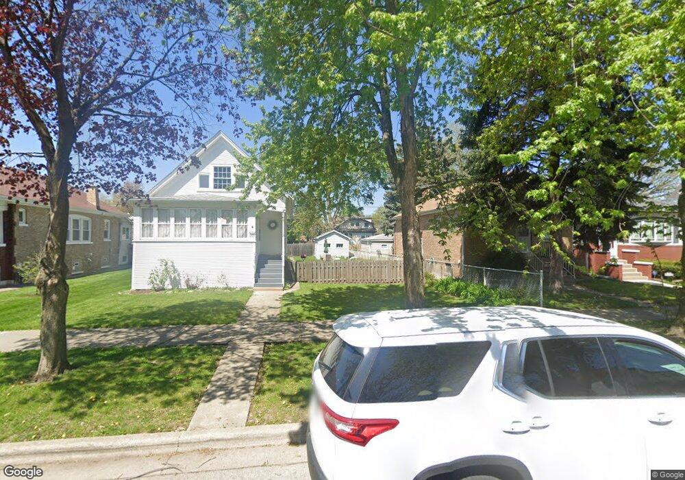
6533 Sinclair Ave Berwyn, IL 60402
Estimated Value: $273,000
Studio
--
Bath
--
Sq Ft
31,363
Sq Ft Lot
About This Home
This home is located at 6533 Sinclair Ave, Berwyn, IL 60402 and is currently estimated at $273,000. 6533 Sinclair Ave is a home located in Cook County with nearby schools including Emerson Elementary School, Heritage Middle School, and J. Sterling Morton High School West.
Ownership History
Date
Name
Owned For
Owner Type
Purchase Details
Closed on
Dec 4, 2023
Sold by
Urbino Dale V and Urbino Rachel A
Bought by
Haar Daniel Anthony and Haar Catherine Patten
Current Estimated Value
Home Financials for this Owner
Home Financials are based on the most recent Mortgage that was taken out on this home.
Original Mortgage
$220,800
Outstanding Balance
$216,571
Interest Rate
7.5%
Mortgage Type
New Conventional
Estimated Equity
$56,429
Create a Home Valuation Report for This Property
The Home Valuation Report is an in-depth analysis detailing your home's value as well as a comparison with similar homes in the area
Home Values in the Area
Average Home Value in this Area
Purchase History
| Date | Buyer | Sale Price | Title Company |
|---|---|---|---|
| Haar Daniel Anthony | $276,000 | None Listed On Document |
Source: Public Records
Mortgage History
| Date | Status | Borrower | Loan Amount |
|---|---|---|---|
| Open | Haar Daniel Anthony | $220,800 |
Source: Public Records
Tax History
| Year | Tax Paid | Tax Assessment Tax Assessment Total Assessment is a certain percentage of the fair market value that is determined by local assessors to be the total taxable value of land and additions on the property. | Land | Improvement |
|---|---|---|---|---|
| 2025 | $1,389 | $3,886 | $3,828 | $58 |
| 2024 | $1,389 | $3,886 | $3,828 | $58 |
| 2023 | $1,482 | $3,886 | $3,828 | $58 |
| 2022 | $1,482 | $3,261 | $3,203 | $58 |
| 2021 | $1,438 | $3,261 | $3,203 | $58 |
| 2020 | $1,359 | $3,261 | $3,203 | $58 |
| 2019 | $1,329 | $2,948 | $2,890 | $58 |
| 2018 | $1,251 | $2,948 | $2,890 | $58 |
| 2017 | $1,280 | $2,948 | $2,890 | $58 |
| 2016 | $1,075 | $2,479 | $2,421 | $58 |
| 2015 | $1,054 | $2,479 | $2,421 | $58 |
| 2014 | $1,016 | $2,479 | $2,421 | $58 |
| 2013 | $904 | $2,479 | $2,421 | $58 |
Source: Public Records
Map
Nearby Homes
- 3239 Wesley Ave
- 6409 Fairfield Ave
- 3401 Ridgeland Ave
- 3447 Ridgeland Ave Unit 203
- 3447 Ridgeland Ave Unit 103
- 3515 Elmwood Ave
- 3227 Cuyler Ave
- 3213 Cuyler Ave
- 3520 Ridgeland Ave
- 3416 Euclid Ave
- 3136 Cuyler Ave
- 3421 Oak Park Ave
- 3303 Grove Ave Unit 310
- 3024 East Ave
- 3619 Gunderson Ave
- 3330 Grove Ave Unit 1S
- 3140 Harvey Ave
- 3601 Euclid Ave
- 3019 Wesley Ave
- 3031 Oak Park Ave
- 6535 Sinclair Ave
- 6531 Sinclair Ave
- 6529 Sinclair Ave
- 6537 Sinclair Ave
- 6527 Sinclair Ave
- 6525 Sinclair Ave
- 6541 Sinclair Ave
- 6521 Sinclair Ave
- 6543 Sinclair Ave
- 6532 33rd St
- 6538 33rd St
- 6524 33rd St
- 6540 33rd St
- 6519 Sinclair Ave
- 6547 Sinclair Ave
- 6522 33rd St
- 6534 Sinclair Ave
- 6536 Sinclair Ave
- 6546 33rd St
- 6517 Sinclair Ave
Your Personal Tour Guide
Ask me questions while you tour the home.