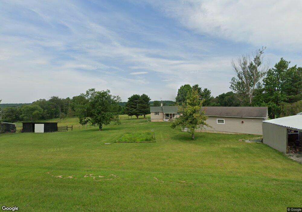
6533 State Route 770 Unit 770 Seaman, OH 45679
Estimated Value: $349,000 - $438,438
3
Beds
2
Baths
1,348
Sq Ft
$305/Sq Ft
Est. Value
About This Home
This home is located at 6533 State Route 770 Unit 770, Seaman, OH 45679 and is currently estimated at $410,610, approximately $304 per square foot. 6533 State Route 770 Unit 770 is a home located in Adams County with nearby schools including North Adams Elementary School and North Adams High School.
Ownership History
Date
Name
Owned For
Owner Type
Purchase Details
Closed on
May 18, 2022
Sold by
Greer Joshua S and Greer Elizabeth J
Bought by
Poe Brandon and Poe Ashley
Current Estimated Value
Home Financials for this Owner
Home Financials are based on the most recent Mortgage that was taken out on this home.
Original Mortgage
$279,650
Outstanding Balance
$267,279
Interest Rate
5.3%
Mortgage Type
New Conventional
Estimated Equity
$143,331
Purchase Details
Closed on
Dec 22, 2016
Sold by
Clark Patricia A
Bought by
Greer Joshua S and Greer Elizabeth J
Home Financials for this Owner
Home Financials are based on the most recent Mortgage that was taken out on this home.
Original Mortgage
$142,800
Interest Rate
3.94%
Mortgage Type
Purchase Money Mortgage
Purchase Details
Closed on
Dec 10, 1999
Sold by
Tully Richard J
Bought by
Clark James W
Purchase Details
Closed on
Jan 1, 1990
Bought by
Tully Richard J
Create a Home Valuation Report for This Property
The Home Valuation Report is an in-depth analysis detailing your home's value as well as a comparison with similar homes in the area
Home Values in the Area
Average Home Value in this Area
Purchase History
| Date | Buyer | Sale Price | Title Company |
|---|---|---|---|
| Poe Brandon | $329,000 | Ineze Norman E | |
| Greer Joshua S | $168,000 | None Available | |
| Clark James W | $102,000 | -- | |
| Tully Richard J | -- | -- |
Source: Public Records
Mortgage History
| Date | Status | Borrower | Loan Amount |
|---|---|---|---|
| Open | Poe Brandon | $279,650 | |
| Previous Owner | Greer Joshua S | $142,800 | |
| Previous Owner | Clark James W | $62,000 | |
| Previous Owner | Clark James W | $47,250 |
Source: Public Records
Tax History Compared to Growth
Tax History
| Year | Tax Paid | Tax Assessment Tax Assessment Total Assessment is a certain percentage of the fair market value that is determined by local assessors to be the total taxable value of land and additions on the property. | Land | Improvement |
|---|---|---|---|---|
| 2024 | $904 | $79,030 | $42,140 | $36,890 |
| 2023 | $910 | $79,030 | $42,140 | $36,890 |
| 2022 | $1,774 | $68,530 | $35,490 | $33,040 |
| 2021 | $1,713 | $68,530 | $35,490 | $33,040 |
| 2020 | $1,749 | $68,530 | $35,490 | $33,040 |
| 2019 | $1,749 | $68,530 | $35,490 | $33,040 |
| 2018 | $1,856 | $59,610 | $30,870 | $28,740 |
| 2017 | $1,827 | $59,610 | $30,870 | $28,740 |
| 2016 | $1,500 | $59,610 | $30,870 | $28,740 |
| 2015 | $1,321 | $54,080 | $26,920 | $27,160 |
| 2014 | $1,321 | $54,080 | $26,920 | $27,160 |
Source: Public Records
Map
Nearby Homes
- 1445 Louisville Rd
- 1765 Greenbrier Rd
- 0 Rocklick Rd Unit 1850847
- 0 Rocklick Rd Unit 22305798
- 0 Rocklick Rd Unit 1827311
- 0 Rocklick Rd Unit 11401099
- 4404 Louisville Rd
- 1143 Dotson Rd
- 530 Mount Leigh Rd
- 1721 May Hill Rd
- 68 Curt Rd
- 1717 Zion Ln
- 635 Pence Rd
- 6514 Tri County Rd
- 17479 Ohio 247
- 1.15 ac Ohio 247
- ac Ohio 247
- 89 Hickory Dr
- 0 Tranquility Pike
- 1865 Ohio 247
- 6533 State Route 770
- 6533 State Route 770
- 6573 State Route 770
- 6573 State Route 770
- 6453 State Route 770
- 6698 State Route 770
- 6698 State Route 770
- 6556 State Route 770
- 6263 State Route 770
- 6768 State Route 770
- 460 Wildlife Rd
- 300 Obanion Rd
- 6015 State Route 770
- 6939 State Route 770
- 6939 St Rt 770
- 112 Obanion Rd
- 6985 Oh-770
- 6985 State Route 770
- 6985 State Route 770
- 2673 Big Woods Rd