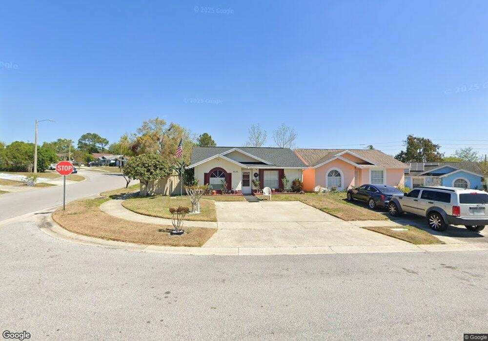
6535 Spring Land Ct Orlando, FL 32818
Estimated Value: $239,846 - $268,000
2
Beds
2
Baths
946
Sq Ft
$264/Sq Ft
Est. Value
About This Home
This home is located at 6535 Spring Land Ct, Orlando, FL 32818 and is currently estimated at $250,212, approximately $264 per square foot. 6535 Spring Land Ct is a home located in Orange County with nearby schools including Pinewood Elementary School, Robinswood Middle School, and Evans High School.
Ownership History
Date
Name
Owned For
Owner Type
Purchase Details
Closed on
Sep 9, 2024
Sold by
Swaby Lenvi C
Bought by
Swaby Lenvi C and Lewis Mark Anthony
Current Estimated Value
Purchase Details
Closed on
Dec 11, 2001
Sold by
Jean M Maurapass M and Emilliane B Maurapass M
Bought by
Edwards Ira C and Edwards Gloria
Home Financials for this Owner
Home Financials are based on the most recent Mortgage that was taken out on this home.
Original Mortgage
$66,500
Interest Rate
6.6%
Mortgage Type
New Conventional
Create a Home Valuation Report for This Property
The Home Valuation Report is an in-depth analysis detailing your home's value as well as a comparison with similar homes in the area
Home Values in the Area
Average Home Value in this Area
Purchase History
| Date | Buyer | Sale Price | Title Company |
|---|---|---|---|
| Swaby Lenvi C | $100 | None Listed On Document | |
| Edwards Ira C | $70,000 | -- |
Source: Public Records
Mortgage History
| Date | Status | Borrower | Loan Amount |
|---|---|---|---|
| Previous Owner | Edwards Ira C | $66,500 |
Source: Public Records
Tax History Compared to Growth
Tax History
| Year | Tax Paid | Tax Assessment Tax Assessment Total Assessment is a certain percentage of the fair market value that is determined by local assessors to be the total taxable value of land and additions on the property. | Land | Improvement |
|---|---|---|---|---|
| 2025 | $465 | $177,720 | $50,000 | $127,720 |
| 2024 | $867 | $171,900 | $50,000 | $121,900 |
| 2023 | $867 | $59,360 | $0 | $0 |
| 2022 | $820 | $57,631 | $0 | $0 |
| 2021 | $808 | $55,952 | $0 | $0 |
| 2020 | $801 | $55,179 | $0 | $0 |
| 2019 | $778 | $53,938 | $0 | $0 |
| 2018 | $403 | $52,932 | $0 | $0 |
| 2017 | $755 | $68,200 | $15,000 | $53,200 |
| 2016 | $735 | $60,934 | $10,000 | $50,934 |
| 2015 | $742 | $59,391 | $10,000 | $49,391 |
| 2014 | $778 | $61,920 | $16,000 | $45,920 |
Source: Public Records
Map
Nearby Homes
- XXXX N Hiawassee Rd
- 3611 Westland Dr
- 3135 Knightsbridge Rd
- 6651 Meritmoor Cir
- 0 N Hiawassee Rd
- 3673 Westland Ct
- 6632 Meritmoor Cir
- 6623 Stardust Ln Unit 341
- 6618 Stardust Ln Unit 237
- 6606 Stardust Ln Unit 243
- 6601 Stardust Ln Unit 353
- 6525 Coral Cove Dr
- 6582 Meritmoor Cir
- 6521 Stardust Ln Unit 213
- 3714 Narroline Dr
- 7301 Habbersham Dr
- 6526 Stardust Ln Unit 399
- 6673 Festival Ln Unit 142
- 6549 Stardust Ln Unit 387
- 3122 Pell Mell Dr
- 6533 Spring Land Ct
- 6527 Spring Land Ct
- 3513 Westland Dr Unit 2
- 3515 Westland Dr
- 3516 Westland Dr
- 3522 Westland Dr
- 3514 Westland Dr
- 6519 Spring Land Ct
- 3524 Westland Dr
- 3521 Westland Dr
- 6517 Spring Land Ct
- 3523 Spring Land Dr
- 3508 Spring Land Dr
- 3508 Spring Land Dr Unit 2
- 3530 Westland Dr
- 6532 Spring Land Ct
- 3523 Westland Dr Unit 2
- 3523 Westland Dr
- 3510 Spring Land Dr