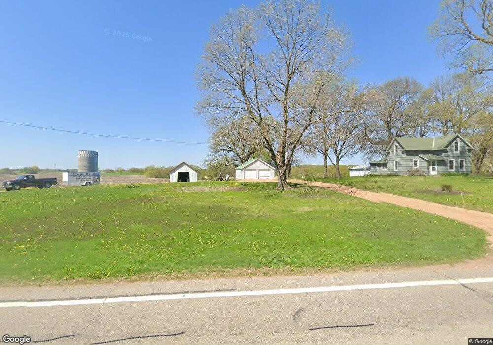
6535 U Hwy S Unit 12 Independence, MN 55359
Estimated Value: $333,727 - $777,000
3
Beds
1
Bath
1,212
Sq Ft
$388/Sq Ft
Est. Value
About This Home
This home is located at 6535 U Hwy S Unit 12, Independence, MN 55359 and is currently estimated at $469,932, approximately $387 per square foot. 6535 U Hwy S Unit 12 is a home located in Hennepin County with nearby schools including Schumann Elementary School, Orono Intermediate Elementary School, and Orono Middle School.
Ownership History
Date
Name
Owned For
Owner Type
Purchase Details
Closed on
Jun 20, 2018
Sold by
Gehlhar Joseph B
Bought by
Grizzly Properties Llc
Current Estimated Value
Home Financials for this Owner
Home Financials are based on the most recent Mortgage that was taken out on this home.
Original Mortgage
$212,000
Interest Rate
4.5%
Mortgage Type
Commercial
Create a Home Valuation Report for This Property
The Home Valuation Report is an in-depth analysis detailing your home's value as well as a comparison with similar homes in the area
Home Values in the Area
Average Home Value in this Area
Purchase History
| Date | Buyer | Sale Price | Title Company |
|---|---|---|---|
| Grizzly Properties Llc | $265,000 | None Available |
Source: Public Records
Mortgage History
| Date | Status | Borrower | Loan Amount |
|---|---|---|---|
| Previous Owner | Grizzly Properties Llc | $212,000 |
Source: Public Records
Tax History Compared to Growth
Tax History
| Year | Tax Paid | Tax Assessment Tax Assessment Total Assessment is a certain percentage of the fair market value that is determined by local assessors to be the total taxable value of land and additions on the property. | Land | Improvement |
|---|---|---|---|---|
| 2024 | $3,454 | $308,400 | $93,600 | $214,800 |
| 2023 | $3,228 | $296,400 | $83,200 | $213,200 |
| 2022 | $3,153 | $298,000 | $91,000 | $207,000 |
| 2021 | $3,089 | $247,000 | $76,000 | $171,000 |
| 2020 | $2,959 | $240,000 | $76,000 | $164,000 |
| 2019 | $1,870 | $222,000 | $64,000 | $158,000 |
| 2018 | $1,891 | $156,000 | $64,000 | $92,000 |
| 2017 | $1,835 | $151,000 | $62,000 | $89,000 |
| 2016 | $1,669 | $141,000 | $63,000 | $78,000 |
| 2015 | $1,652 | $141,000 | $63,000 | $78,000 |
| 2014 | -- | $134,000 | $70,000 | $64,000 |
Source: Public Records
Map
Nearby Homes
- TBD W Main St
- 6126 Gustavus Dr
- 6340 Pagenkopf Rd
- 1511 Meadow Ln
- 2125 Heritage Trail
- 2211 Heritage Trail
- 5670 Main St W
- TBD 2 Drake Dr
- TBD 1 Drake Dr
- 2625 Valley Rd
- 5475 Main St W
- 49xx County Road 6
- 6013 County Road 6
- 1635 Delano Ave
- 5455 Timber Trail
- 5299 Manchester Dr Unit 1
- 5293 Manchester Dr Unit 4
- 6695 Mckown Ct
- 36XX Watertown Rd
- 2852 County Road 92 N
- 6511 Highway 12
- 6511 Highway 12 Unit 12
- 1985/1989 Co Rd
- 1920 County Road 90
- 1985 County Road 90
- 2020 County Road 90
- 1625 County Road 90
- 1940 County Road 90 Unit 24
- 1940 County Road 90 Unit 23
- 1940 County Road 90 Unit 22
- 1940 County Road 90 Unit 21
- 1940 County Road 90 Unit 20
- 1940 County Road 90 Unit 19
- 1940 County Road 90 Unit 18
- 1940 County Road 90 Unit 17
- 1940 County Road 90 Unit 16
- 1940 County Road 90 Unit 15
- 1940 County Road 90 Unit 14
- 1940 County Road 90 Unit 13
- 1940 County Road 90 Unit 12