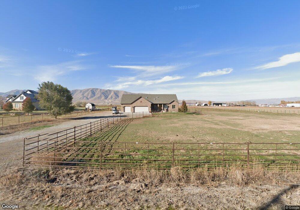
6538 S 4000 W Spanish Fork, UT 84660
Estimated Value: $871,000 - $1,918,000
5
Beds
3
Baths
2,966
Sq Ft
$467/Sq Ft
Est. Value
About This Home
This home is located at 6538 S 4000 W, Spanish Fork, UT 84660 and is currently estimated at $1,385,955, approximately $467 per square foot. 6538 S 4000 W is a home with nearby schools including Brockbank Elementary School, Spanish Fork Jr High School, and Spanish Fork High School.
Ownership History
Date
Name
Owned For
Owner Type
Purchase Details
Closed on
Sep 24, 2007
Sold by
Central Bank
Bought by
Warner Dustin R and Warner Ashley E
Current Estimated Value
Home Financials for this Owner
Home Financials are based on the most recent Mortgage that was taken out on this home.
Original Mortgage
$200,000
Outstanding Balance
$125,910
Interest Rate
6.46%
Mortgage Type
Credit Line Revolving
Estimated Equity
$1,260,045
Create a Home Valuation Report for This Property
The Home Valuation Report is an in-depth analysis detailing your home's value as well as a comparison with similar homes in the area
Home Values in the Area
Average Home Value in this Area
Purchase History
| Date | Buyer | Sale Price | Title Company |
|---|---|---|---|
| Warner Dustin R | -- | Backman |
Source: Public Records
Mortgage History
| Date | Status | Borrower | Loan Amount |
|---|---|---|---|
| Open | Warner Dustin R | $200,000 |
Source: Public Records
Tax History Compared to Growth
Tax History
| Year | Tax Paid | Tax Assessment Tax Assessment Total Assessment is a certain percentage of the fair market value that is determined by local assessors to be the total taxable value of land and additions on the property. | Land | Improvement |
|---|---|---|---|---|
| 2025 | $4,056 | $468,312 | $461,300 | $733,500 |
| 2024 | $4,056 | $402,509 | $0 | $0 |
| 2023 | $4,075 | $404,675 | $0 | $0 |
| 2022 | $3,750 | $1,015,700 | $468,400 | $547,300 |
| 2021 | $3,266 | $742,600 | $331,100 | $411,500 |
| 2020 | $2,999 | $694,600 | $283,100 | $411,500 |
| 2019 | $2,942 | $645,000 | $233,500 | $411,500 |
| 2018 | $2,775 | $581,100 | $213,500 | $367,600 |
| 2017 | $2,421 | $186,057 | $0 | $0 |
| 2016 | $2,433 | $181,151 | $0 | $0 |
| 2015 | $2,328 | $171,890 | $0 | $0 |
| 2014 | -- | $172,002 | $0 | $0 |
Source: Public Records
Map
Nearby Homes
- 6612 S 3200 W
- 6668 S 3200 W
- 6692 S 3200 W
- 5884 S 3200 W
- 2968 W 7300 S
- 5310 S 3200 W
- 5200 S River Dr Unit 3
- 5272 S River Ln
- 5959 W 8000 S
- 4248 S 3200 W
- 8982 S 4800 W
- 1101 W 1580 N
- 1101 W 1580 N Unit 171
- 1068 S 3440 E Unit 120
- 1085 S 3440 E Unit 107
- 2182 W 4600 S
- 1179 N 1750 W
- 9284 S 3550 W
- 9337 S 3950 W
- 1782 N 1240 E
- 6580 S 4000 W
- 6400 S 4000 W
- 6400 S 4000 W Unit 3
- 6690 S 4000 W
- 5600 W 6400 S
- 6424 S 4000 W
- 6705 S 4000 W
- 4022 W 6400 S
- 3968 W 6400 S
- 4108 W 6400 S
- 4134 W 6400 S
- 5419 S Lincoln Beach Rd Unit 6
- 5351 S Lincoln Beach Rd Unit 3
- 5419 S Lincoln Beach Rd
- 5351 S Lincoln Beach Rd
- 4072 W 6400 S
- 6754 S 4000 W
- 4192 W 6400 S
- 3858 W 6400 S
- 3992 W 6800 S