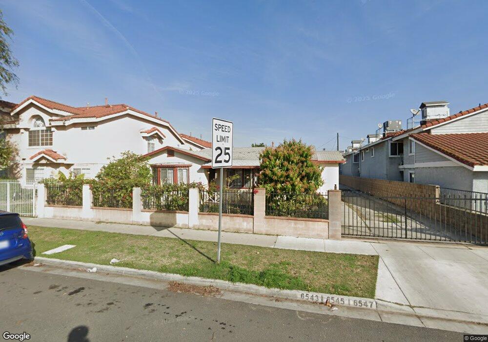
6543 72nd St Paramount, CA 90723
Estimated Value: $1,010,000 - $1,302,000
5
Beds
3
Baths
2,826
Sq Ft
$410/Sq Ft
Est. Value
About This Home
This home is located at 6543 72nd St, Paramount, CA 90723 and is currently estimated at $1,157,667, approximately $409 per square foot. 6543 72nd St is a home located in Los Angeles County with nearby schools including Wesley Gaines School, Leona Jackson Middle School, and Paramount High School.
Ownership History
Date
Name
Owned For
Owner Type
Purchase Details
Closed on
May 8, 2001
Sold by
Lay Hear
Bought by
Ngo Long Thai and Lay Hear
Current Estimated Value
Home Financials for this Owner
Home Financials are based on the most recent Mortgage that was taken out on this home.
Original Mortgage
$150,000
Interest Rate
6.89%
Create a Home Valuation Report for This Property
The Home Valuation Report is an in-depth analysis detailing your home's value as well as a comparison with similar homes in the area
Home Values in the Area
Average Home Value in this Area
Purchase History
| Date | Buyer | Sale Price | Title Company |
|---|---|---|---|
| Ngo Long Thai | -- | Fidelity Title |
Source: Public Records
Mortgage History
| Date | Status | Borrower | Loan Amount |
|---|---|---|---|
| Closed | Ngo Long Thai | $150,000 |
Source: Public Records
Tax History
| Year | Tax Paid | Tax Assessment Tax Assessment Total Assessment is a certain percentage of the fair market value that is determined by local assessors to be the total taxable value of land and additions on the property. | Land | Improvement |
|---|---|---|---|---|
| 2025 | $5,773 | $375,467 | $123,632 | $251,835 |
| 2024 | $5,773 | $368,106 | $121,208 | $246,898 |
| 2023 | $5,678 | $360,889 | $118,832 | $242,057 |
| 2022 | $5,541 | $353,813 | $116,502 | $237,311 |
| 2021 | $5,415 | $346,876 | $114,218 | $232,658 |
| 2020 | $5,310 | $343,320 | $113,047 | $230,273 |
| 2019 | $5,525 | $336,589 | $110,831 | $225,758 |
| 2018 | $4,948 | $329,990 | $108,658 | $221,332 |
| 2016 | $4,460 | $317,179 | $104,440 | $212,739 |
| 2015 | $4,228 | $312,416 | $102,872 | $209,544 |
| 2014 | $4,335 | $306,297 | $100,857 | $205,440 |
Source: Public Records
Map
Nearby Homes
- 6535 E 72nd St Unit 1
- 1050 E 72nd St
- 6824 Marcelle St
- 6733 Caro St Unit 47
- 16600 Orange Ave Unit 124
- 16600 Orange Ave Unit 146
- 16600 Orange Ave Unit 130
- 16600 Orange Ave Unit 48
- 16600 Orange Ave Unit 77
- 16710 Orange Ave Unit L59
- 15351 Orange Ave Unit 17
- 6841 Millmark Ave
- 7229 Jackson St
- 15325 Orange Ave
- 16601 Garfield Ave Unit 91
- 16601 Garfield Ave Unit 110
- 16707 Garfield Ave Unit 1806
- 15812 Atlantic
- 15137 Gundry Ave Unit F
- 1208 S White Ave
- 6535 72nd St Unit 4
- 6535 72nd St Unit 3
- 6535 72nd St Unit 2
- 6535 72nd St Unit 1
- 6535 72nd St Unit 15
- 6535 72nd St Unit 14
- 6535 72nd St Unit 13
- 6535 72nd St Unit 12
- 6535 72nd St Unit 11
- 6535 72nd St Unit 10
- 6535 72nd St Unit 9
- 6535 72nd St Unit 8
- 6535 72nd St Unit 7
- 6535 72nd St Unit 6
- 6535 72nd St Unit 5
- 16306 Ansmith Ave
- 16314 Ansmith Ave
- 6548 Motz St
- 16225 Ansmith Ave
- 6601 72nd St
Your Personal Tour Guide
Ask me questions while you tour the home.