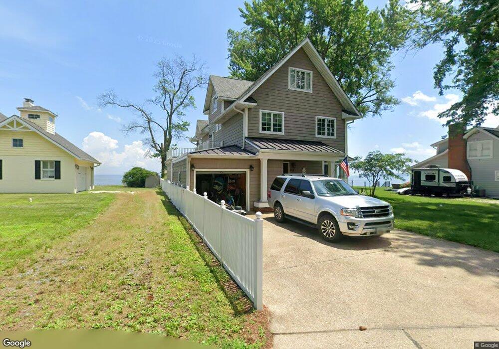
6543 Clagett Ave Tracys Landing, MD 20779
Estimated Value: $882,000 - $1,148,000
--
Bed
2
Baths
3,240
Sq Ft
$324/Sq Ft
Est. Value
About This Home
This home is located at 6543 Clagett Ave, Tracys Landing, MD 20779 and is currently estimated at $1,048,287, approximately $323 per square foot. 6543 Clagett Ave is a home located in Anne Arundel County with nearby schools including Deale Elementary School, Southern Middle School, and Southern High School.
Ownership History
Date
Name
Owned For
Owner Type
Purchase Details
Closed on
May 6, 2024
Sold by
Church William Campbell Gibson and Church Stacy Elizabeth
Bought by
Church William Campbell Gib
Current Estimated Value
Purchase Details
Closed on
Dec 1, 2009
Sold by
Wimmel James T
Bought by
Church William G and Church Stacy E
Home Financials for this Owner
Home Financials are based on the most recent Mortgage that was taken out on this home.
Original Mortgage
$417,000
Interest Rate
5.01%
Mortgage Type
New Conventional
Create a Home Valuation Report for This Property
The Home Valuation Report is an in-depth analysis detailing your home's value as well as a comparison with similar homes in the area
Home Values in the Area
Average Home Value in this Area
Purchase History
| Date | Buyer | Sale Price | Title Company |
|---|---|---|---|
| Church William Campbell Gib | -- | None Listed On Document | |
| Church William G | $545,000 | -- |
Source: Public Records
Mortgage History
| Date | Status | Borrower | Loan Amount |
|---|---|---|---|
| Previous Owner | Church William G | $417,000 |
Source: Public Records
Tax History Compared to Growth
Tax History
| Year | Tax Paid | Tax Assessment Tax Assessment Total Assessment is a certain percentage of the fair market value that is determined by local assessors to be the total taxable value of land and additions on the property. | Land | Improvement |
|---|---|---|---|---|
| 2025 | $8,466 | $880,333 | -- | -- |
| 2024 | $8,466 | $804,167 | $0 | $0 |
| 2023 | $8,197 | $728,000 | $398,000 | $330,000 |
| 2022 | $7,676 | $708,533 | $0 | $0 |
| 2021 | $15,057 | $689,067 | $0 | $0 |
| 2020 | $7,347 | $669,600 | $398,000 | $271,600 |
| 2019 | $7,227 | $664,067 | $0 | $0 |
| 2018 | $6,678 | $658,533 | $0 | $0 |
| 2017 | $6,802 | $653,000 | $0 | $0 |
| 2016 | -- | $630,233 | $0 | $0 |
| 2015 | -- | $607,467 | $0 | $0 |
| 2014 | -- | $460,100 | $0 | $0 |
Source: Public Records
Map
Nearby Homes
- 525 James Ave
- 520 Ark Haven Rd
- 254 Friendship Rd
- 610 E Marshall Ave
- 6047 Melbourne Ave
- 6281 Franklin Gibson Rd
- 617 Ford Rd
- 703 Trapper Way
- 60 Friendship Rd
- 6061 Drum Point Rd
- 175 Tucker Ct
- 6037 Drum Point Rd
- 6690 Old Solomons Island Rd
- 0 Fairhaven Rd
- 619 Park Place
- 802 Walnut Ave
- 900 Walnut Ave
- 5930 Sneed Dr
- 9550 N Side Dr
- 5918 Sneed Dr
- 6539 Clagett Ave
- 6549 Clagett Ave
- 516 Howard Ave
- 6535 Clagett Ave
- 514 Howard Ave
- 535 Herring Ave
- 6533 Clagett Ave
- 533 Herring Ave
- 510 Howard Ave
- 6553 Clagett Ave
- 6531 Clagett Ave
- 509 Howard Ave
- 508 Howard Ave
- 529 Herring Ave
- 506 Howard Ave
- 525 Herring Ave
- 6557 Clagett Ave
- 6527 Clagett Ave
- 6556 Clagett Ave
- 538 Herring Ave