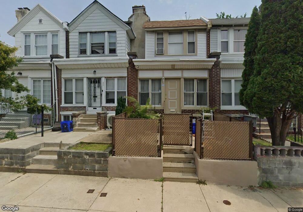
6543 N Woodstock St Philadelphia, PA 19138
West Oak Lane NeighborhoodEstimated Value: $179,233 - $235,000
3
Beds
1
Bath
1,124
Sq Ft
$178/Sq Ft
Est. Value
About This Home
This home is located at 6543 N Woodstock St, Philadelphia, PA 19138 and is currently estimated at $200,058, approximately $177 per square foot. 6543 N Woodstock St is a home located in Philadelphia County with nearby schools including Prince Hall School, Gen. Louis Wagner Middle School, and Martin Luther King High School.
Ownership History
Date
Name
Owned For
Owner Type
Purchase Details
Closed on
Sep 7, 2007
Sold by
Affinity Homes & Properties Llc
Bought by
Cooper Keisha
Current Estimated Value
Home Financials for this Owner
Home Financials are based on the most recent Mortgage that was taken out on this home.
Original Mortgage
$114,000
Outstanding Balance
$94,062
Interest Rate
6.63%
Mortgage Type
Purchase Money Mortgage
Estimated Equity
$105,996
Purchase Details
Closed on
Apr 20, 2007
Sold by
Southwest Capital Investments Llc
Bought by
Affinity Homes & Properties Llc
Purchase Details
Closed on
Sep 12, 2005
Sold by
Shedrick Azalee and Shedrick Valerie
Bought by
Southwest Capital Investments Llc and Show Homes Inc
Create a Home Valuation Report for This Property
The Home Valuation Report is an in-depth analysis detailing your home's value as well as a comparison with similar homes in the area
Home Values in the Area
Average Home Value in this Area
Purchase History
| Date | Buyer | Sale Price | Title Company |
|---|---|---|---|
| Cooper Keisha | $114,000 | None Available | |
| Affinity Homes & Properties Llc | $54,000 | None Available | |
| Southwest Capital Investments Llc | $35,000 | None Available |
Source: Public Records
Mortgage History
| Date | Status | Borrower | Loan Amount |
|---|---|---|---|
| Open | Cooper Keisha | $114,000 |
Source: Public Records
Tax History Compared to Growth
Tax History
| Year | Tax Paid | Tax Assessment Tax Assessment Total Assessment is a certain percentage of the fair market value that is determined by local assessors to be the total taxable value of land and additions on the property. | Land | Improvement |
|---|---|---|---|---|
| 2025 | $1,828 | $160,800 | $32,160 | $128,640 |
| 2024 | $1,828 | $160,800 | $32,160 | $128,640 |
| 2023 | $1,828 | $130,600 | $26,120 | $104,480 |
| 2022 | $794 | $85,600 | $26,120 | $59,480 |
| 2021 | $1,424 | $0 | $0 | $0 |
| 2020 | $1,424 | $0 | $0 | $0 |
| 2019 | $1,487 | $0 | $0 | $0 |
| 2018 | $1,288 | $0 | $0 | $0 |
| 2017 | $1,288 | $0 | $0 | $0 |
| 2016 | $1,288 | $0 | $0 | $0 |
| 2015 | $1,158 | $0 | $0 | $0 |
| 2014 | -- | $86,400 | $7,578 | $78,822 |
| 2012 | -- | $11,424 | $2,028 | $9,396 |
Source: Public Records
Map
Nearby Homes
- 6558 Limekiln Pike
- 1914 W 65th Ave
- 2022 66th Ave
- 6534 N Lambert St
- 6600 N Opal St
- 6436 N 20th St
- 6420 N Woodstock St
- 6419 Limekiln Pike
- 6603 N 21st St
- 2105 Stenton Ave
- 6421 N 21st St
- 6518 Ogontz Ave
- 1917 Colonial St
- 2115 Stenton Ave
- 2120 66th Ave
- 1916 Colonial St
- 2012 E Chelten Ave
- 2125 Stenton Ave
- 6436 Ogontz Ave
- 2061 Independence St
- 6545 N Woodstock St
- 6541 N Woodstock St
- 6539 N Woodstock St
- 6537 N Woodstock St
- 6551 N Woodstock St
- 6535 N Woodstock St
- 6533 N Woodstock St
- 6555 N Woodstock St
- 6531 N Woodstock St
- 6538 Limekiln Pike
- 6536 Limekiln Pike
- 6540 Limekiln Pike
- 6534 Limekiln Pike
- 6529 N Woodstock St
- 6557 N Woodstock St
- 6542 Limekiln Pike
- 6532 Limekiln Pike
- 6544 Limekiln Pike
- 6538 N Woodstock St
- 6544 N Woodstock St